STS094-728-24
| NASA Photo ID | STS094-728-24 |
| Focal Length | 100mm |
| Date taken | 1997.07.05 |
| Time taken | 12:17:02 GMT |

Cloud masks available for this image:
Spacecraft nadir point: 19.9° N, 73.6° W
Photo center point: 19.5° N, 72.5° W
Photo center point by machine learning:
Photo center point: 19.5° N, 72.5° W
Photo center point by machine learning:
Nadir to Photo Center: East
Spacecraft Altitude: 159 nautical miles (294km)
Country or Geographic Name: | HAITI |
Features: | GULF OF LA GONAVE |
| Features Found Using Machine Learning: | |
Cloud Cover Percentage: | 10 (1-10)% |
Sun Elevation Angle: | 25° |
Sun Azimuth: | 73° |
Camera: | Hasselblad |
Focal Length: | 100mm |
Camera Tilt: | 24 degrees |
Format: | 5069: Kodak Elite 100S, E6 Reversal, Replaces Lumiere, Warmer in tone vs. Lumiere |
Film Exposure: | Normal |
| Additional Information | |
| Width | Height | Annotated | Cropped | Purpose | Links |
|---|---|---|---|---|---|
| 4048 pixels | 4048 pixels | No | No | Earth From Space collection | Download Image |
| 639 pixels | 639 pixels | No | No | Earth From Space collection | Download Image |
| 516 pixels | 509 pixels | No | No | Download Image |
Download Packaged File
Download a Google Earth KML for this Image
View photo footprint information
Download a GeoTIFF for this photo
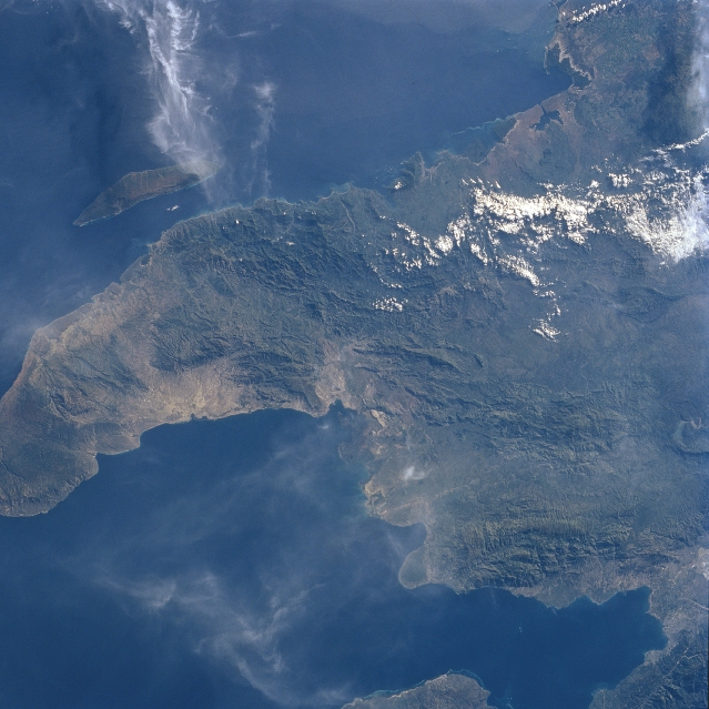
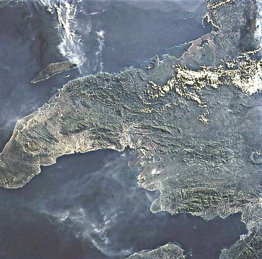
Image Caption: STS094-728-024 Gulf of Gonave, Haiti July 1997
The northwest peninsula of Haiti and the Gulf of Gonave are visible in this northeast-looking view. The Gulf of Gonave is situated in the pincers of two mountainous peninsulas, and is considered one of the most beautiful in the world. Haiti, an Aboriginal Indian term, means "Land of Mountains". The mountains of the north, visible on this image, are made up of exposed limestone, which forms the terrain of the region. The porosity of the limestone prevents the formation of natural water reservoirs and facilitates run-off of rivulets, which denude the forests and erode the plains. Most of the country, including this northern portion, is semi-arid. Off the north coast of Haiti, the island of Tortuga or as referred to by the Haitans, the 'Island of Torture' is visible. The island is 25 miles (40 km) long and covers an area of 70 sq. miles (180 sq. km). Near the lower center of the image, a portion of the mountainous, barren Gonave Island is discernible.
The northwest peninsula of Haiti and the Gulf of Gonave are visible in this northeast-looking view. The Gulf of Gonave is situated in the pincers of two mountainous peninsulas, and is considered one of the most beautiful in the world. Haiti, an Aboriginal Indian term, means "Land of Mountains". The mountains of the north, visible on this image, are made up of exposed limestone, which forms the terrain of the region. The porosity of the limestone prevents the formation of natural water reservoirs and facilitates run-off of rivulets, which denude the forests and erode the plains. Most of the country, including this northern portion, is semi-arid. Off the north coast of Haiti, the island of Tortuga or as referred to by the Haitans, the 'Island of Torture' is visible. The island is 25 miles (40 km) long and covers an area of 70 sq. miles (180 sq. km). Near the lower center of the image, a portion of the mountainous, barren Gonave Island is discernible.
