STS094-712-21
| NASA Photo ID | STS094-712-21 |
| Focal Length | 100mm |
| Date taken | 1997.07.__ |
| Time taken | GMT |
Cloud masks available for this image:
Spacecraft nadir point:
Photo center point: 27.0° N, 75.0° E
Photo center point by machine learning:
Photo center point: 27.0° N, 75.0° E
Photo center point by machine learning:
Nadir to Photo Center:
Spacecraft Altitude: nautical miles (0km)
Country or Geographic Name: | INDIA |
Features: | SAMBHAR SALT LAKE |
| Features Found Using Machine Learning: | |
Cloud Cover Percentage: | 0 (no clouds present) |
Sun Elevation Angle: | ° |
Sun Azimuth: | ° |
Camera: | Hasselblad |
Focal Length: | 100mm |
Camera Tilt: | Low Oblique |
Format: | 5069: Kodak Elite 100S, E6 Reversal, Replaces Lumiere, Warmer in tone vs. Lumiere |
Film Exposure: | Normal |
| Additional Information | |
| Width | Height | Annotated | Cropped | Purpose | Links |
|---|---|---|---|---|---|
| 4067 pixels | 3959 pixels | No | No | Earth From Space collection | Download Image |
| 639 pixels | 623 pixels | No | No | Earth From Space collection | Download Image |
| 665 pixels | 612 pixels | No | No | Download Image |
Download Packaged File
Download a Google Earth KML for this Image
View photo footprint information
Download a GeoTIFF for this photo
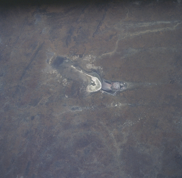
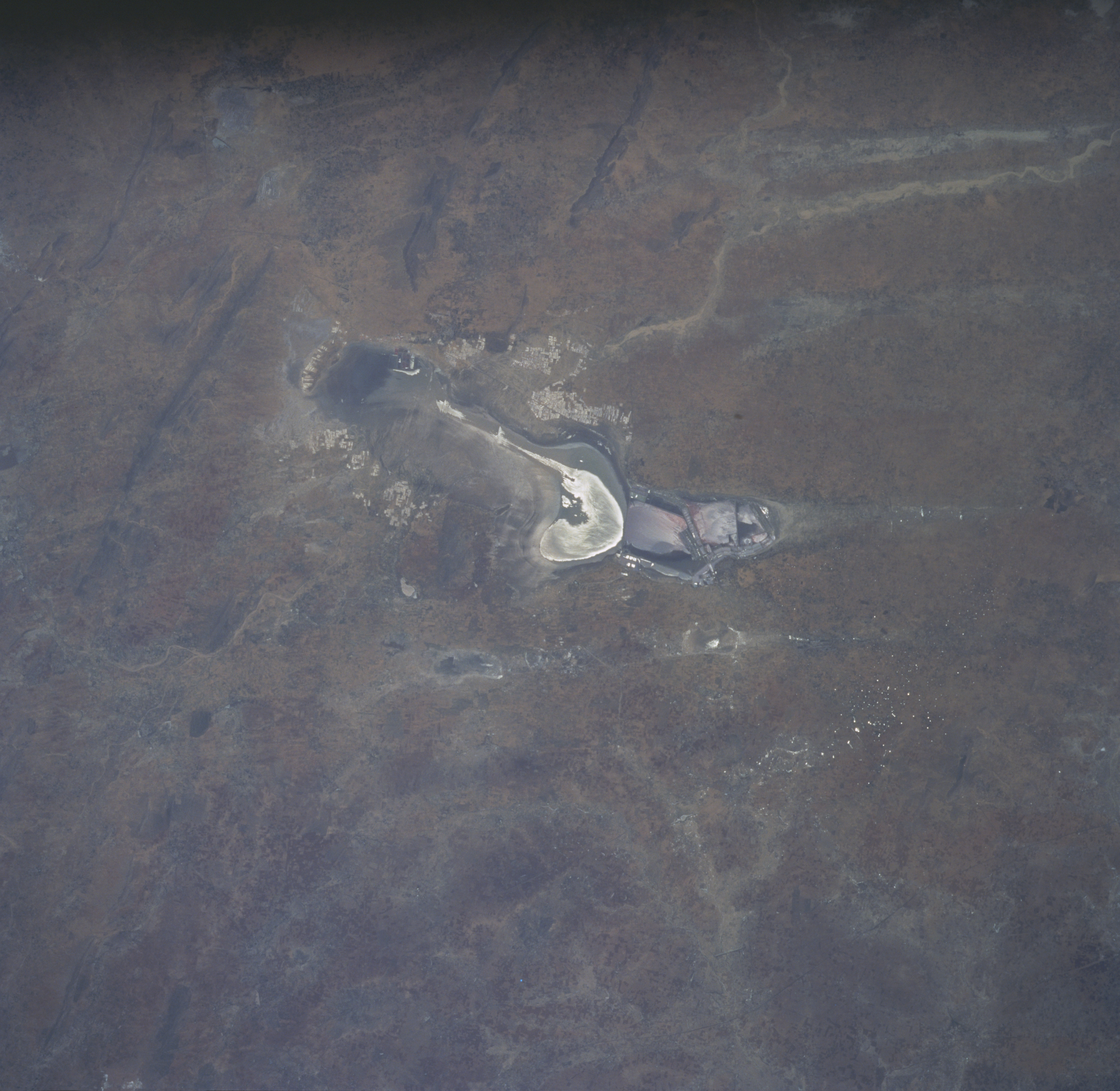
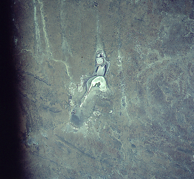
Image Caption: STS094-712-021 Sambhar Salt Lake, India July 1997
The elongated Sambhar Salt Lake, situated in a depression of the low, northeast-southwest trending Aravalli Mountains (a few faint ridgelines are visible in the upper left quadrant), is recognizable at the center of the image. The general region is on the eastern fringe of the Great Indian (Thar) Desert and the western edge of the semiarid climate of northwest India. The lake is just west of the Indian city of Jaipur. This ephemeral salt lake measures approximately 20 miles (32 km) in an east-west direction. Several distinct sections of the lake can be identified. For example a couple of areas of standing water are visible (uniform, tan-looking) as well as the highly mineralized, dry surface (whitish-looking area). The lake is used intensively for the commercial mining of salt. Water levels in the lake fluctuates dramatically, depending on how much precipitation the region receives in a given year.
The elongated Sambhar Salt Lake, situated in a depression of the low, northeast-southwest trending Aravalli Mountains (a few faint ridgelines are visible in the upper left quadrant), is recognizable at the center of the image. The general region is on the eastern fringe of the Great Indian (Thar) Desert and the western edge of the semiarid climate of northwest India. The lake is just west of the Indian city of Jaipur. This ephemeral salt lake measures approximately 20 miles (32 km) in an east-west direction. Several distinct sections of the lake can be identified. For example a couple of areas of standing water are visible (uniform, tan-looking) as well as the highly mineralized, dry surface (whitish-looking area). The lake is used intensively for the commercial mining of salt. Water levels in the lake fluctuates dramatically, depending on how much precipitation the region receives in a given year.
