STS094-703-99

| NASA Photo ID | STS094-703-99 |
| Focal Length | 250mm |
| Date taken | 1997.07.12 |
| Time taken | 16:32:44 GMT |
Cloud masks available for this image:
Spacecraft nadir point: 5.7° S, 49.1° W
Photo center point: 7.5° S, 47.5° W
Photo center point by machine learning:
Photo center point: 7.5° S, 47.5° W
Photo center point by machine learning:
Nadir to Photo Center: Southeast
Spacecraft Altitude: 161 nautical miles (298km)
Country or Geographic Name: | BRAZIL |
Features: | RIO TOCATINS |
| Features Found Using Machine Learning: | |
Cloud Cover Percentage: | 5 (1-10)% |
Sun Elevation Angle: | 57° |
Sun Azimuth: | 328° |
Camera: | Hasselblad |
Focal Length: | 250mm |
Camera Tilt: | 42 degrees |
Format: | 2443: Kodak Aerochrome 2443, color IR, thin base, EA-5 process thru June 1999, E-6 process afterward |
Film Exposure: | Normal |
| Additional Information | |
| Width | Height | Annotated | Cropped | Purpose | Links |
|---|---|---|---|---|---|
| 4074 pixels | 4096 pixels | No | No | Earth From Space collection | Download Image |
| 636 pixels | 640 pixels | No | No | Earth From Space collection | Download Image |
Download Packaged File
Download a Google Earth KML for this Image
View photo footprint information
Download a GeoTIFF for this photo
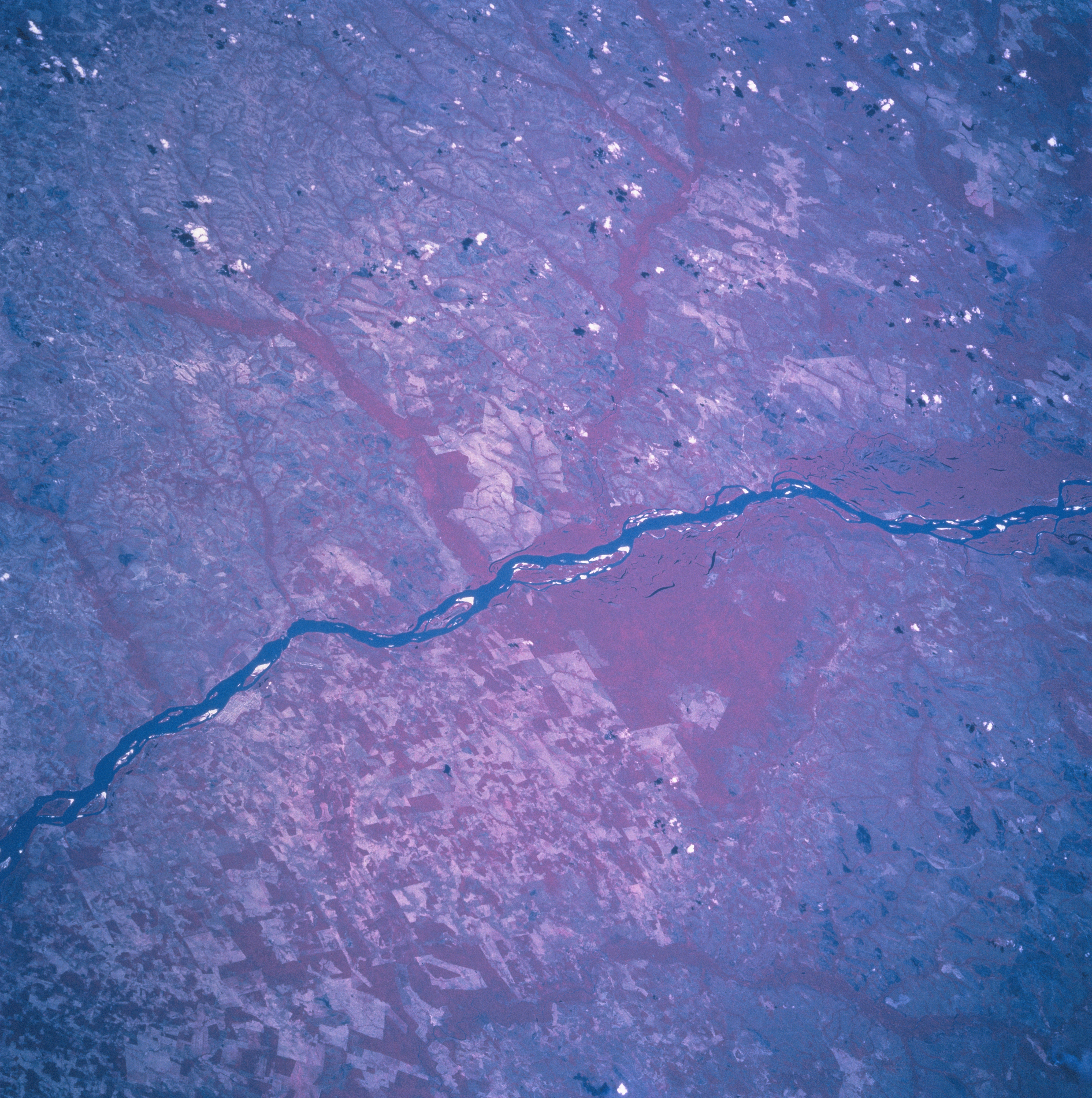
Image Caption: STS094-703-099 Rio Araguaia, Brazil July 1997
The northeasterly flowing Rio Araguaia (dark, linear feature), one of many rivers that drain the Amazon Basin in east central Brazil, is easily traced laterally across this color infrared image. The color infrared picture (green vegetation is shown as various reddish hues) not only shows the main channel of the river and numerous sand bars (white surfaces within the river), but forested tributary streams are also visible as uniform looking reddish swaths that connect to the main channel of the Rio Araguaia. Two low-lying, densely vegetated swampy areas with numerous small lakes (dark features) can be identified near the center of the image and also near the southwest edge of the scene. The lighter looking terrain, some with angular-looking, large field patterns, are areas that have been cleared for farming or cattle ranching. The Brazalian state of Para is west of the river and Tocantins state is east of the river.
The northeasterly flowing Rio Araguaia (dark, linear feature), one of many rivers that drain the Amazon Basin in east central Brazil, is easily traced laterally across this color infrared image. The color infrared picture (green vegetation is shown as various reddish hues) not only shows the main channel of the river and numerous sand bars (white surfaces within the river), but forested tributary streams are also visible as uniform looking reddish swaths that connect to the main channel of the Rio Araguaia. Two low-lying, densely vegetated swampy areas with numerous small lakes (dark features) can be identified near the center of the image and also near the southwest edge of the scene. The lighter looking terrain, some with angular-looking, large field patterns, are areas that have been cleared for farming or cattle ranching. The Brazalian state of Para is west of the river and Tocantins state is east of the river.
