STS093-715-6
| NASA Photo ID | STS093-715-6 |
| Focal Length | 100mm |
| Date taken | 1999.07.25 |
| Time taken | 12:46:31 GMT |
Resolutions offered for this image:
1031 x 1024 pixels 2063 x 2048 pixels 4127 x 4096 pixels 2059 x 1996 pixels 515 x 512 pixels 2059 x 1996 pixels 640 x 620 pixels 640 x 620 pixels
1031 x 1024 pixels 2063 x 2048 pixels 4127 x 4096 pixels 2059 x 1996 pixels 515 x 512 pixels 2059 x 1996 pixels 640 x 620 pixels 640 x 620 pixels


Cloud masks available for this image:
Spacecraft nadir point: 26.0° S, 69.8° W
Photo center point: 26.5° S, 68.5° W
Photo center point by machine learning:
Photo center point: 26.5° S, 68.5° W
Photo center point by machine learning:
Nadir to Photo Center: East
Spacecraft Altitude: 147 nautical miles (272km)
Camera: | Hasselblad |
Focal Length: | 100mm |
Camera Tilt: | 30 degrees |
Format: | 5069: Kodak Elite 100S, E6 Reversal, Replaces Lumiere, Warmer in tone vs. Lumiere |
Film Exposure: | |
| Additional Information | |
| Width | Height | Annotated | Cropped | Purpose | Links |
|---|---|---|---|---|---|
| 1031 pixels | 1024 pixels | No | No | Download Image | |
| 2063 pixels | 2048 pixels | No | No | Download Image | |
| 4127 pixels | 4096 pixels | No | No | Download Image | |
| 2059 pixels | 1996 pixels | No | No | Download Image | |
| 515 pixels | 512 pixels | No | No | Download Image | |
| 2059 pixels | 1996 pixels | No | No | Public Affairs Office (PAO) | Download Image |
| 640 pixels | 620 pixels | No | No | Public Affairs Office (PAO) | Download Image |
| 640 pixels | 620 pixels | Download Image |
Download Packaged File
Download a Google Earth KML for this Image
View photo footprint information
Download a GeoTIFF for this photo
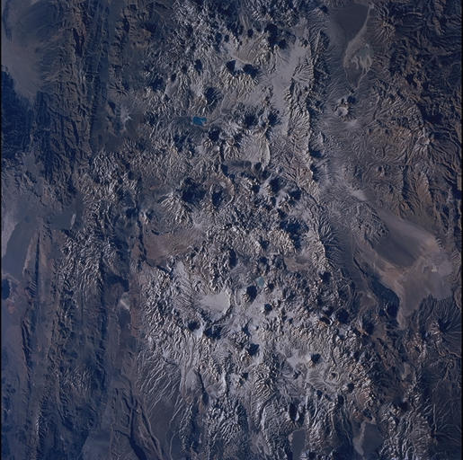
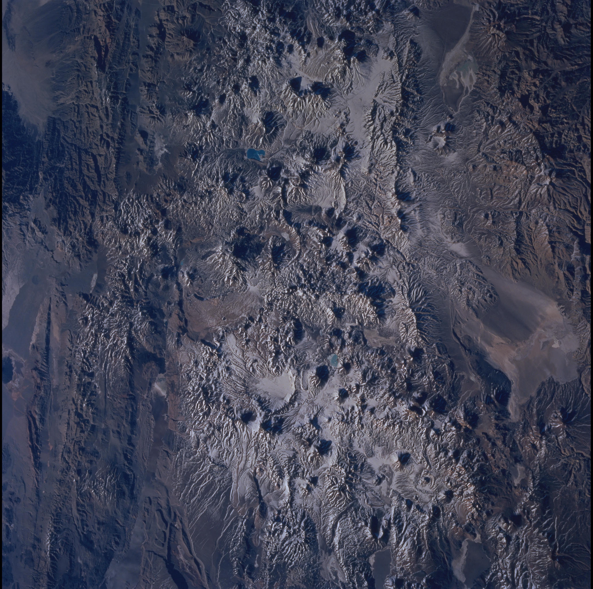
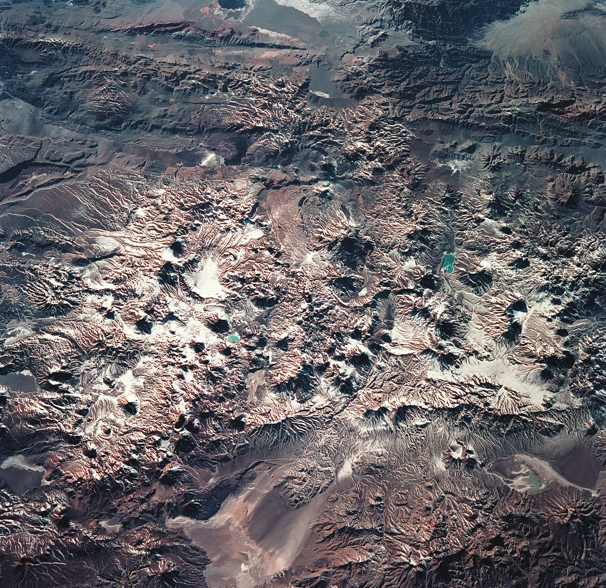
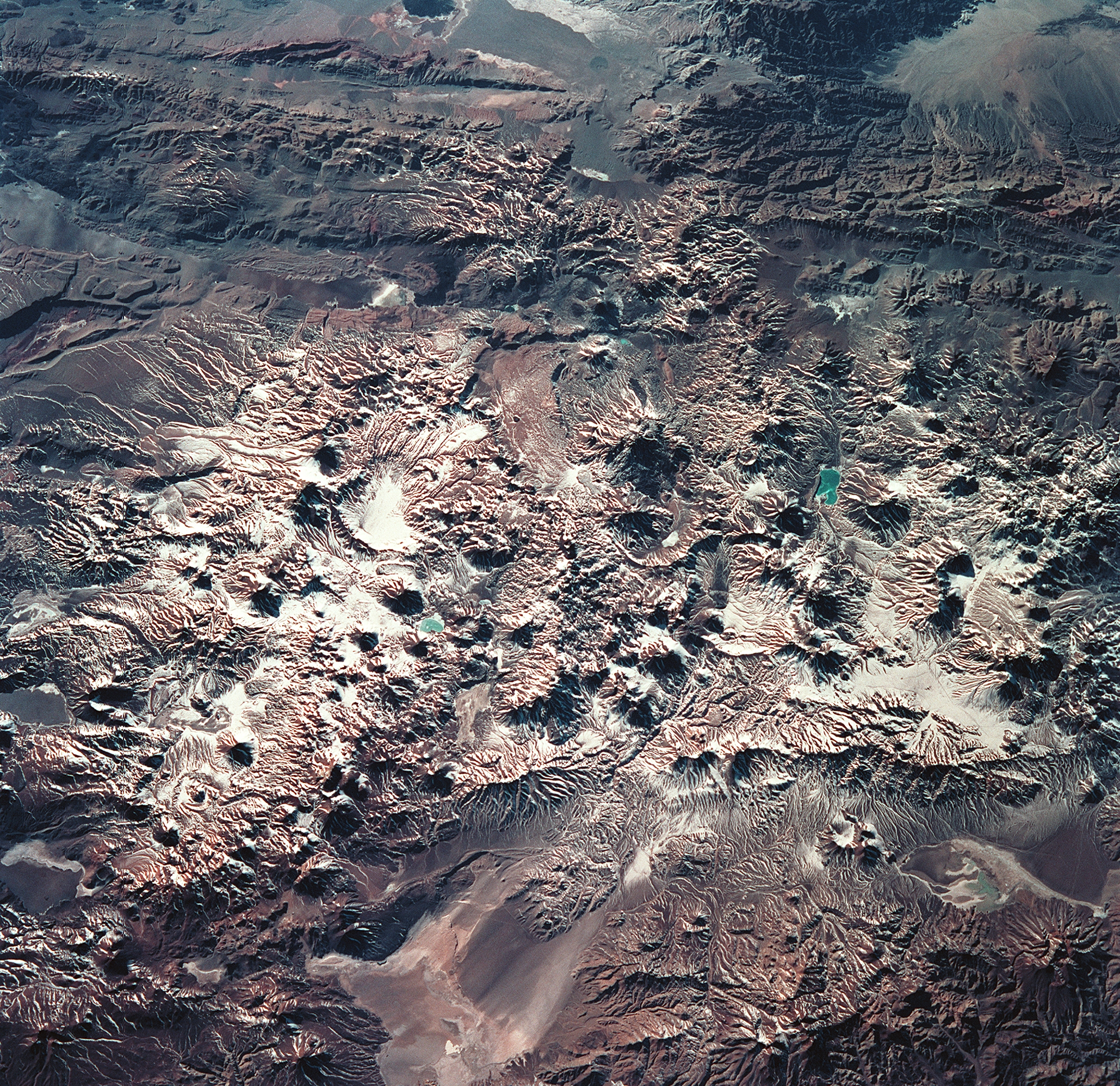
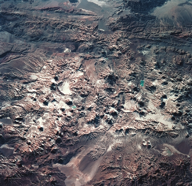
Image Caption: The early morning sun highlights Laguna Verde and the High Andes of the Atacama Province of Chile and the Catamarca Province of Argentina. The jewel-like Laguna Verde (center left) sits amid apparent east-west lines of volcanic peaks that average 19,000 ft (5791 m) elevation. At the upper right are darker mountains of folded and thrusted rocks. The light colored areas at the bottom are Salar de Perdenales (left) and Salar de Maricunga (right). Salars, which are common in the Andes, are salty lakebeds that are usually dry. The prevailing wind direction (out of the west) is clearly discernible at the edges of the salars. This image covers the same region as STS93-704-87.
