STS093-709-46
| NASA Photo ID | STS093-709-46 |
| Focal Length | 250mm |
| Date taken | 1999.07.25 |
| Time taken | 05:38:45 GMT |
Resolutions offered for this image:
1034 x 1024 pixels 2069 x 2048 pixels 4139 x 4096 pixels 2069 x 2001 pixels 517 x 512 pixels 2069 x 2001 pixels 639 x 618 pixels 639 x 618 pixels
1034 x 1024 pixels 2069 x 2048 pixels 4139 x 4096 pixels 2069 x 2001 pixels 517 x 512 pixels 2069 x 2001 pixels 639 x 618 pixels 639 x 618 pixels


Cloud masks available for this image:
Spacecraft nadir point: 11.6° S, 133.9° E
Photo center point: 11.5° S, 131.0° E
Photo center point by machine learning:
Photo center point: 11.5° S, 131.0° E
Photo center point by machine learning:
Nadir to Photo Center: West
Spacecraft Altitude: 156 nautical miles (289km)
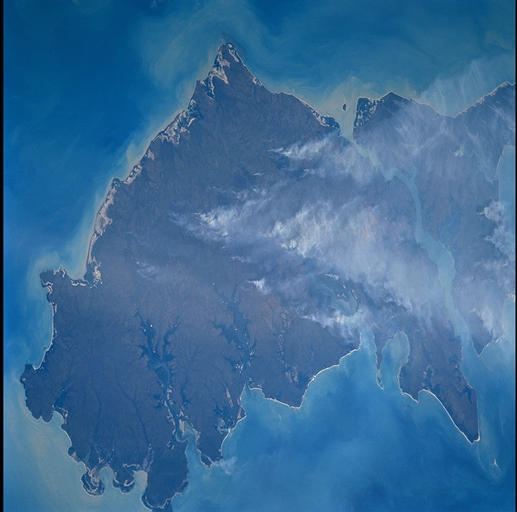
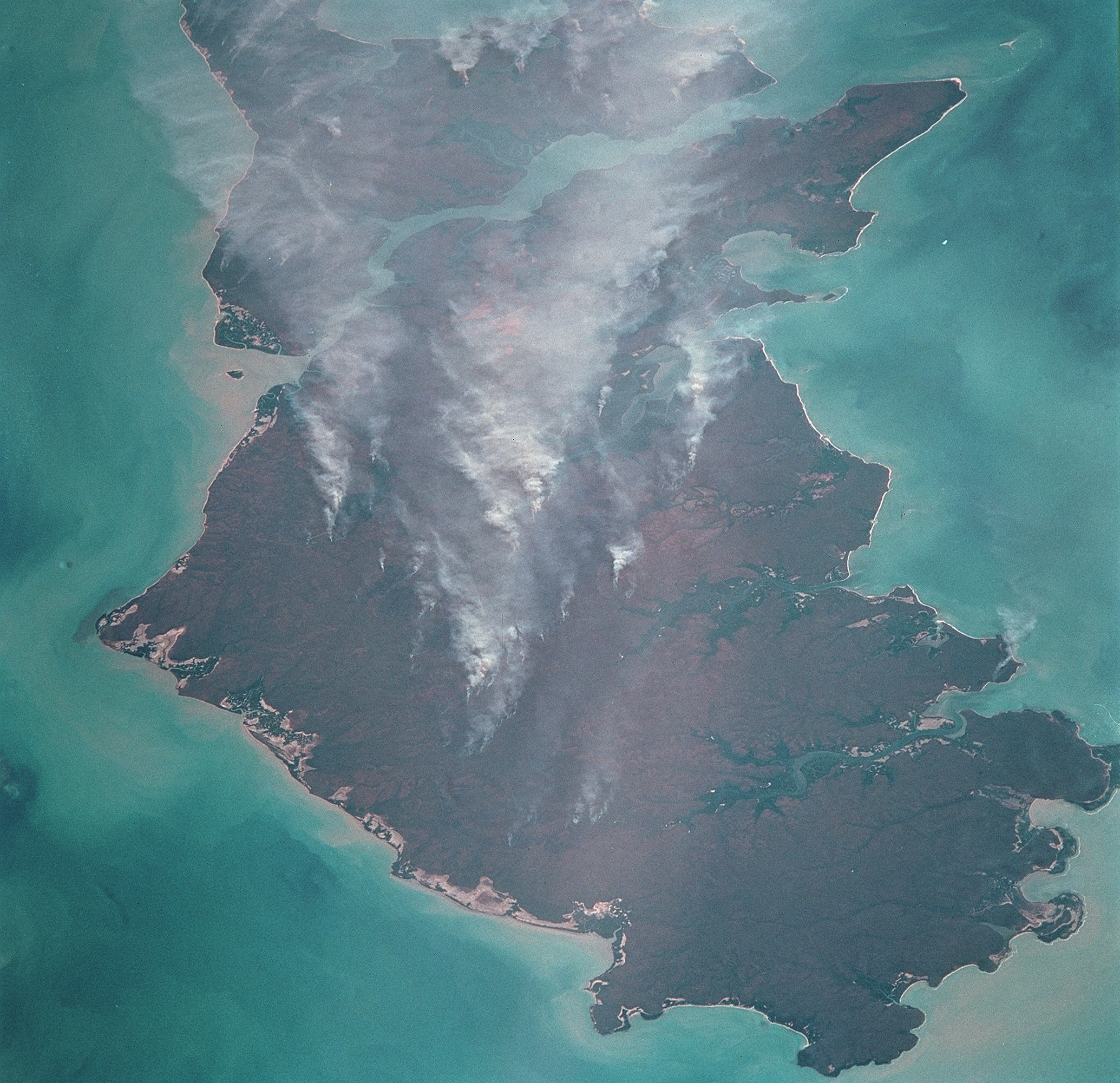
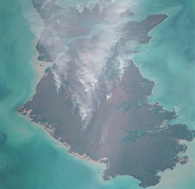
Country or Geographic Name: | AUSTRALIA-NT |
Features: | MELVILLE ISLAND, SMOKE |
| Features Found Using Machine Learning: | |
Cloud Cover Percentage: | 10 (1-10)% |
Sun Elevation Angle: | 42° |
Sun Azimuth: | 310° |
Camera: | Hasselblad |
Focal Length: | 250mm |
Camera Tilt: | 48 degrees |
Format: | 5069: Kodak Elite 100S, E6 Reversal, Replaces Lumiere, Warmer in tone vs. Lumiere |
Film Exposure: | |
| Additional Information | |
| Width | Height | Annotated | Cropped | Purpose | Links |
|---|---|---|---|---|---|
| 1034 pixels | 1024 pixels | No | No | Download Image | |
| 2069 pixels | 2048 pixels | No | No | Download Image | |
| 4139 pixels | 4096 pixels | No | No | Download Image | |
| 2069 pixels | 2001 pixels | No | No | Download Image | |
| 517 pixels | 512 pixels | No | No | Download Image | |
| 2069 pixels | 2001 pixels | No | No | Public Affairs Office (PAO) | Download Image |
| 639 pixels | 618 pixels | No | No | Public Affairs Office (PAO) | Download Image |
| 639 pixels | 618 pixels | Download Image |
Download Packaged File
Download a Google Earth KML for this Image
View photo footprint information
Download a GeoTIFF for this photo
Image Caption: Melville Island (bottom) and Bathurst Island are across Clarence Strait just north of the city of Darwin in the Northern Territory of Australia. In 1978, ownership of Melville passed from the Ausrtalian government to the remaining indigenous Aboriginal people, the Tiwi. Seasonal fires are common in the region; winter is the season for agricultural land clearing of the native monsoonal forests. Smoke from the fires on the islands is being blown NW by the prevailing winter winds.
