STS092-723-79
| NASA Photo ID | STS092-723-79 |
| Focal Length | 250mm |
| Date taken | 2000.10.15 |
| Time taken | 12:25:56 GMT |
Resolutions offered for this image:
1031 x 1024 pixels 2063 x 2048 pixels 4127 x 4096 pixels 515 x 512 pixels 1171 x 1289 pixels 400 x 363 pixels
1031 x 1024 pixels 2063 x 2048 pixels 4127 x 4096 pixels 515 x 512 pixels 1171 x 1289 pixels 400 x 363 pixels


Cloud masks available for this image:
Spacecraft nadir point: 11.3° N, 45.3° E
Photo center point: 11.5° N, 43.0° E
Photo center point by machine learning:
Photo center point: 11.5° N, 43.0° E
Photo center point by machine learning:
Nadir to Photo Center: West
Spacecraft Altitude: 202 nautical miles (374km)
Country or Geographic Name: | DJIBOUTI |
Features: | GULF OF TADJOURA |
| Features Found Using Machine Learning: | |
Cloud Cover Percentage: | 10 (1-10)% |
Sun Elevation Angle: | 31° |
Sun Azimuth: | 252° |
Camera: | Hasselblad |
Focal Length: | 250mm |
Camera Tilt: | 34 degrees |
Format: | 5069: Kodak Elite 100S, E6 Reversal, Replaces Lumiere, Warmer in tone vs. Lumiere |
Film Exposure: | |
| Additional Information | |
| Width | Height | Annotated | Cropped | Purpose | Links |
|---|---|---|---|---|---|
| 1031 pixels | 1024 pixels | No | No | Download Image | |
| 2063 pixels | 2048 pixels | No | No | Download Image | |
| 4127 pixels | 4096 pixels | No | No | Download Image | |
| 515 pixels | 512 pixels | No | No | Download Image | |
| 1171 pixels | 1289 pixels | No | No | Download Image | |
| 400 pixels | 363 pixels | Download Image |
Download Packaged File
Download a Google Earth KML for this Image
View photo footprint information
Download a GeoTIFF for this photo
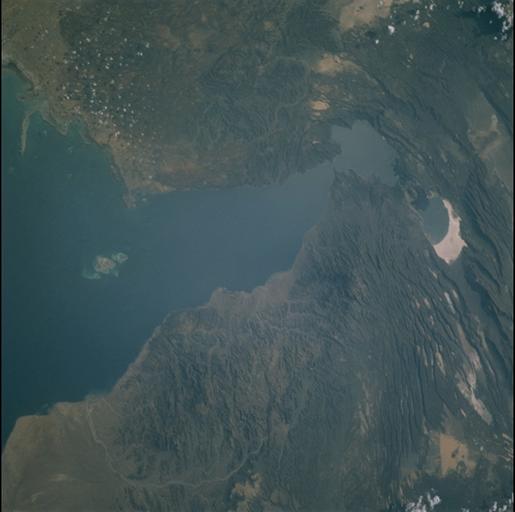
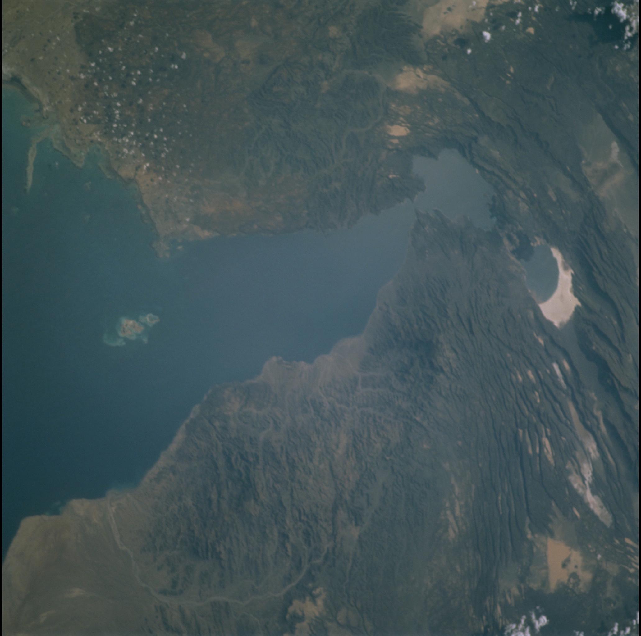
Image Caption: Gulf of Tadjourah, Djibouti
The Gulf of Tadjourah is in the Afar region of the Horn of Africa, where
three great rift systems interact - the Gulf of Aden, Red Sea, and
Ethiopian rifts; the Gulf is an extension of the Aden rift. Lake Assal
(top center) occupies a rift valley and is the lowest point in Africa
(168 m below sea level); a natural barrier of young lava flows (less
than 0.3 million years old) keeps marine waters of the Gulf of Tadjourah
from filling the depression. Sea water does occasionally spill into Lake
Assal, then evaporates to leave highly reflective salt deposits on the
lake floor, well below sea level. The dark, linear features in the lava
fields are fault escarpments that cast shadows in the afternoon light;
particularly good examples can be seen west (left) of Lake Assal.
