STS092-722-68
| NASA Photo ID | STS092-722-68 |
| Focal Length | 100mm |
| Date taken | 2000.10.13 |
| Time taken | 17:31:19 GMT |
Resolutions offered for this image:
1031 x 1024 pixels 2063 x 2048 pixels 4127 x 4096 pixels 4080 x 4080 pixels 515 x 512 pixels 2579 x 2550 pixels 400 x 395 pixels
1031 x 1024 pixels 2063 x 2048 pixels 4127 x 4096 pixels 4080 x 4080 pixels 515 x 512 pixels 2579 x 2550 pixels 400 x 395 pixels


Cloud masks available for this image:
Spacecraft nadir point: 19.9° N, 12.7° W
Photo center point: 21.0° N, 11.5° W
Photo center point by machine learning:
Photo center point: 21.0° N, 11.5° W
Photo center point by machine learning:
Nadir to Photo Center: Northeast
Spacecraft Altitude: 202 nautical miles (374km)
Country or Geographic Name: | MAURITANIA |
Features: | ISS, RICHAT STRUCTURE |
| Features Found Using Machine Learning: | |
Cloud Cover Percentage: | 50 (26-50)% |
Sun Elevation Angle: | 12° |
Sun Azimuth: | 257° |
Camera: | Hasselblad |
Focal Length: | 100mm |
Camera Tilt: | 26 degrees |
Format: | 5069: Kodak Elite 100S, E6 Reversal, Replaces Lumiere, Warmer in tone vs. Lumiere |
Film Exposure: | |
| Additional Information | |
| Width | Height | Annotated | Cropped | Purpose | Links |
|---|---|---|---|---|---|
| 1031 pixels | 1024 pixels | No | No | Download Image | |
| 2063 pixels | 2048 pixels | No | No | Download Image | |
| 4127 pixels | 4096 pixels | No | No | Download Image | |
| 4080 pixels | 4080 pixels | No | No | Download Image | |
| 515 pixels | 512 pixels | No | No | Download Image | |
| 2579 pixels | 2550 pixels | No | No | Download Image | |
| 400 pixels | 395 pixels | Download Image |
Download Packaged File
Download a Google Earth KML for this Image
View photo footprint information
Download a GeoTIFF for this photo
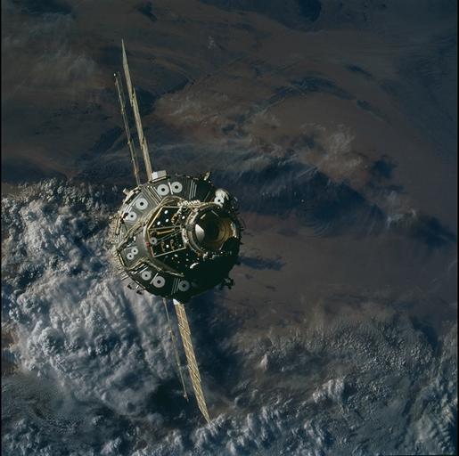
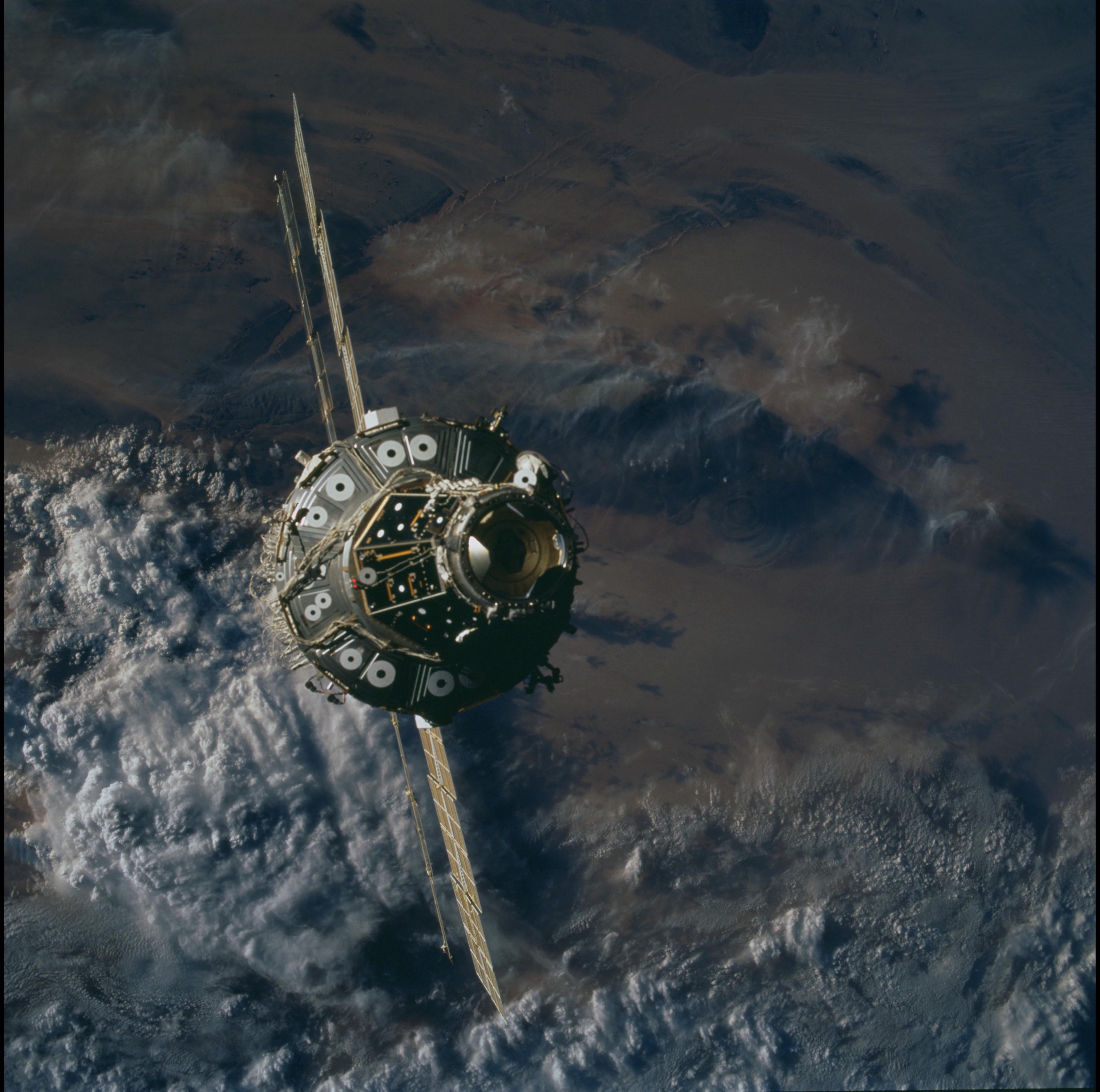
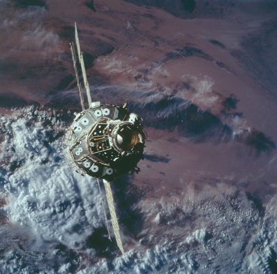
Image Caption: ISS and Richat Dome, Mauritania
To the right of the International Space Station, the circular feature in
the Mauritanian desert is Richat dome. The 24-mile- (39-km)-wide
structure was formed by intrusion of molten rock at depth, which domed
the overlying rock layers upward. Rock layers of differing compositions
weather away at different rates, so that concentric ridges have
developed within the structure.
