STS092-712-28
| NASA Photo ID | STS092-712-28 |
| Focal Length | 100mm |
| Date taken | 2000.10.__ |
| Time taken | GMT |
Resolutions offered for this image:
1031 x 1024 pixels 2063 x 2048 pixels 4127 x 4096 pixels 515 x 512 pixels 1307 x 1291 pixels 400 x 405 pixels
1031 x 1024 pixels 2063 x 2048 pixels 4127 x 4096 pixels 515 x 512 pixels 1307 x 1291 pixels 400 x 405 pixels

Cloud masks available for this image:
Spacecraft nadir point:
Photo center point: 16.5° N, 41.0° E
Photo center point by machine learning:
Photo center point: 16.5° N, 41.0° E
Photo center point by machine learning:
Nadir to Photo Center:
Spacecraft Altitude: nautical miles (0km)
Camera: | Hasselblad |
Focal Length: | 100mm |
Camera Tilt: | |
Format: | 5069: Kodak Elite 100S, E6 Reversal, Replaces Lumiere, Warmer in tone vs. Lumiere |
Film Exposure: | |
| Additional Information | |
| Width | Height | Annotated | Cropped | Purpose | Links |
|---|---|---|---|---|---|
| 1031 pixels | 1024 pixels | No | No | Download Image | |
| 2063 pixels | 2048 pixels | No | No | Download Image | |
| 4127 pixels | 4096 pixels | No | No | Download Image | |
| 515 pixels | 512 pixels | No | No | Download Image | |
| 1307 pixels | 1291 pixels | No | No | Download Image | |
| 400 pixels | 405 pixels | Download Image |
Download Packaged File
Download a Google Earth KML for this Image
View photo footprint information
Download a GeoTIFF for this photo
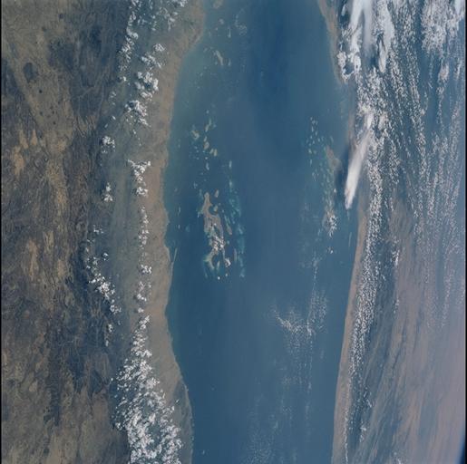
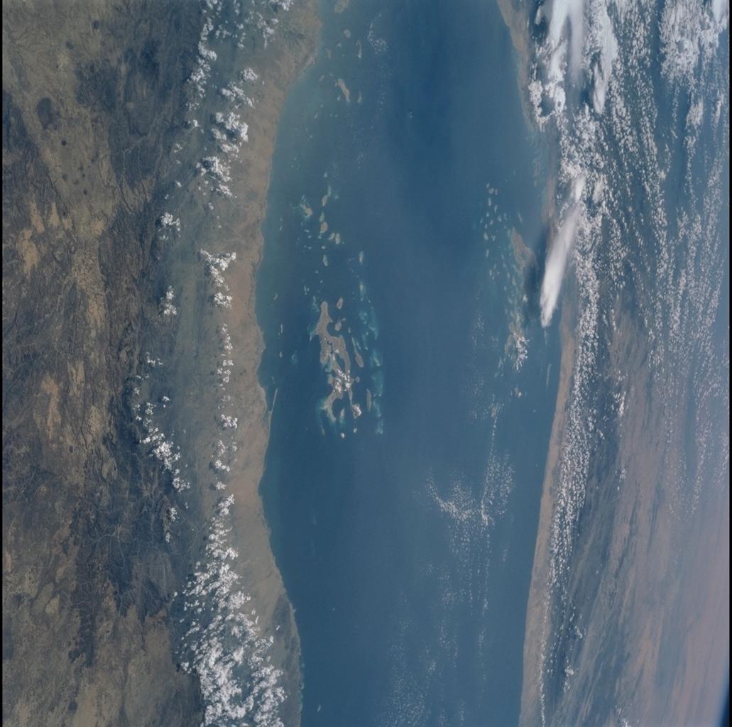
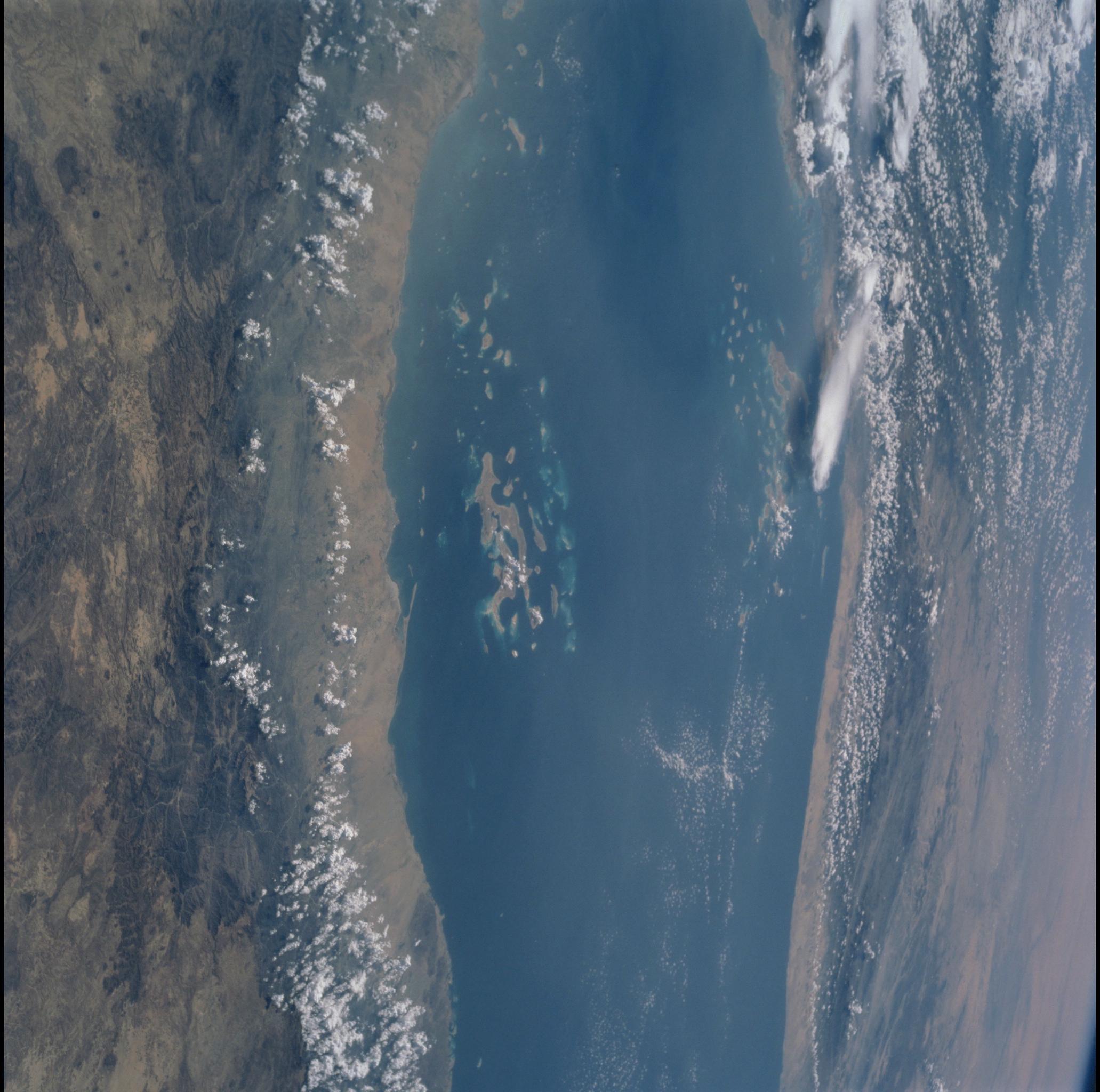
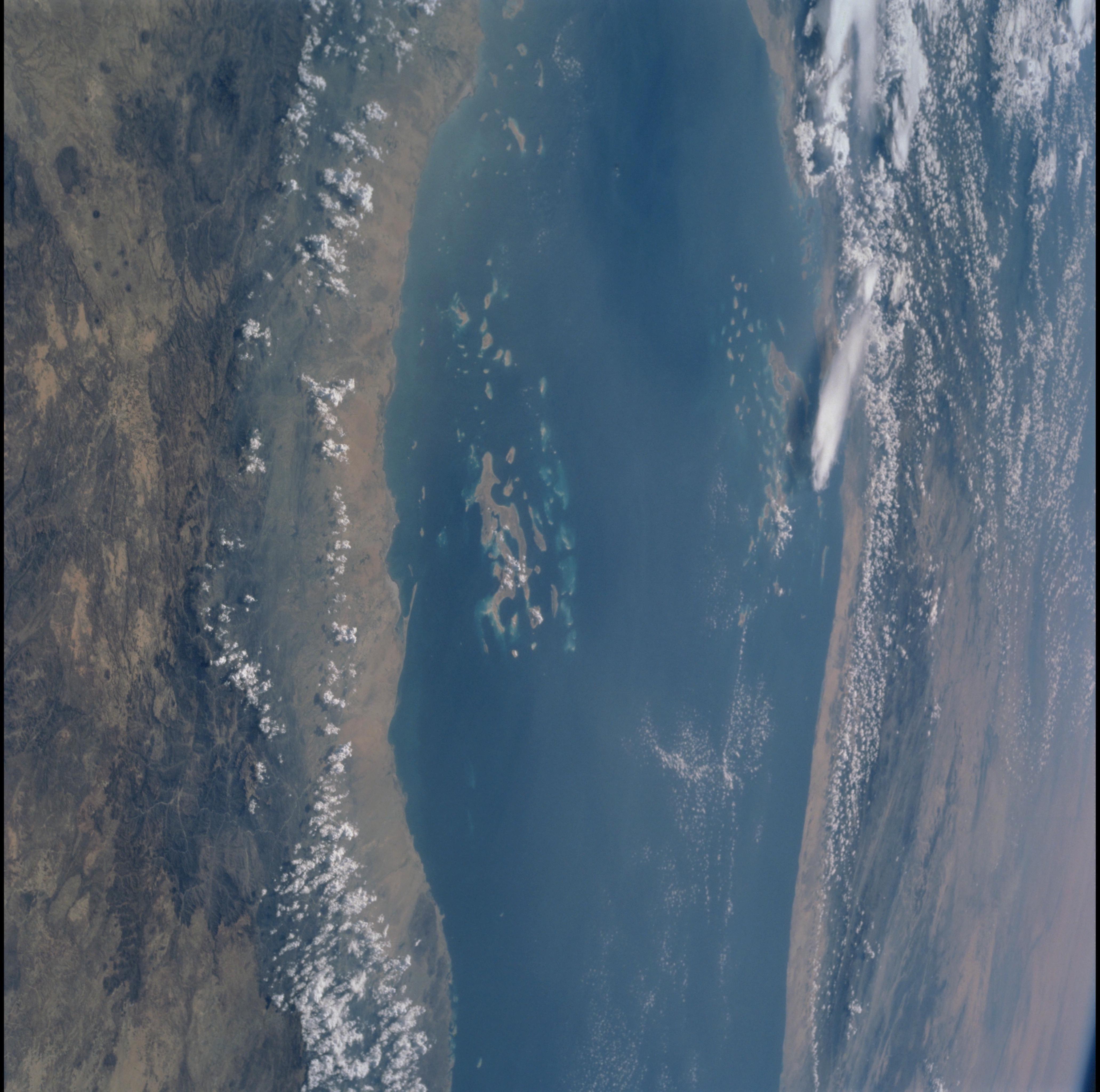
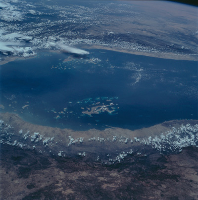
Image Caption: Red Sea Reefs
Along the Saudi Arabian coast of the Red Sea (near side) is the Farasan
Archipelago; across the Sea, off the coast of Eritrea, is the Dahlak
Archipelago. Corals and other marine organisms have colonized the
margins of submerged fault blocks of the Red Sea rift; thus, the reefs
show the same northerly alignment as the coastline and the faults
onshore. A national marine park has been proposed for the Dahlak
islands, an area with abundant and diverse fish life, as well as
breeding populations of sea turtles. The Farasan Archipelago, which
covers about 600 square kilometers, hosts the most extensive stand of
mangroves in the Red Sea, and seagrass beds fringing the islands are
important nursery grounds for Spanish mackeral.
