STS092-711-21

| NASA Photo ID | STS092-711-21 |
| Focal Length | 250mm |
| Date taken | 2000.10.18 |
| Time taken | 23:00:09 GMT |
Resolutions offered for this image:
1035 x 1024 pixels 2071 x 2048 pixels 4143 x 4096 pixels 517 x 512 pixels 1303 x 1295 pixels 400 x 398 pixels
1035 x 1024 pixels 2071 x 2048 pixels 4143 x 4096 pixels 517 x 512 pixels 1303 x 1295 pixels 400 x 398 pixels


Cloud masks available for this image:
Spacecraft nadir point: 42.5° S, 170.5° E
Photo center point: 41.0° S, 175.0° E
Photo center point by machine learning:
Photo center point: 41.0° S, 175.0° E
Photo center point by machine learning:
Nadir to Photo Center: East
Spacecraft Altitude: 213 nautical miles (394km)
Country or Geographic Name: | NEW ZEALAND-NI |
Features: | LAKE WAIRARAPA, COOK STR. |
| Features Found Using Machine Learning: | |
Cloud Cover Percentage: | 10 (1-10)% |
Sun Elevation Angle: | 53° |
Sun Azimuth: | 35° |
Camera: | Hasselblad |
Focal Length: | 250mm |
Camera Tilt: | 53 degrees |
Format: | 5069: Kodak Elite 100S, E6 Reversal, Replaces Lumiere, Warmer in tone vs. Lumiere |
Film Exposure: | |
| Additional Information | |
| Width | Height | Annotated | Cropped | Purpose | Links |
|---|---|---|---|---|---|
| 1035 pixels | 1024 pixels | No | No | Download Image | |
| 2071 pixels | 2048 pixels | No | No | Download Image | |
| 4143 pixels | 4096 pixels | No | No | Download Image | |
| 517 pixels | 512 pixels | No | No | Download Image | |
| 1303 pixels | 1295 pixels | No | No | Download Image | |
| 400 pixels | 398 pixels | Download Image |
Download Packaged File
Download a Google Earth KML for this Image
View photo footprint information
Download a GeoTIFF for this photo
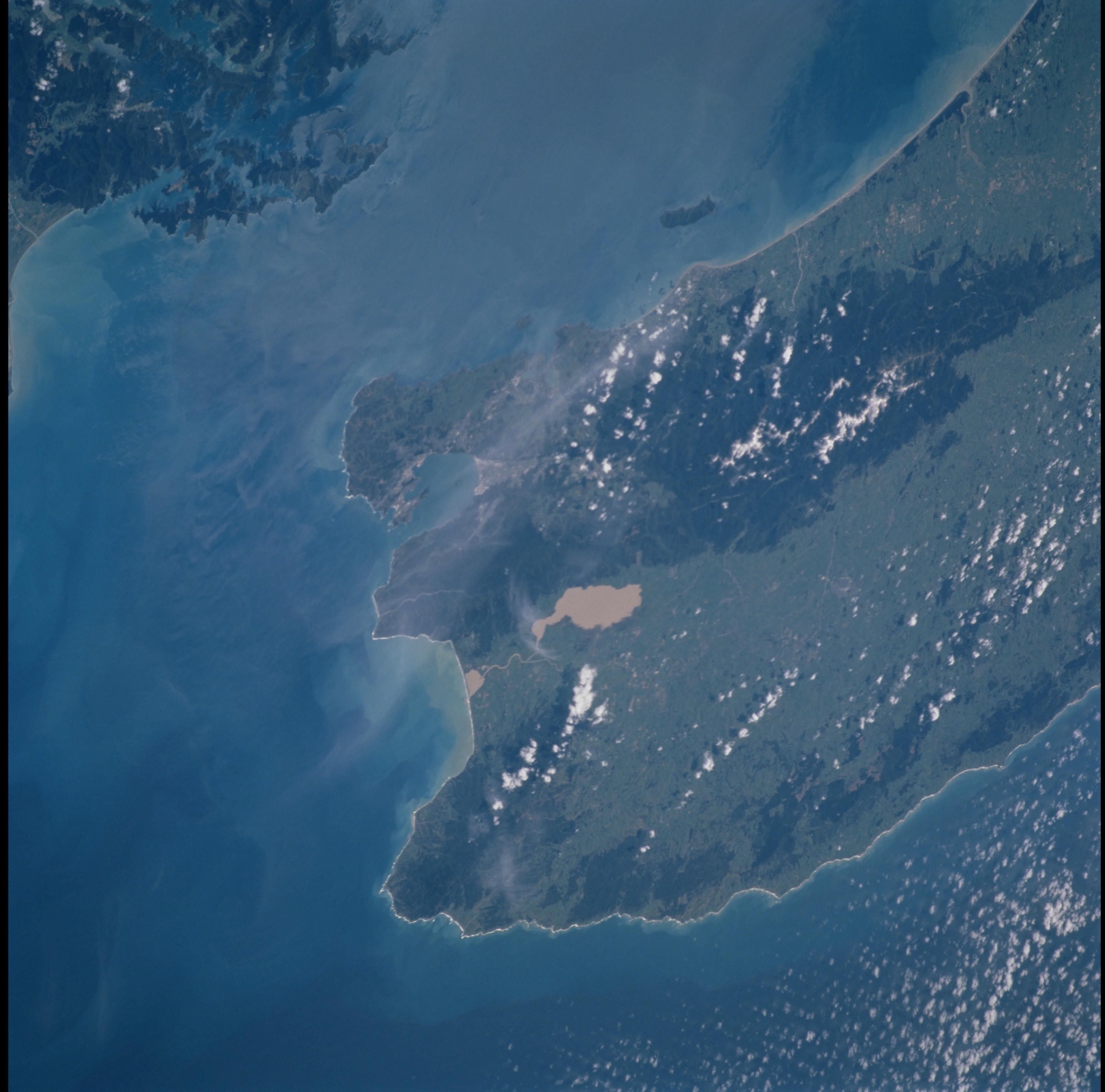
Image Caption: Wellington, North Island, New Zealand
The city of Wellington is on Port Nicholson bay at the southern tip of
North Island and lies astride a strand of the Marlborough fault zone
(sharp linear break between darker vegetated and light-colored areas).
The structural style of the Australian/Pacific tectonic plate boundary
changes in the region of the Marlborough zone: the Hikurangi trench
system (subduction zone) along the east side of North Island gives way
to the Alpine fault system (transform zone) through South Island.
Earthquakes are common in the Wellington area, as activity on faults of
either the Alpine or the Hikurangi system can result in ground movement
in the Marlborough zone.
