STS092-706-5
| NASA Photo ID | STS092-706-5 |
| Focal Length | 40mm |
| Date taken | 2000.10.13 |
| Time taken | 16:01:18 GMT |
Resolutions offered for this image:
1031 x 1024 pixels 2063 x 2048 pixels 4127 x 4096 pixels 515 x 512 pixels 3072 x 3072 pixels 639 x 639 pixels
1031 x 1024 pixels 2063 x 2048 pixels 4127 x 4096 pixels 515 x 512 pixels 3072 x 3072 pixels 639 x 639 pixels


Cloud masks available for this image:
Spacecraft nadir point: 25.8° N, 16.0° E
Photo center point: 22.5° N, 13.0° E
Photo center point by machine learning:
Photo center point: 22.5° N, 13.0° E
Photo center point by machine learning:
Nadir to Photo Center: Southwest
Spacecraft Altitude: 202 nautical miles (374km)
Country or Geographic Name: | NIGER |
Features: | PAN-TENERE DESERT, ISS |
| Features Found Using Machine Learning: | |
Cloud Cover Percentage: | 25 (11-25)% |
Sun Elevation Angle: | 6° |
Sun Azimuth: | 258° |
Camera: | Hasselblad |
Focal Length: | 40mm |
Camera Tilt: | High Oblique |
Format: | 5069: Kodak Elite 100S, E6 Reversal, Replaces Lumiere, Warmer in tone vs. Lumiere |
Film Exposure: | |
| Additional Information | |
| Width | Height | Annotated | Cropped | Purpose | Links |
|---|---|---|---|---|---|
| 1031 pixels | 1024 pixels | No | No | Download Image | |
| 2063 pixels | 2048 pixels | No | No | Download Image | |
| 4127 pixels | 4096 pixels | No | No | Download Image | |
| 515 pixels | 512 pixels | No | No | Download Image | |
| 3072 pixels | 3072 pixels | No | No | Public Affairs Office (PAO) | Download Image |
| 639 pixels | 639 pixels | No | No | Public Affairs Office (PAO) | Download Image |
Download Packaged File
Download a Google Earth KML for this Image
View photo footprint information
Download a GeoTIFF for this photo
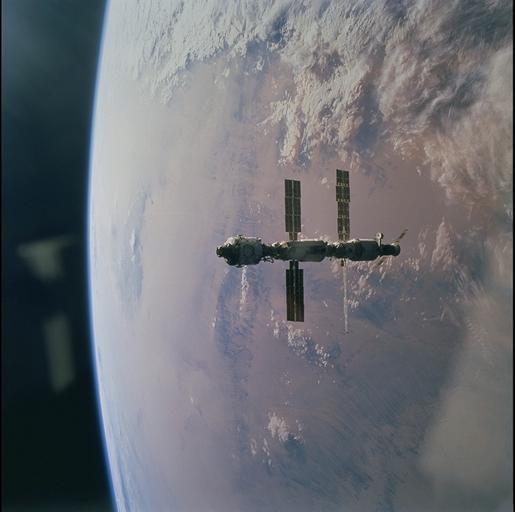
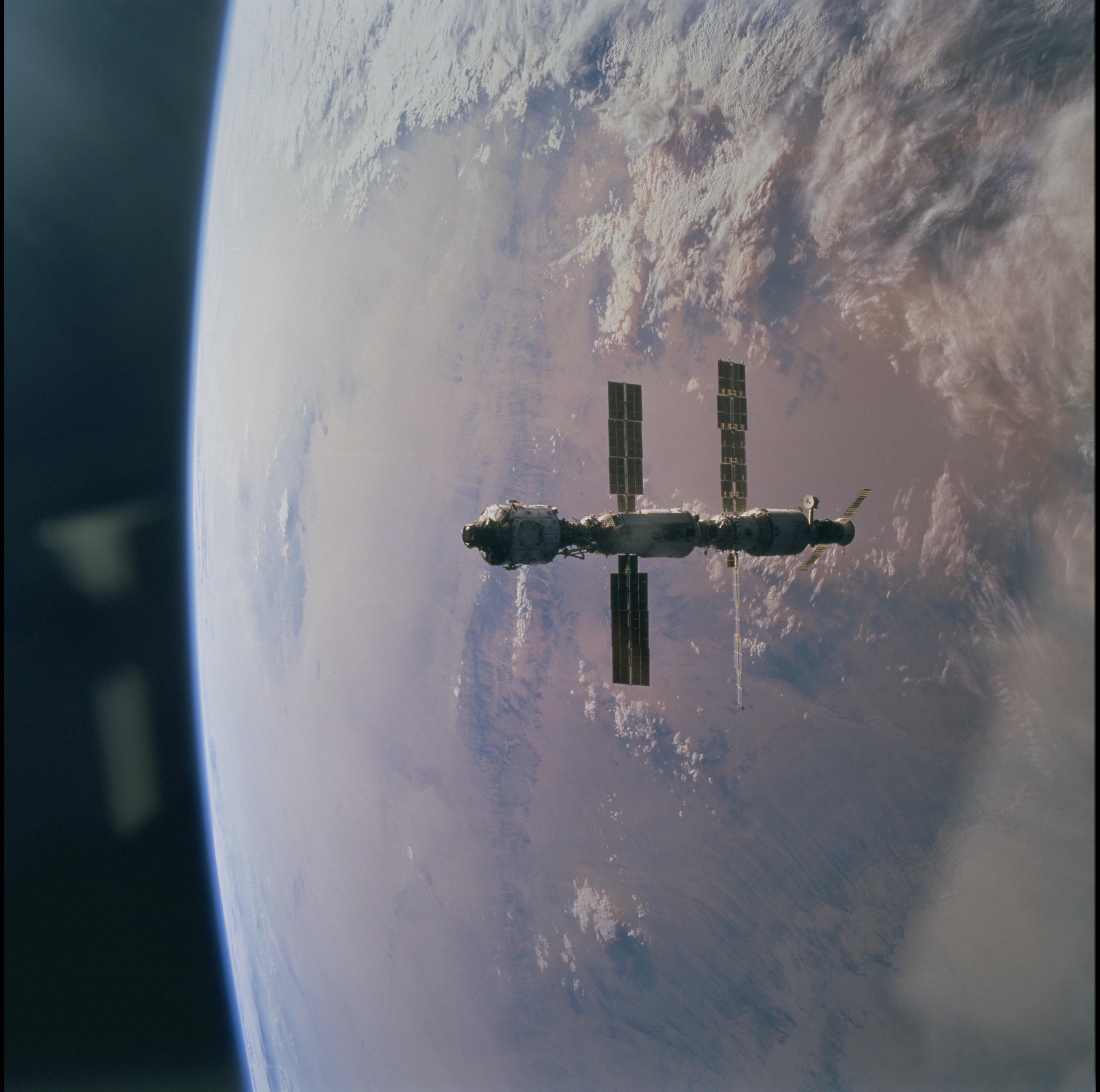
Image Caption: ISS over the central Sahara
The first components of the International Space Station are in stark
contrast to the Bodele Desert in Northeastern Chad. The dark streaks are
wind cut grooves in the soft rock of the desert floor. They align with
the prevailing winds and they can be remarkably deep.
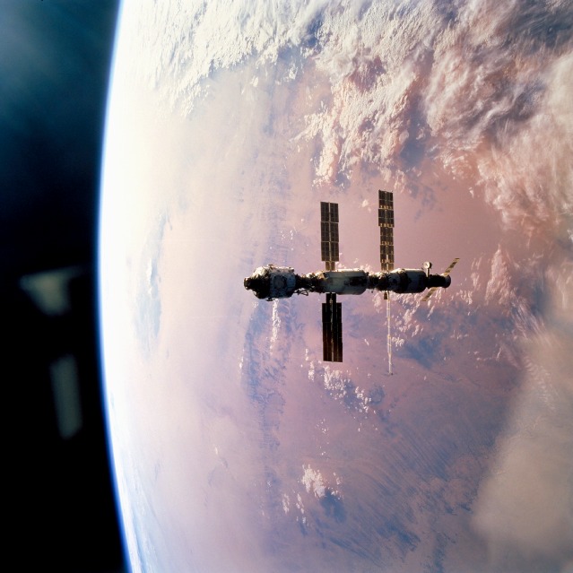
The first components of the International Space Station are in stark
contrast to the Bodele Desert in Northeastern Chad. The dark streaks are
wind cut grooves in the soft rock of the desert floor. They align with
the prevailing winds and they can be remarkably deep.
