STS092-336-4
| NASA Photo ID | STS092-336-4 |
| Focal Length | mm |
| Date taken | 2000.10.17 |
| Time taken | 16:44:59 GMT |
Resolutions offered for this image:
3070 x 2044 pixels 515 x 342 pixels 3004 x 1997 pixels 639 x 425 pixels
3070 x 2044 pixels 515 x 342 pixels 3004 x 1997 pixels 639 x 425 pixels

Cloud masks available for this image:
Spacecraft nadir point: 36.6° N, 5.9° W
Photo center point: 36.0° N, 6.0° W
Photo center point by machine learning:
Photo center point: 36.0° N, 6.0° W
Photo center point by machine learning:
Nadir to Photo Center: South
Spacecraft Altitude: 203 nautical miles (376km)
Country or Geographic Name: | SPAIN |
Features: | STRAIT OF GIBRALTAR |
| Features Found Using Machine Learning: | |
Cloud Cover Percentage: | 10 (1-10)% |
Sun Elevation Angle: | 11° |
Sun Azimuth: | 250° |
Camera: | Nikon 35mm film camera |
Focal Length: | mm |
Camera Tilt: | 10 degrees |
Format: | 3101: Kodak, natural color negative, Ektar 100-3101, ASA 125, standard base |
Film Exposure: | |
| Additional Information | |
| Width | Height | Annotated | Cropped | Purpose | Links |
|---|---|---|---|---|---|
| 3070 pixels | 2044 pixels | No | No | Download Image | |
| 515 pixels | 342 pixels | No | No | Download Image | |
| 3004 pixels | 1997 pixels | No | No | Public Affairs Office (PAO) | Download Image |
| 639 pixels | 425 pixels | No | No | Public Affairs Office (PAO) | Download Image |
Download Packaged File
Download a Google Earth KML for this Image
View photo footprint information
Download a GeoTIFF for this photo
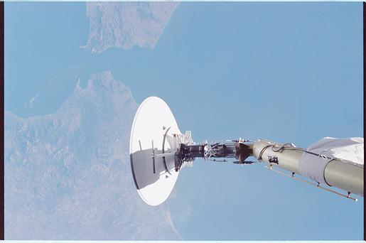
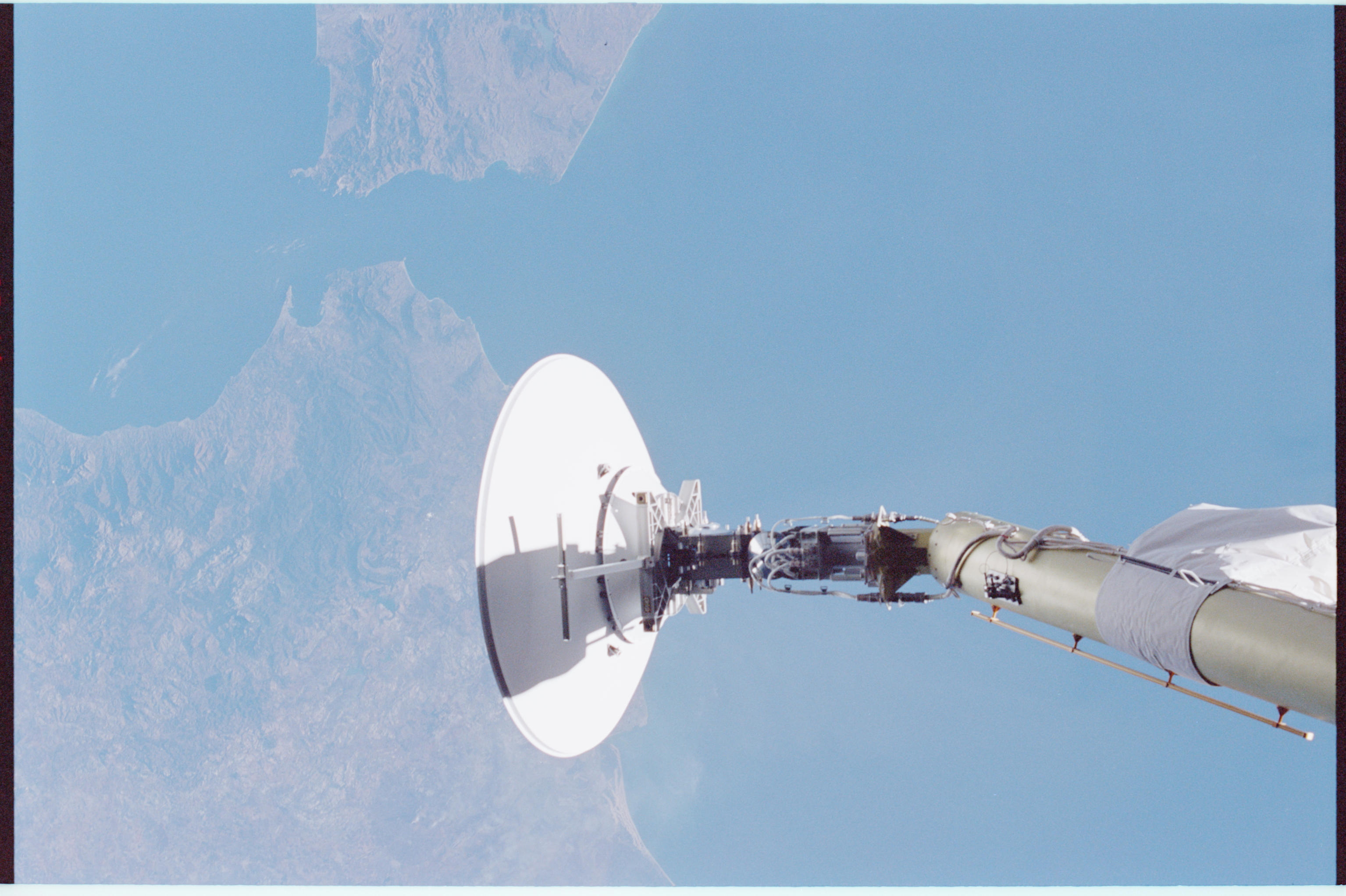
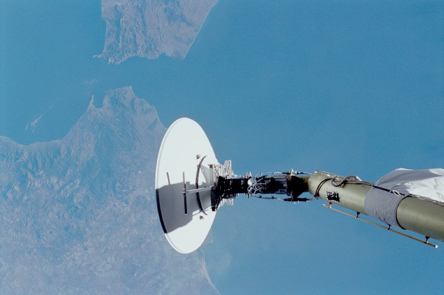
Image Caption: Antenna with the Straits of Gibraltar in the background
This shot of the SGANT (Space to Ground Antenna) Dish on the
international space station also shows the Straits of Gibraltar in the
background. This narrow channel connects the Atlantic Ocean and
Mediterranean Sea. It is 36 miles (58 km) long and narrows to 8 miles
(13 km) in width between Point Marroqui, Spain, and Point Cires,
Morocco. Oceanographers are interested in the flow through this strait
because the Mediterranean outflow plays an important role in the
circulation of the North Atlantic Ocean, and determine the mass, heat,
and salt balances of the Mediterranean. The flow is complex because
waters are confined in the strait and internal waves formed can have
displacements of up to 50 m.
