STS092-324-26
| NASA Photo ID | STS092-324-26 |
| Focal Length | mm |
| Date taken | 2000.10.23 |
| Time taken | 18:42:41 GMT |
Resolutions offered for this image:
540 x 364 pixels 1551 x 1046 pixels 3070 x 2044 pixels 515 x 342 pixels 1551 x 1046 pixels 400 x 270 pixels
540 x 364 pixels 1551 x 1046 pixels 3070 x 2044 pixels 515 x 342 pixels 1551 x 1046 pixels 400 x 270 pixels


Cloud masks available for this image:
Spacecraft nadir point: 37.2° N, 71.0° W
Photo center point: 36.5° N, 76.5° W
Photo center point by machine learning:
Photo center point: 36.5° N, 76.5° W
Photo center point by machine learning:
Nadir to Photo Center: West
Spacecraft Altitude: 202 nautical miles (374km)
Country or Geographic Name: | USA-NORTH CAROLINA |
Features: | PAMLICO SOUND, SMOKE |
| Features Found Using Machine Learning: | |
Cloud Cover Percentage: | 25 (11-25)% |
Sun Elevation Angle: | 32° |
Sun Azimuth: | 220° |
Camera: | Nikon 35mm film camera |
Focal Length: | mm |
Camera Tilt: | High Oblique |
Format: | 5069: Kodak Elite 100S, E6 Reversal, Replaces Lumiere, Warmer in tone vs. Lumiere |
Film Exposure: | |
| Additional Information | |
| Width | Height | Annotated | Cropped | Purpose | Links |
|---|---|---|---|---|---|
| 540 pixels | 364 pixels | Yes | Yes | Earth From Space collection | Download Image |
| 1551 pixels | 1046 pixels | No | Yes | NASA's Earth Observatory web site | Download Image |
| 3070 pixels | 2044 pixels | No | No | Download Image | |
| 515 pixels | 342 pixels | No | No | Download Image | |
| 1551 pixels | 1046 pixels | No | No | Download Image | |
| 400 pixels | 270 pixels | No | Photographic Highlights | Download Image |
Download Packaged File
Download a Google Earth KML for this Image
View photo footprint information
Download a GeoTIFF for this photo
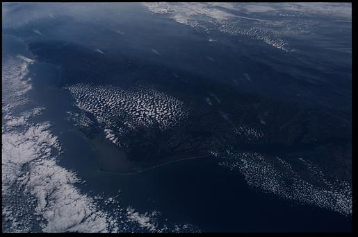
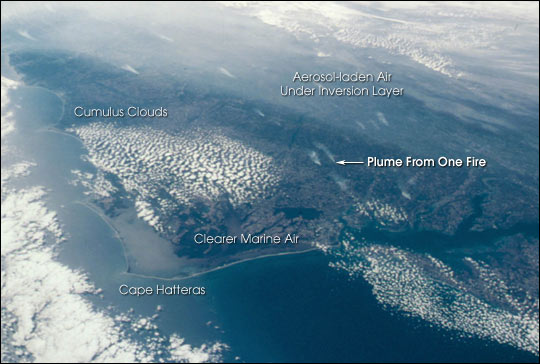
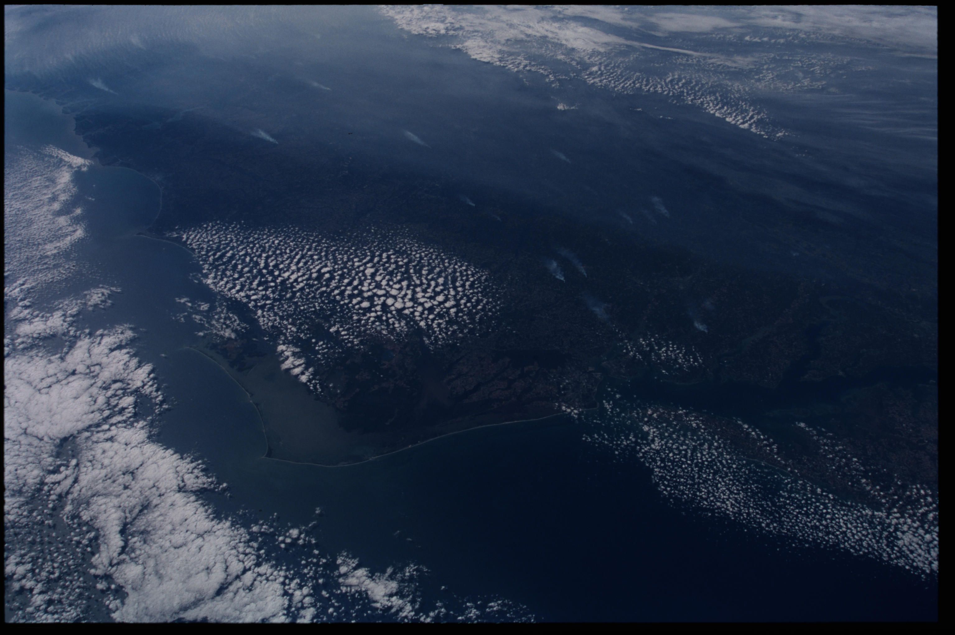
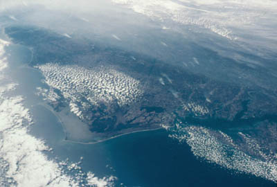
Image Caption: This photograph taken from the Space Shuttle Discovery was taken at a slightly oblique look angle to better view air pollution and other atmospheric features. The photograph was taken with the Shuttle in a position over the Atlantic Ocean looking back toward the North Carolina and Virginia coast. The astronauts used a 35 mm camera and standard color film. The section of coast shown stretches from the Delmarva Peninsula on the right to beyond Charleston, South Carolina on the left.
On October 23, 2000, high pressure centered over the northeastern U.S. had created a capping inversion for aerosols. Forest fire smoke and industrial air pollution accumulated under the inversion. The inversion pattern is stronger inland, and the aerosols are being banked against the Piedmont. Relatively clearer air is flowing from the ocean over the Carolina coastal plain. Small smoke plumes from individual fires can also be seen on the ground stretching from central Virginia to Raleigh, NC.
On October 23, 2000, high pressure centered over the northeastern U.S. had created a capping inversion for aerosols. Forest fire smoke and industrial air pollution accumulated under the inversion. The inversion pattern is stronger inland, and the aerosols are being banked against the Piedmont. Relatively clearer air is flowing from the ocean over the Carolina coastal plain. Small smoke plumes from individual fires can also be seen on the ground stretching from central Virginia to Raleigh, NC.
