STS091-707-17
| NASA Photo ID | STS091-707-17 |
| Focal Length | 250mm |
| Date taken | 1998.06.07 |
| Time taken | 21:27:17 GMT |
Resolutions offered for this image:
4019 x 4019 pixels 640 x 640 pixels 518 x 505 pixels 479 x 478 pixels
4019 x 4019 pixels 640 x 640 pixels 518 x 505 pixels 479 x 478 pixels
Cloud masks available for this image:
Spacecraft nadir point: 32.5° N, 94.1° W
Photo center point: 31.5° N, 92.0° W
Photo center point by machine learning:
Photo center point: 31.5° N, 92.0° W
Photo center point by machine learning:
Nadir to Photo Center: East
Spacecraft Altitude: 197 nautical miles (365km)
Country or Geographic Name: | USA-LOUISIANA |
Features: | ATCHAFALAYA RIVER |
| Features Found Using Machine Learning: | |
Cloud Cover Percentage: | 0 (no clouds present) |
Sun Elevation Angle: | 47° |
Sun Azimuth: | 270° |
Camera: | Hasselblad |
Focal Length: | 250mm |
Camera Tilt: | 35 degrees |
Format: | 5069: Kodak Elite 100S, E6 Reversal, Replaces Lumiere, Warmer in tone vs. Lumiere |
Film Exposure: | Normal |
| Additional Information | |
| Width | Height | Annotated | Cropped | Purpose | Links |
|---|---|---|---|---|---|
| 4019 pixels | 4019 pixels | No | No | Earth From Space collection | Download Image |
| 640 pixels | 640 pixels | No | No | Earth From Space collection | Download Image |
| 518 pixels | 505 pixels | No | No | Download Image | |
| 479 pixels | 478 pixels | Download Image |
Download Packaged File
Download a Google Earth KML for this Image
View photo footprint information
Download a GeoTIFF for this photo
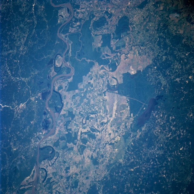
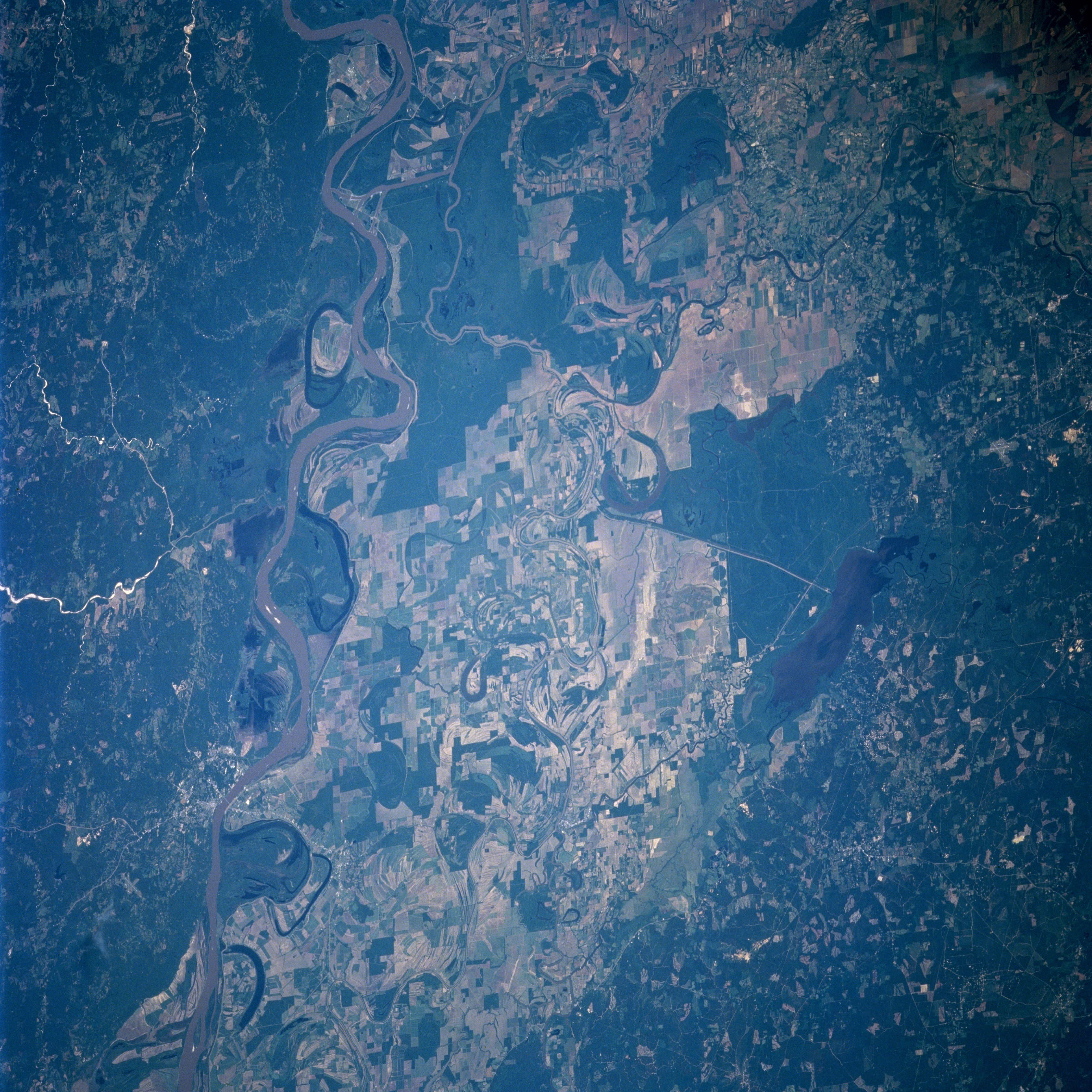
Image Caption: STS091-707-017 Mississippi River and Floodplain, Louisiana, USA June 1998
The meander scars, including numerous oxbow lakes that have been created by the Mississippi River, are very evident on this easterly view of the broad floodplain of the Mississippi River. In the image the Mississippi River extends in a north-south direction from north of Natchez, MS to northeast of Baton Rouge, LA. Hydrologically the Mississippi floodplain is complicated by a canal that connects this river to the Atchafalaya River (near the southern edge of the picture), and also by the Red River (south of the crescent shaped oxbow lake near center) that merges with the Atchafalaya. The Black River parallels the Mississippi in this image. When the Black river from the north joins the Red River from the southwest it becomes the Atchafalaya River. Catahoyla Lake (elongated, dark feature) is connected to the Black River (narrow, meandering river with large loops at the center of the photograph) by a linear canal, northeast of a crescent shaped oxbow lake near the center of the image. Cultivated field patterns (multicolored, angular features) are visible on the fertile soils of the floodplain west of the main channel of the Mississippi River. Extensive wooded areas (darker landscapes) are observed immediately east of the Mississippi River and along the western edge of the picture.
The meander scars, including numerous oxbow lakes that have been created by the Mississippi River, are very evident on this easterly view of the broad floodplain of the Mississippi River. In the image the Mississippi River extends in a north-south direction from north of Natchez, MS to northeast of Baton Rouge, LA. Hydrologically the Mississippi floodplain is complicated by a canal that connects this river to the Atchafalaya River (near the southern edge of the picture), and also by the Red River (south of the crescent shaped oxbow lake near center) that merges with the Atchafalaya. The Black River parallels the Mississippi in this image. When the Black river from the north joins the Red River from the southwest it becomes the Atchafalaya River. Catahoyla Lake (elongated, dark feature) is connected to the Black River (narrow, meandering river with large loops at the center of the photograph) by a linear canal, northeast of a crescent shaped oxbow lake near the center of the image. Cultivated field patterns (multicolored, angular features) are visible on the fertile soils of the floodplain west of the main channel of the Mississippi River. Extensive wooded areas (darker landscapes) are observed immediately east of the Mississippi River and along the western edge of the picture.
