STS091-704-82

| NASA Photo ID | STS091-704-82 |
| Focal Length | 250mm |
| Date taken | 1998.06.06 |
| Time taken | 11:42:09 GMT |
Resolutions offered for this image:
3911 x 4032 pixels 620 x 640 pixels 1260 x 1281 pixels 504 x 512 pixels
3911 x 4032 pixels 620 x 640 pixels 1260 x 1281 pixels 504 x 512 pixels

Cloud masks available for this image:
Spacecraft nadir point: 27.2° N, 54.5° E
Photo center point: 29.5° N, 55.5° E
Photo center point by machine learning:
Photo center point: 29.5° N, 55.5° E
Photo center point by machine learning:
Nadir to Photo Center: North
Spacecraft Altitude: 198 nautical miles (367km)
Country or Geographic Name: | IRAN |
Features: | NAMAKE SIRIAN DESERT |
| Features Found Using Machine Learning: | |
Cloud Cover Percentage: | 5 (1-10)% |
Sun Elevation Angle: | 44° |
Sun Azimuth: | 276° |
Camera: | Hasselblad |
Focal Length: | 250mm |
Camera Tilt: | 37 degrees |
Format: | 5069: Kodak Elite 100S, E6 Reversal, Replaces Lumiere, Warmer in tone vs. Lumiere |
Film Exposure: | Normal |
| Additional Information | |
| Width | Height | Annotated | Cropped | Purpose | Links |
|---|---|---|---|---|---|
| 3911 pixels | 4032 pixels | No | No | Earth From Space collection | Download Image |
| 620 pixels | 640 pixels | No | No | Earth From Space collection | Download Image |
| 1260 pixels | 1281 pixels | No | No | Download Image | |
| 504 pixels | 512 pixels | No | No | Download Image |
Download Packaged File
Download a Google Earth KML for this Image
View photo footprint information
Download a GeoTIFF for this photo
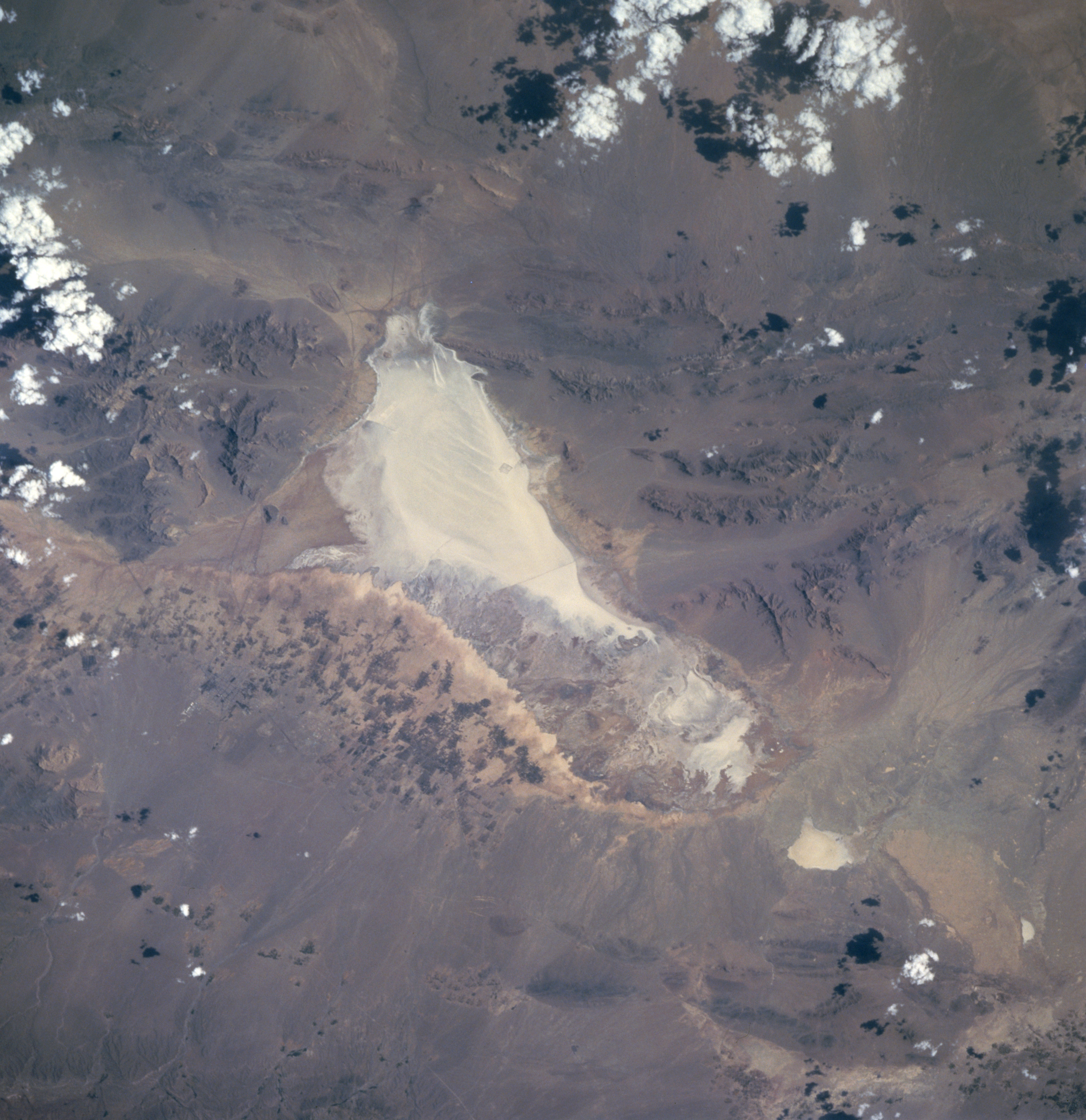
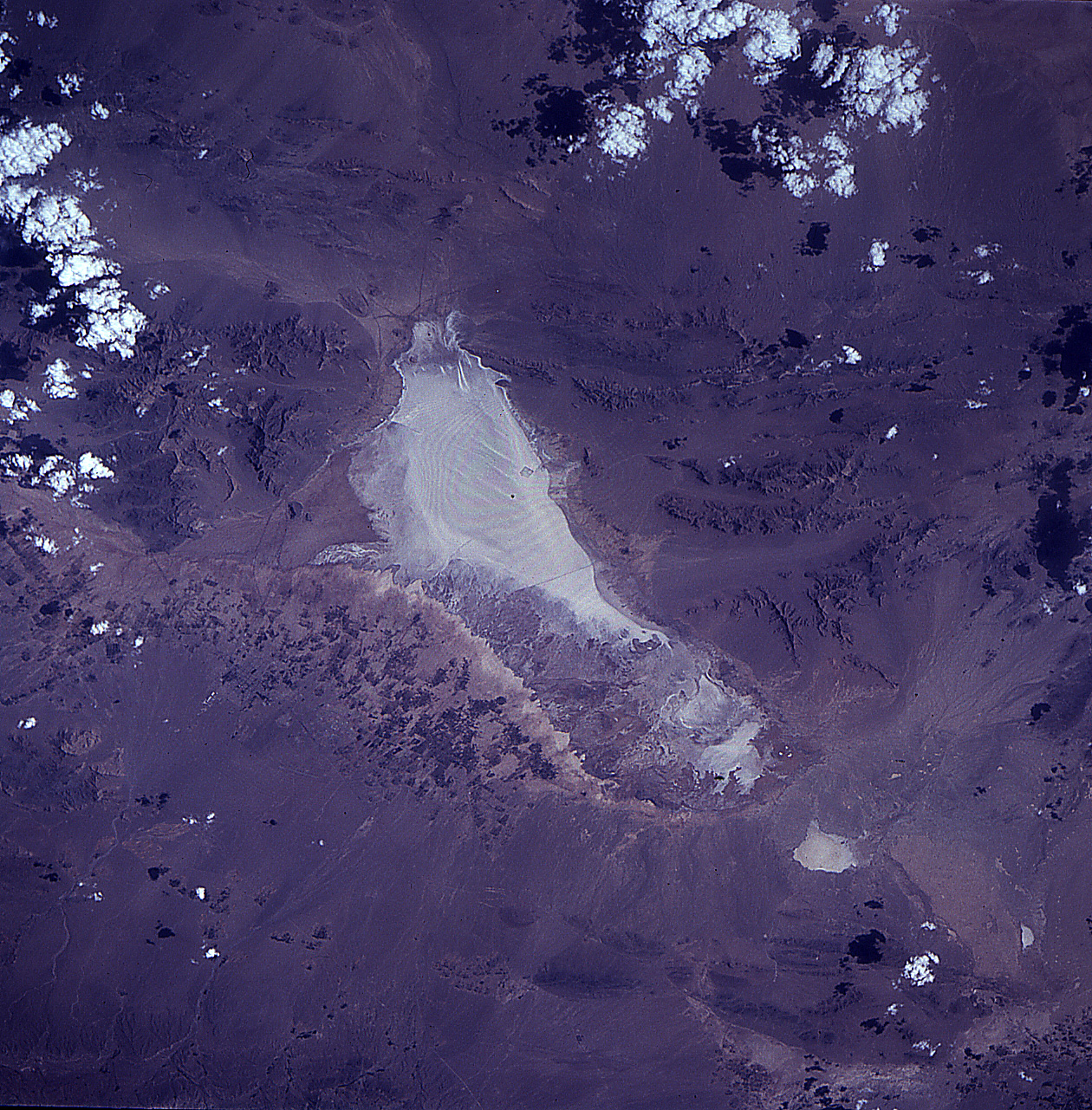
Image Caption: STS091-704-082 Hamak-e-Sirtan Desert, Iran June 1998
The highly reflective dry lakebed (center of image) is part of the Namak-e-Sirtan Desert that is located in south central Iran. The southern end of the dry lakebed is flanked by rugged mountains where peaks exceed 8900 feet (2710 meters) in elevation. This arid valley only receives an average of 7 inches (180 mm) of precipitation annually. East of the dry lake the mottled-looking (alternating dark and light) landscape shows a limited area where dry land agriculture is possible. Towards the center of the agricultural activity Sirjan, a special economic free trade zone, is developing. The Sirjan area provides a natural overland corridor in the province of Kerman where ground transportation of commercial goods from the Persian Gulf can be distributed throughout Iran, as well as other countries of Asia.
The highly reflective dry lakebed (center of image) is part of the Namak-e-Sirtan Desert that is located in south central Iran. The southern end of the dry lakebed is flanked by rugged mountains where peaks exceed 8900 feet (2710 meters) in elevation. This arid valley only receives an average of 7 inches (180 mm) of precipitation annually. East of the dry lake the mottled-looking (alternating dark and light) landscape shows a limited area where dry land agriculture is possible. Towards the center of the agricultural activity Sirjan, a special economic free trade zone, is developing. The Sirjan area provides a natural overland corridor in the province of Kerman where ground transportation of commercial goods from the Persian Gulf can be distributed throughout Iran, as well as other countries of Asia.
