STS091-701-74
| NASA Photo ID | STS091-701-74 |
| Focal Length | 250mm |
| Date taken | 1998.06.03 |
| Time taken | 22:24:09 GMT |
Cloud masks available for this image:
Spacecraft nadir point: 21.0° N, 96.8° W
Photo center point: 16.5° N, 94.5° W
Photo center point by machine learning:
Photo center point: 16.5° N, 94.5° W
Photo center point by machine learning:
Nadir to Photo Center: Southeast
Spacecraft Altitude: 197 nautical miles (365km)
Country or Geographic Name: | MEXICO |
Features: | SMOKE, COAST, MUERTO SEA |
| Features Found Using Machine Learning: | |
Cloud Cover Percentage: | 15 (11-25)% |
Sun Elevation Angle: | 35° |
Sun Azimuth: | 283° |
Camera: | Hasselblad |
Focal Length: | 250mm |
Camera Tilt: | Low Oblique |
Format: | 5069: Kodak Elite 100S, E6 Reversal, Replaces Lumiere, Warmer in tone vs. Lumiere |
Film Exposure: | Over Exposed |
| Additional Information | |
| Width | Height | Annotated | Cropped | Purpose | Links |
|---|---|---|---|---|---|
| 4096 pixels | 4096 pixels | No | No | Earth From Space collection | Download Image |
| 640 pixels | 640 pixels | No | No | Earth From Space collection | Download Image |
Download Packaged File
Download a Google Earth KML for this Image
View photo footprint information
Download a GeoTIFF for this photo
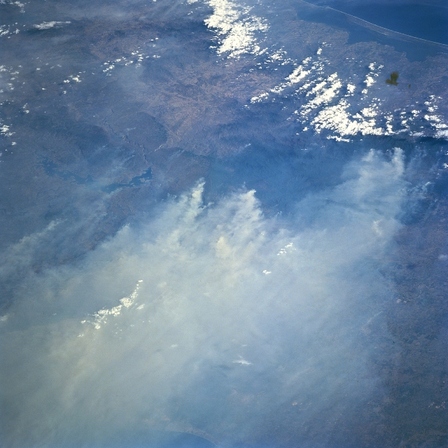
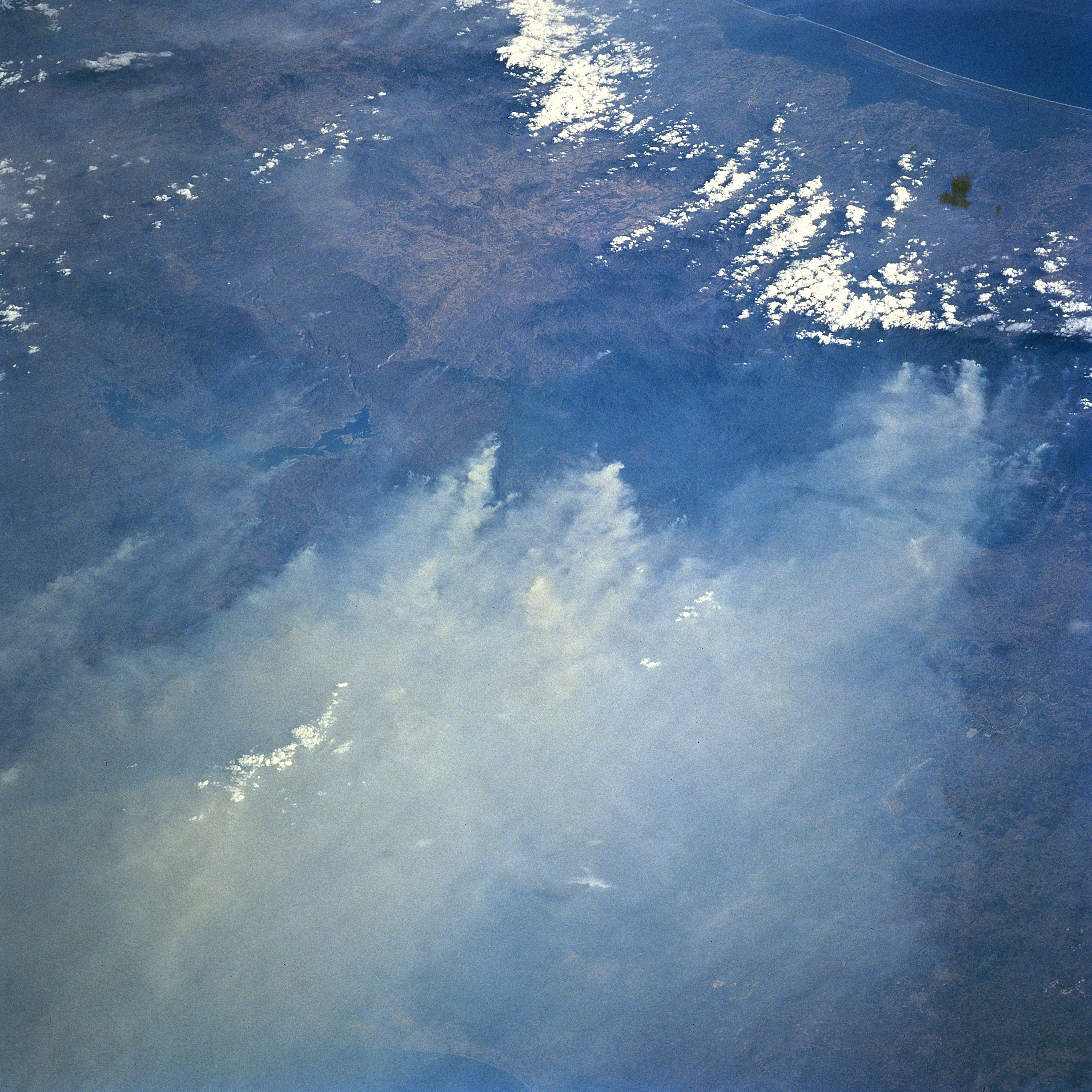
Image Caption: STS091-701-074 Fires, Isthmus of Thuantepec, Mexico June 1998
Many of the extensive, land clearing fires and the resultant smoke on the forested slopes of the mountains in southern Mexico are seen in this southwest-looking view of the Isthumus of Tehuantepec. The two major features that help to identify the specific geographic area in this image are the dark, crescent-shaped feature with the irregular edges (Nezahualcayotl Reservoir--left center of image) and the dark Muerto Lagoon and the Gulf of Tehuantepec (upper right corner). The environmental impact of these fires at times reached as far north as the central plains of the United States. (Refer to STS91-713-024 for fires and smoke palls along the Bay of Campeche coast of Mexico).
Many of the extensive, land clearing fires and the resultant smoke on the forested slopes of the mountains in southern Mexico are seen in this southwest-looking view of the Isthumus of Tehuantepec. The two major features that help to identify the specific geographic area in this image are the dark, crescent-shaped feature with the irregular edges (Nezahualcayotl Reservoir--left center of image) and the dark Muerto Lagoon and the Gulf of Tehuantepec (upper right corner). The environmental impact of these fires at times reached as far north as the central plains of the United States. (Refer to STS91-713-024 for fires and smoke palls along the Bay of Campeche coast of Mexico).
