STS090-759-49
| NASA Photo ID | STS090-759-49 |
| Focal Length | 250mm |
| Date taken | 1998.04.28 |
| Time taken | 10:22:54 GMT |

Cloud masks available for this image:
Spacecraft nadir point: 37.9° N, 23.0° E
Photo center point: 38.0° N, 23.5° E
Photo center point by machine learning:
Photo center point: 38.0° N, 23.5° E
Photo center point by machine learning:
Nadir to Photo Center: East
Spacecraft Altitude: 131 nautical miles (243km)
Country or Geographic Name: | GREECE |
Features: | ATHENS, AIYINA ISLAND |
| Features Found Using Machine Learning: | |
Cloud Cover Percentage: | 5 (1-10)% |
Sun Elevation Angle: | 66° |
Sun Azimuth: | 178° |
Camera: | Hasselblad |
Focal Length: | 250mm |
Camera Tilt: | 13 degrees |
Format: | 5069: Kodak Elite 100S, E6 Reversal, Replaces Lumiere, Warmer in tone vs. Lumiere |
Film Exposure: | Normal |
| Additional Information | |
| Width | Height | Annotated | Cropped | Purpose | Links |
|---|---|---|---|---|---|
| 4067 pixels | 4067 pixels | No | No | Earth From Space collection | Download Image |
| 639 pixels | 639 pixels | No | No | Earth From Space collection | Download Image |
| 640 pixels | 640 pixels | No | No | Photographic Highlights | Download Image |
Download Packaged File
Download a Google Earth KML for this Image
View photo footprint information
Download a GeoTIFF for this photo
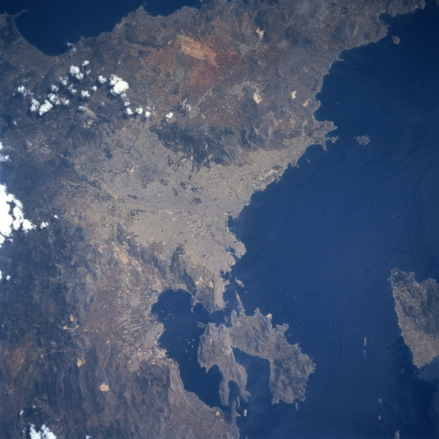
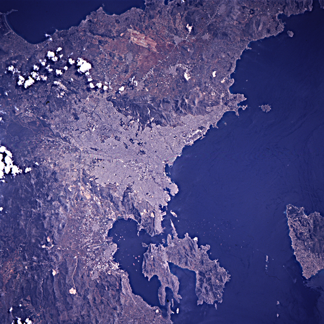
Image Caption: STS090-759-49 Athens, Greece April 1998
Athens, the capital and largest city in Greece (center of the image), and one of the world's most historical and beautiful cities, can be seen in this northeast looking view. Named for Athena, the goddess of wisdom, Athens is the hub of Greek political, industrial, and cultural life. Together, Athens and its port city of Piraeus, account for nearly 45% of Greece's industrial output. The city is located on a plain cut by limestone ridges. On the green hill of the Acropolis, the light
rectangular areas of the Parthenon and the Agora are easily visible. Most all the buildings in the city are constructed of white marble. The Saronic Gulf, an inlet to the Aegean Sea, lies a few miles (km) southwest of the city. The climate of Athens is temperate and dry. The more reflective clear area near the right center of the image is the Spata Airfield. Aiyina Island is visible near the bottom right of the image.
