STS090-755-47

| NASA Photo ID | STS090-755-47 |
| Focal Length | 250mm |
| Date taken | 1998.04.19 |
| Time taken | 21:22:04 GMT |
Resolutions offered for this image:
4061 x 4061 pixels 639 x 639 pixels 2513 x 2514 pixels 2513 x 2514 pixels 516 x 511 pixels 479 x 479 pixels
4061 x 4061 pixels 639 x 639 pixels 2513 x 2514 pixels 2513 x 2514 pixels 516 x 511 pixels 479 x 479 pixels

Cloud masks available for this image:
Spacecraft nadir point: 36.6° N, 117.7° W
Photo center point: 36.5° N, 118.0° W
Photo center point by machine learning:
Photo center point: 36.5° N, 118.0° W
Photo center point by machine learning:
Nadir to Photo Center: West
Spacecraft Altitude: 137 nautical miles (254km)
Country or Geographic Name: | USA-CALIFORNIA |
Features: | OWENS LAKE |
| Features Found Using Machine Learning: | |
Cloud Cover Percentage: | 0 (no clouds present) |
Sun Elevation Angle: | 57° |
Sun Azimuth: | 226° |
Camera: | Hasselblad |
Focal Length: | 250mm |
Camera Tilt: | 8 degrees |
Format: | 5069: Kodak Elite 100S, E6 Reversal, Replaces Lumiere, Warmer in tone vs. Lumiere |
Film Exposure: | Normal |
| Additional Information | |
| Width | Height | Annotated | Cropped | Purpose | Links |
|---|---|---|---|---|---|
| 4061 pixels | 4061 pixels | No | No | Earth From Space collection | Download Image |
| 639 pixels | 639 pixels | No | No | Earth From Space collection | Download Image |
| 2513 pixels | 2514 pixels | Download Image | |||
| 2513 pixels | 2514 pixels | Download Image | |||
| 516 pixels | 511 pixels | No | No | Download Image | |
| 479 pixels | 479 pixels | Download Image |
Download Packaged File
Download a Google Earth KML for this Image
View photo footprint information
Download a GeoTIFF for this photo
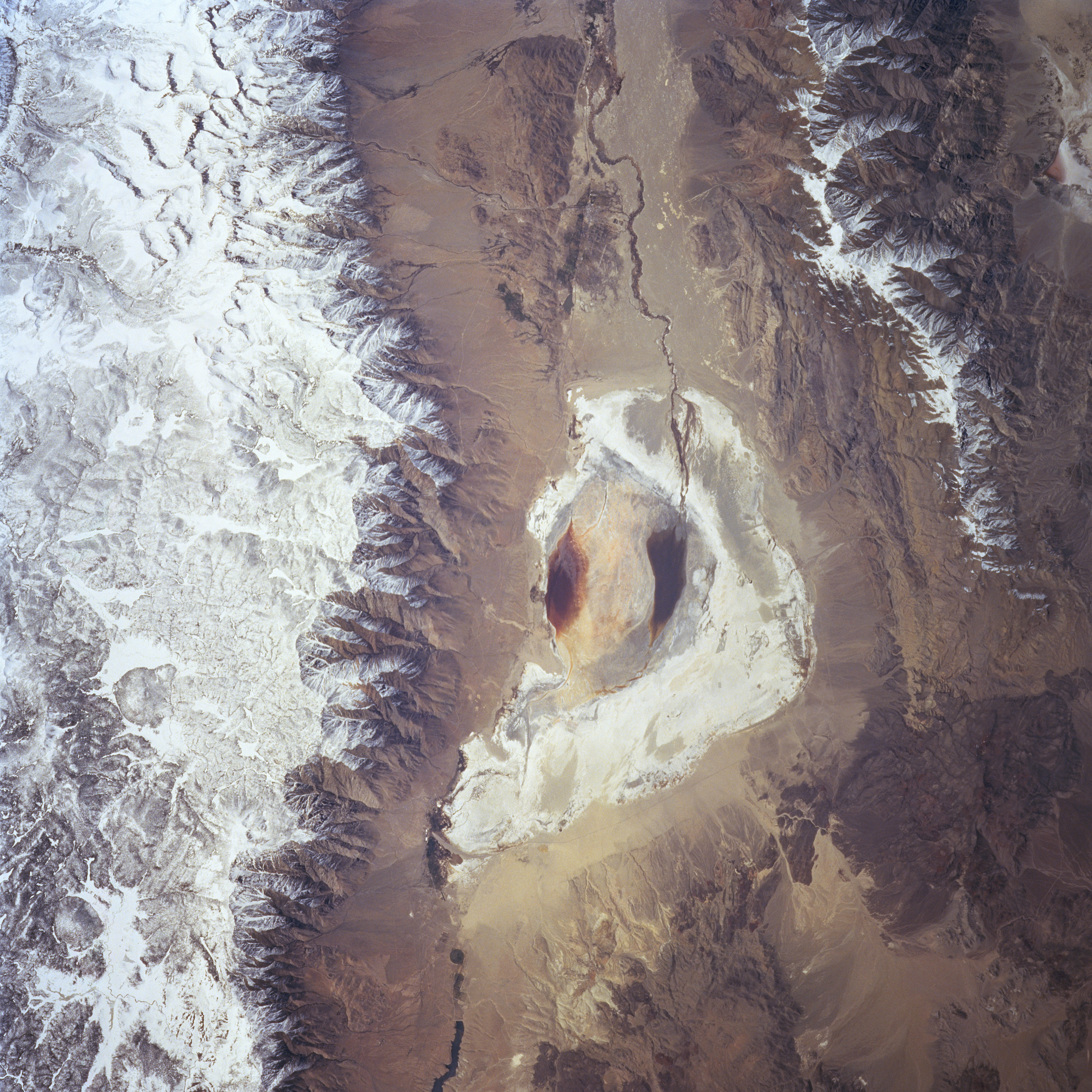
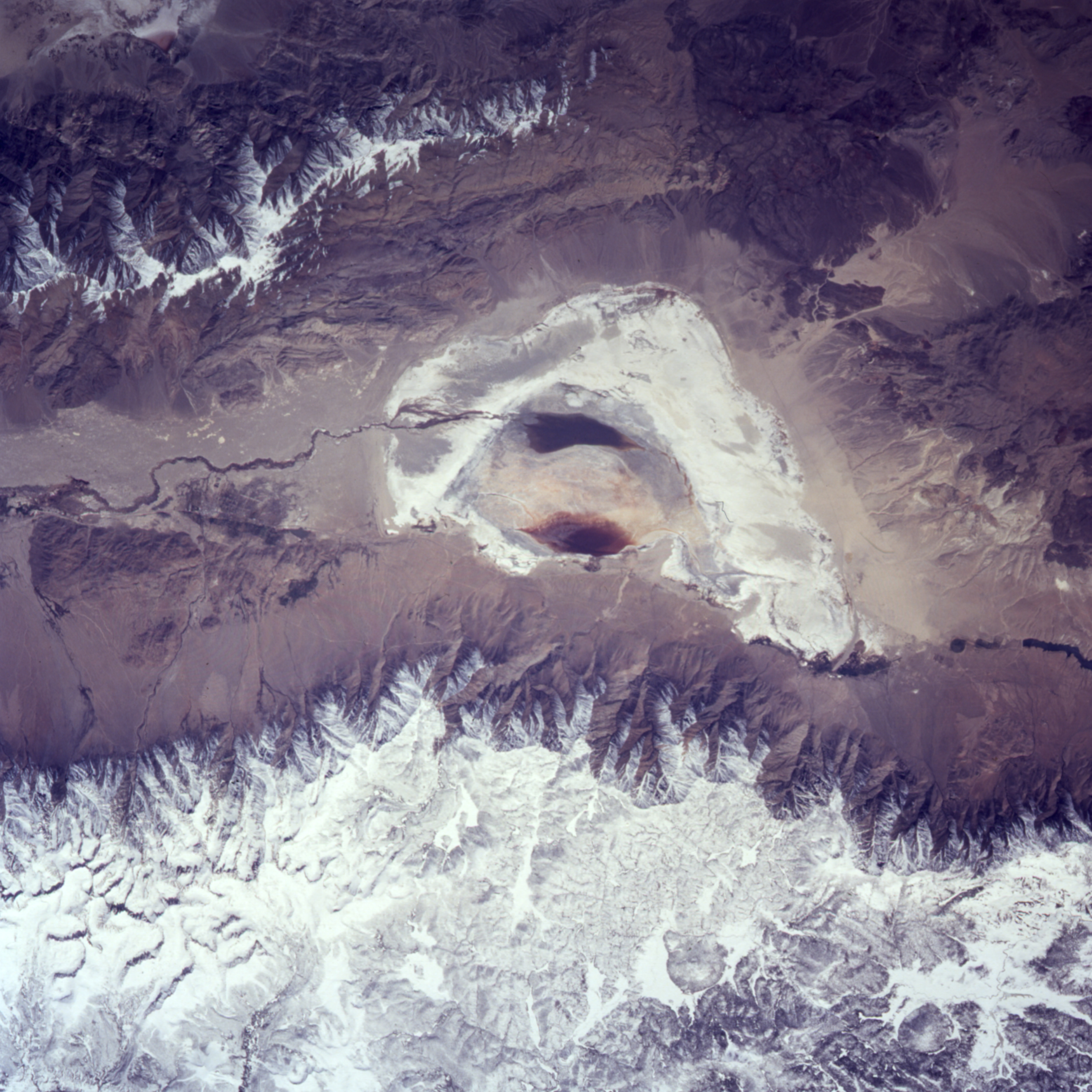
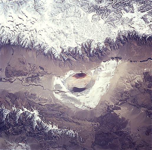
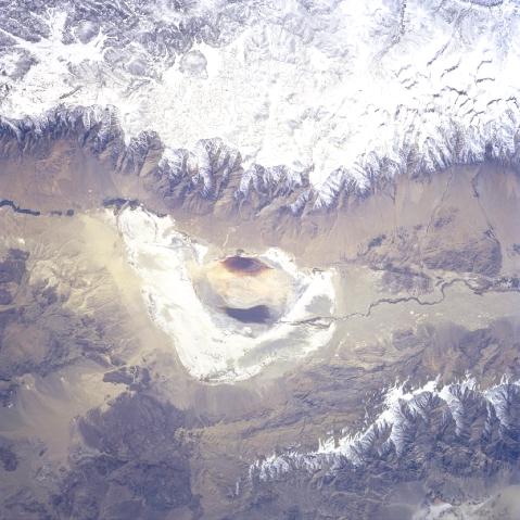
Image Caption: STS090-755-047 Owens Dry Lake, California April 1998
Owens Lake, now a dry lakebed, can be seen in this view. The high snow-covered peaks of the Sierra Nevada are visible to the west of the dry lake and cover the top-third of the image. The rugged snow-capped Inyo Mountains can be seen to the east of the dry lake in the lower center and lower left of the image. Owens Lake formerly held waters 18 miles (29 km) long and 10 miles (16 km) wide. The lake was fed by the Owens River, seen traversing the image from north to south. The water from the river is now taken via the Los Angeles Aqueduct to the city of Los Angeles to supplement their drinking water. The dry lakebed is a source of dust storms in the western United States.
Owens Lake, now a dry lakebed, can be seen in this view. The high snow-covered peaks of the Sierra Nevada are visible to the west of the dry lake and cover the top-third of the image. The rugged snow-capped Inyo Mountains can be seen to the east of the dry lake in the lower center and lower left of the image. Owens Lake formerly held waters 18 miles (29 km) long and 10 miles (16 km) wide. The lake was fed by the Owens River, seen traversing the image from north to south. The water from the river is now taken via the Los Angeles Aqueduct to the city of Los Angeles to supplement their drinking water. The dry lakebed is a source of dust storms in the western United States.
