STS090-752-94

| NASA Photo ID | STS090-752-94 |
| Focal Length | 40mm |
| Date taken | 1998.05.02 |
| Time taken | 15:55:14 GMT |
Resolutions offered for this image:
4080 x 4080 pixels 640 x 640 pixels 505 x 514 pixels 516 x 514 pixels 479 x 479 pixels 516 x 514 pixels
4080 x 4080 pixels 640 x 640 pixels 505 x 514 pixels 516 x 514 pixels 479 x 479 pixels 516 x 514 pixels


Cloud masks available for this image:
Spacecraft nadir point: 39.2° N, 108.5° W
Photo center point: 41.0° N, 112.0° W
Photo center point by machine learning:
Photo center point: 41.0° N, 112.0° W
Photo center point by machine learning:
Nadir to Photo Center: Northwest
Spacecraft Altitude: 132 nautical miles (244km)
Country or Geographic Name: | USA-UTAH |
Features: | PAN-GREAT SALT L. & DES. |
| Features Found Using Machine Learning: | |
Cloud Cover Percentage: | 10 (1-10)% |
Sun Elevation Angle: | 41° |
Sun Azimuth: | 105° |
Camera: | Hasselblad |
Focal Length: | 40mm |
Camera Tilt: | High Oblique |
Format: | 5069: Kodak Elite 100S, E6 Reversal, Replaces Lumiere, Warmer in tone vs. Lumiere |
Film Exposure: | Normal |
| Additional Information | |
| Width | Height | Annotated | Cropped | Purpose | Links |
|---|---|---|---|---|---|
| 4080 pixels | 4080 pixels | No | No | Earth From Space collection | Download Image |
| 640 pixels | 640 pixels | No | No | Earth From Space collection | Download Image |
| 505 pixels | 514 pixels | Earth From Space phase 2 | Download Image | ||
| 516 pixels | 514 pixels | Earth From Space phase 2 | Download Image | ||
| 479 pixels | 479 pixels | Download Image | |||
| 516 pixels | 514 pixels | No | No | Download Image |
Download Packaged File
Download a Google Earth KML for this Image
View photo footprint information
Download a GeoTIFF for this photo
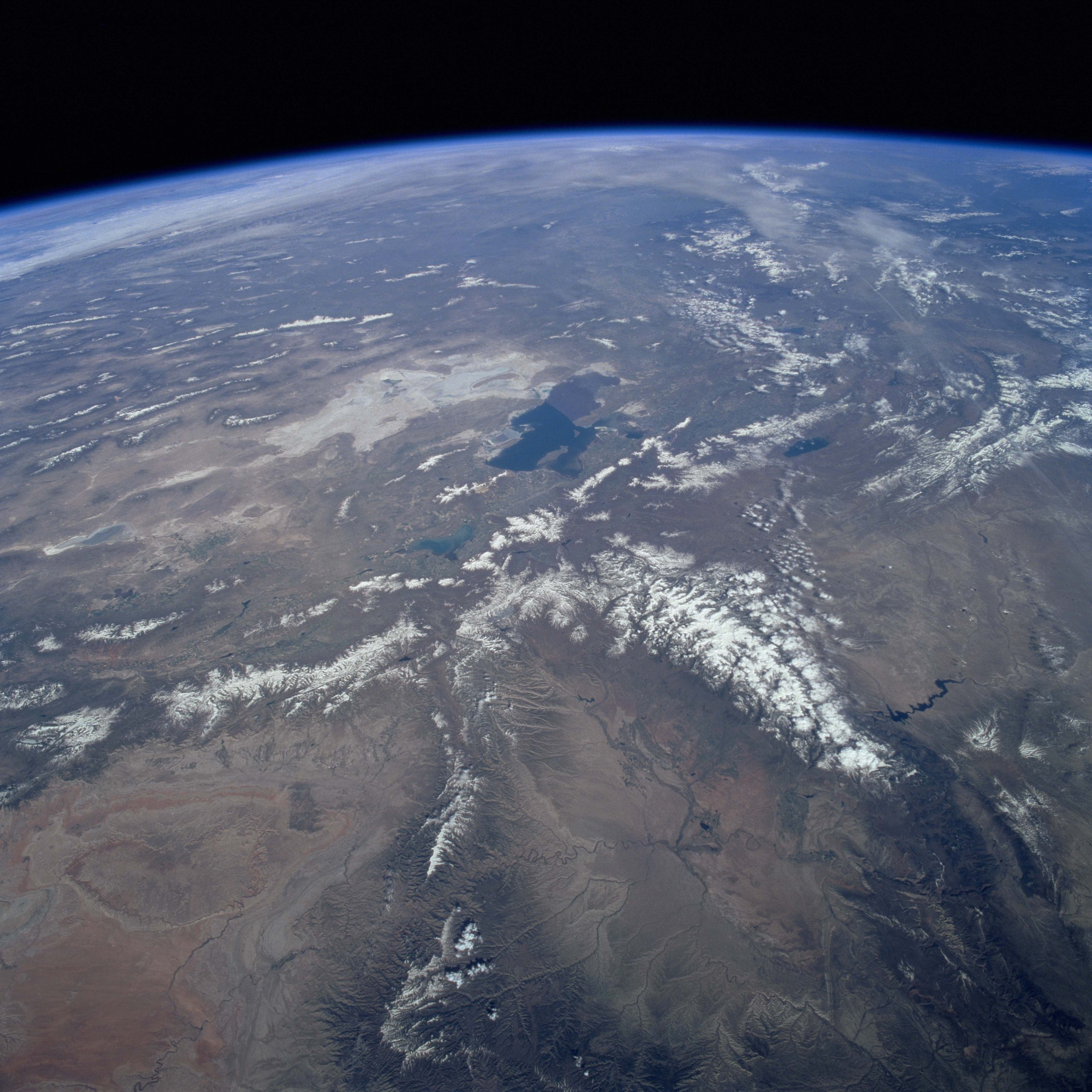
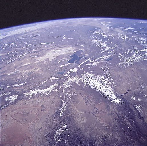
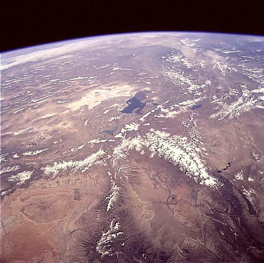
Image Caption: STS090-752-094 Wasatch Mountains and Uinta Mountains, Utah April 1998
A northwest-looking image shows the rugged terrain of northern Utah extending westward and northward into the Basin and Range Province of northern Nevada and southern Oregon. The Great Salt Lake is visible just slightly above the center of the image. To the lake's west is the Great Salt Lake Desert, the floor of former Lake Bonneville. Just south of the Great Salt Lake and at the center of the image is Utah Lake. East of Utah Lake and extending north-south are the snow-covered peaks of the Wasatch Range, considered part of the Rocky Mountains. Extending in an east-west line are the faulted, snow-covered Uinta Mountains, which are also part of the Rocky Mountains. North of the Uinta Mountains near the right center of the image are the Great Divide Basin and the Flaming Gorge Reservoir of southwestern Wyoming. To the south of the Uinta Mountains and north of the Book Cliffs is the Uinta Basin, a major oil and natural gas region. Toward the bottom left of the image is the San Rafael Desert.
A northwest-looking image shows the rugged terrain of northern Utah extending westward and northward into the Basin and Range Province of northern Nevada and southern Oregon. The Great Salt Lake is visible just slightly above the center of the image. To the lake's west is the Great Salt Lake Desert, the floor of former Lake Bonneville. Just south of the Great Salt Lake and at the center of the image is Utah Lake. East of Utah Lake and extending north-south are the snow-covered peaks of the Wasatch Range, considered part of the Rocky Mountains. Extending in an east-west line are the faulted, snow-covered Uinta Mountains, which are also part of the Rocky Mountains. North of the Uinta Mountains near the right center of the image are the Great Divide Basin and the Flaming Gorge Reservoir of southwestern Wyoming. To the south of the Uinta Mountains and north of the Book Cliffs is the Uinta Basin, a major oil and natural gas region. Toward the bottom left of the image is the San Rafael Desert.
