STS090-712-5

| NASA Photo ID | STS090-712-5 |
| Focal Length | 250mm |
| Date taken | 1998.04.25 |
| Time taken | 16:24:54 GMT |
Resolutions offered for this image:
4067 x 4091 pixels 636 x 640 pixels 3461 x 3415 pixels 512 x 511 pixels 479 x 479 pixels
4067 x 4091 pixels 636 x 640 pixels 3461 x 3415 pixels 512 x 511 pixels 479 x 479 pixels

Cloud masks available for this image:
Spacecraft nadir point: 31.7° N, 104.3° W
Photo center point: 32.0° N, 105.0° W
Photo center point by machine learning:
Photo center point: 32.0° N, 105.0° W
Photo center point by machine learning:
Nadir to Photo Center: West
Spacecraft Altitude: 134 nautical miles (248km)
Country or Geographic Name: | USA-TEXAS |
Features: | GUADALUPE MTS., PIVOT AGR |
| Features Found Using Machine Learning: | |
Cloud Cover Percentage: | 5 (1-10)% |
Sun Elevation Angle: | 51° |
Sun Azimuth: | 109° |
Camera: | Hasselblad |
Focal Length: | 250mm |
Camera Tilt: | 19 degrees |
Format: | 5069: Kodak Elite 100S, E6 Reversal, Replaces Lumiere, Warmer in tone vs. Lumiere |
Film Exposure: | Normal |
| Additional Information | |
| Width | Height | Annotated | Cropped | Purpose | Links |
|---|---|---|---|---|---|
| 4067 pixels | 4091 pixels | No | No | Earth From Space collection | Download Image |
| 636 pixels | 640 pixels | No | No | Earth From Space collection | Download Image |
| 3461 pixels | 3415 pixels | Download Image | |||
| 512 pixels | 511 pixels | No | No | Download Image | |
| 479 pixels | 479 pixels | Download Image |
Download Packaged File
Download a Google Earth KML for this Image
View photo footprint information
Download a GeoTIFF for this photo
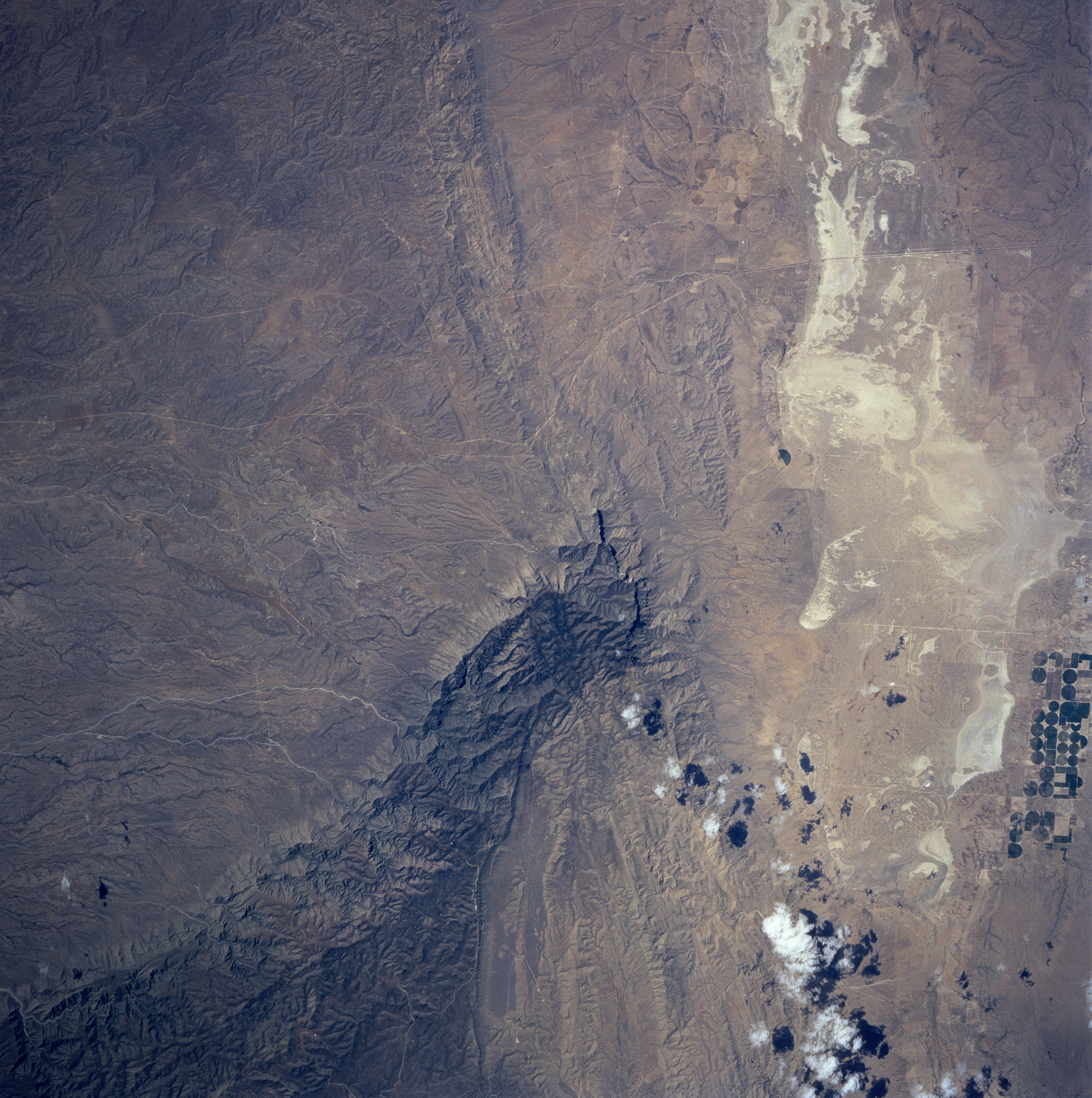
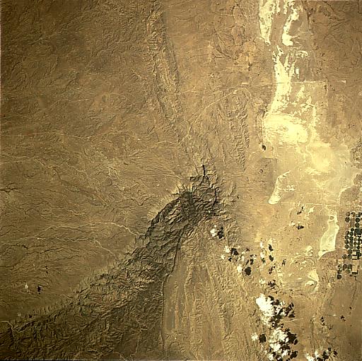
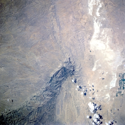
Image Caption: STS090-712-005 Guadalupe Mountains, Texas, USA April 1998
The southern end of the Guadalupe Mountains that includes Guadalupe Peak (8751 feet-2667 meters), the highest point in Texas, is located almost in the center of the picture. In order to preserve the extensive fossil reef (largest in the world) Guadalupe Mountain National Park was created in 1972. The highly reflective surfaces west-southwest of the mountains are salt flats (dry lake beds). The darker, circular patterns west of the Guadalupe Mountains are cultivated, irrigated farmlands where center pivot irrigation techniques are being used to grow crops in this arid environment.
The southern end of the Guadalupe Mountains that includes Guadalupe Peak (8751 feet-2667 meters), the highest point in Texas, is located almost in the center of the picture. In order to preserve the extensive fossil reef (largest in the world) Guadalupe Mountain National Park was created in 1972. The highly reflective surfaces west-southwest of the mountains are salt flats (dry lake beds). The darker, circular patterns west of the Guadalupe Mountains are cultivated, irrigated farmlands where center pivot irrigation techniques are being used to grow crops in this arid environment.
