STS090-712-37
| NASA Photo ID | STS090-712-37 |
| Focal Length | 250mm |
| Date taken | 1998.04.25 |
| Time taken | 16:30:53 GMT |
Resolutions offered for this image:
4006 x 4006 pixels 639 x 639 pixels 516 x 520 pixels 479 x 479 pixels
4006 x 4006 pixels 639 x 639 pixels 516 x 520 pixels 479 x 479 pixels

Cloud masks available for this image:
Spacecraft nadir point: 38.5° N, 77.5° W
Photo center point: 38.5° N, 76.5° W
Photo center point by machine learning:
Photo center point: 38.5° N, 76.5° W
Photo center point by machine learning:
Nadir to Photo Center: East
Spacecraft Altitude: 133 nautical miles (246km)
Country or Geographic Name: | USA-MARYLAND |
Features: | SUNGLINT, PATUXENT RIVER |
| Features Found Using Machine Learning: | |
Cloud Cover Percentage: | 0 (no clouds present) |
Sun Elevation Angle: | 64° |
Sun Azimuth: | 159° |
Camera: | Hasselblad |
Focal Length: | 250mm |
Camera Tilt: | 24 degrees |
Format: | 5069: Kodak Elite 100S, E6 Reversal, Replaces Lumiere, Warmer in tone vs. Lumiere |
Film Exposure: | Normal |
| Additional Information | |
| Width | Height | Annotated | Cropped | Purpose | Links |
|---|---|---|---|---|---|
| 4006 pixels | 4006 pixels | No | No | Earth From Space collection | Download Image |
| 639 pixels | 639 pixels | No | No | Earth From Space collection | Download Image |
| 516 pixels | 520 pixels | No | No | Download Image | |
| 479 pixels | 479 pixels | Download Image |
Download Packaged File
Download a Google Earth KML for this Image
View photo footprint information
Download a GeoTIFF for this photo
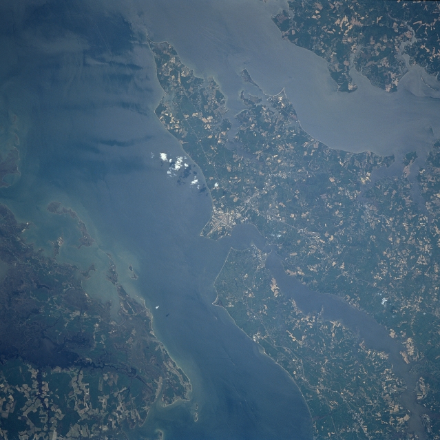
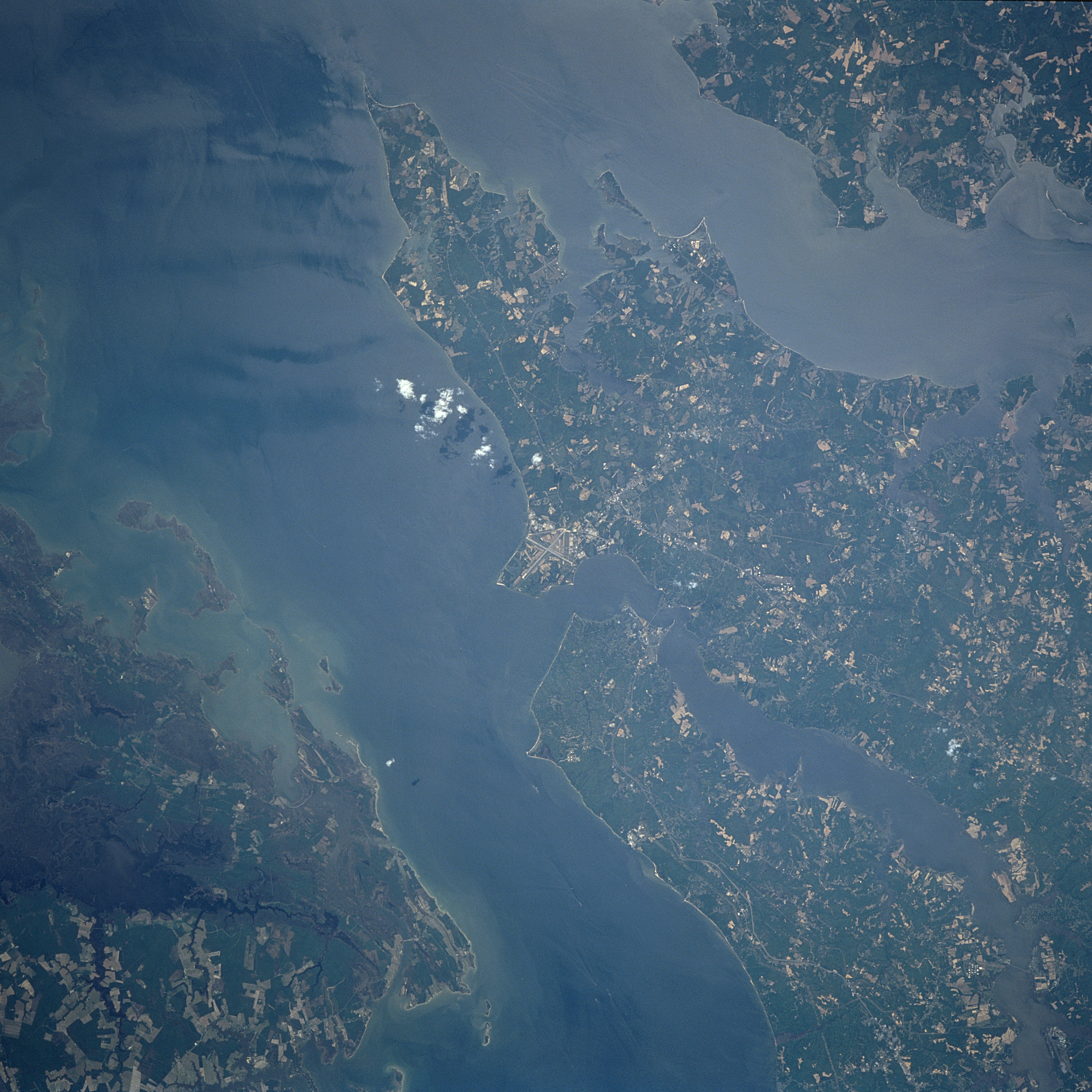
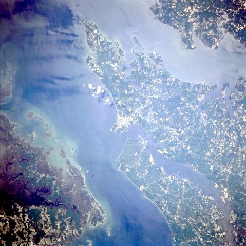
Image Caption: STS090-712-037 Patuxent River Naval Air Center, Maryland April, 1998
Located 65 miles (105 km) southeast of Washington D. C. on a peninsula known as Center Point, the runways of the Patuxent River Naval Air Center can be seen in this south-looking view. The runways mark the area just south of where the mouth of the Patuxent River enters Chesapeake Bay. Patuxent was commissioned in April 1943 to centralize widely dispersed air testing facilities and is presently home to the Naval Air Warfare Center Aircraft Division. Chesapeake Bay covers a good portion of the left side of the image. A small portion of the Delmarva Peninsula from Taylor's Island to Hooper Island is visible in the bottom left portion of the image. The mouth of the Potomac River is visible in the upper center and upper right portion of the image.
Located 65 miles (105 km) southeast of Washington D. C. on a peninsula known as Center Point, the runways of the Patuxent River Naval Air Center can be seen in this south-looking view. The runways mark the area just south of where the mouth of the Patuxent River enters Chesapeake Bay. Patuxent was commissioned in April 1943 to centralize widely dispersed air testing facilities and is presently home to the Naval Air Warfare Center Aircraft Division. Chesapeake Bay covers a good portion of the left side of the image. A small portion of the Delmarva Peninsula from Taylor's Island to Hooper Island is visible in the bottom left portion of the image. The mouth of the Potomac River is visible in the upper center and upper right portion of the image.
