STS090-705-87
| NASA Photo ID | STS090-705-87 |
| Focal Length | 250mm |
| Date taken | 1998.04.18 |
| Time taken | 21:23:16 GMT |
Resolutions offered for this image:
4000 x 4000 pixels 1087 x 1072 pixels 4025 x 4091 pixels 629 x 640 pixels 4000 x 4000 pixels 768 x 768 pixels 479 x 480 pixels 518 x 518 pixels
4000 x 4000 pixels 1087 x 1072 pixels 4025 x 4091 pixels 629 x 640 pixels 4000 x 4000 pixels 768 x 768 pixels 479 x 480 pixels 518 x 518 pixels


Cloud masks available for this image:
Spacecraft nadir point: 33.8° N, 120.7° W
Photo center point: 34.0° N, 118.0° W
Photo center point by machine learning:
Photo center point: 34.0° N, 118.0° W
Photo center point by machine learning:
Nadir to Photo Center: East
Spacecraft Altitude: 138 nautical miles (256km)
Country or Geographic Name: | USA-CALIFORNIA |
Features: | LOS ANGELES, STREETS |
| Features Found Using Machine Learning: | |
Cloud Cover Percentage: | 0 (no clouds present) |
Sun Elevation Angle: | 61° |
Sun Azimuth: | 224° |
Camera: | Hasselblad |
Focal Length: | 250mm |
Camera Tilt: | 50 degrees |
Format: | 5069: Kodak Elite 100S, E6 Reversal, Replaces Lumiere, Warmer in tone vs. Lumiere |
Film Exposure: | Normal |
| Additional Information | |
| Width | Height | Annotated | Cropped | Purpose | Links |
|---|---|---|---|---|---|
| 4000 pixels | 4000 pixels | Cities collection | Download Image | ||
| 1087 pixels | 1072 pixels | No | No | Cities collection | Download Image |
| 4025 pixels | 4091 pixels | No | No | Earth From Space collection | Download Image |
| 629 pixels | 640 pixels | No | No | Earth From Space collection | Download Image |
| 4000 pixels | 4000 pixels | No | No | Scientist Request | Download Image |
| 768 pixels | 768 pixels | No | No | Scientist Request | Download Image |
| 479 pixels | 480 pixels | Download Image | |||
| 518 pixels | 518 pixels | No | No | Download Image |
Download Packaged File
Download a Google Earth KML for this Image
View photo footprint information
Download a GeoTIFF for this photo
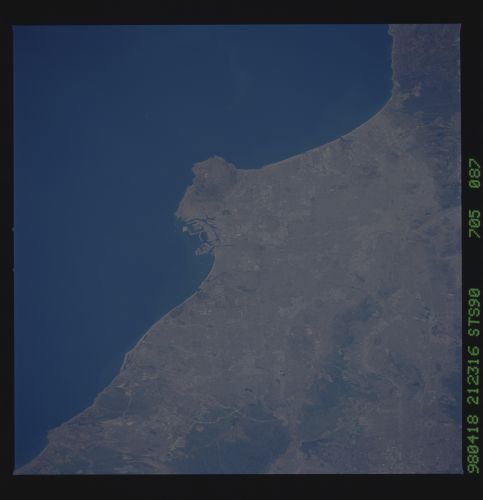
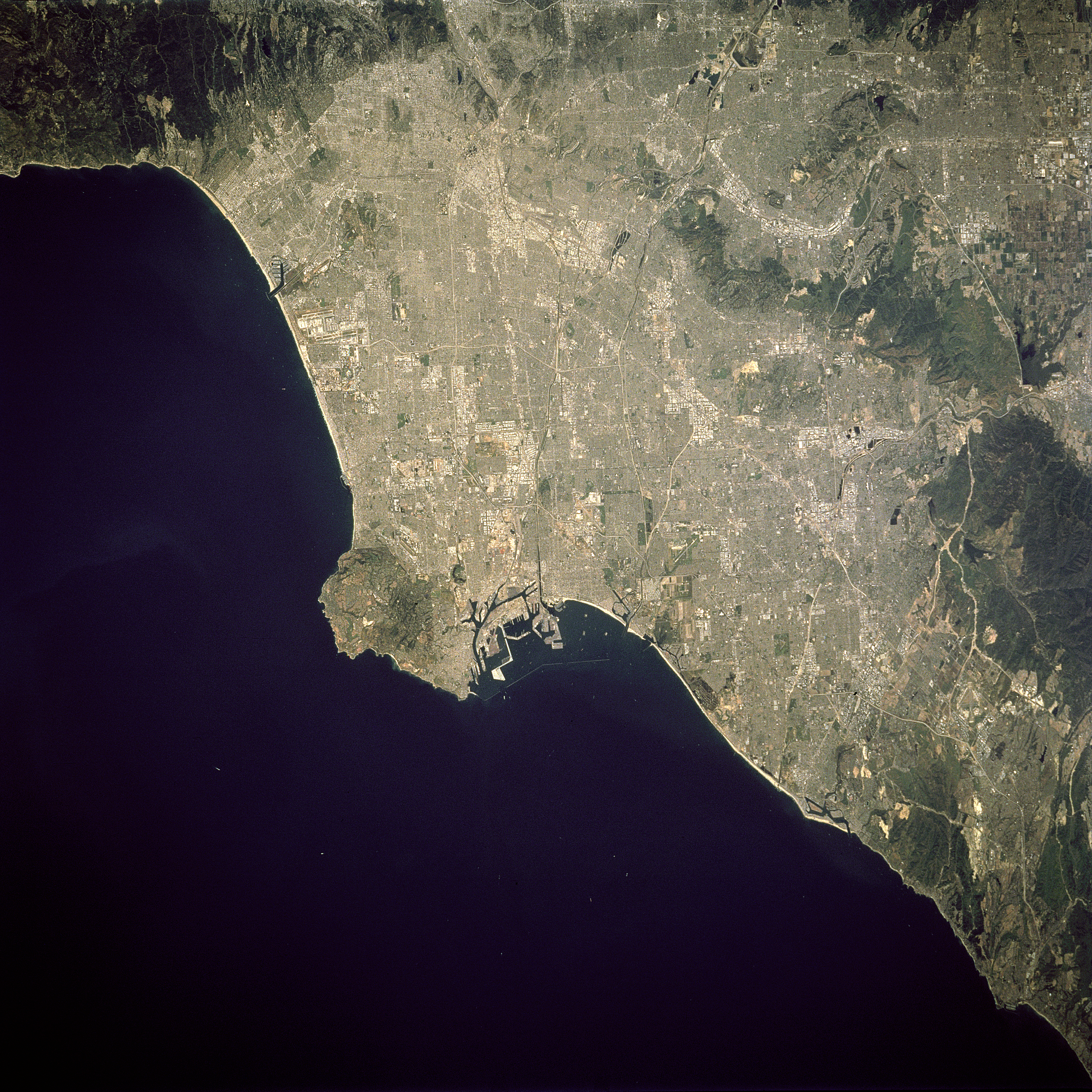
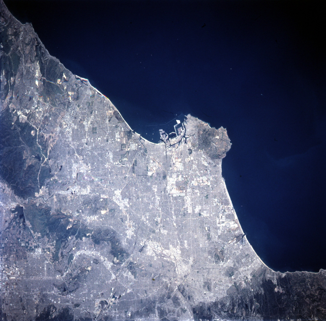
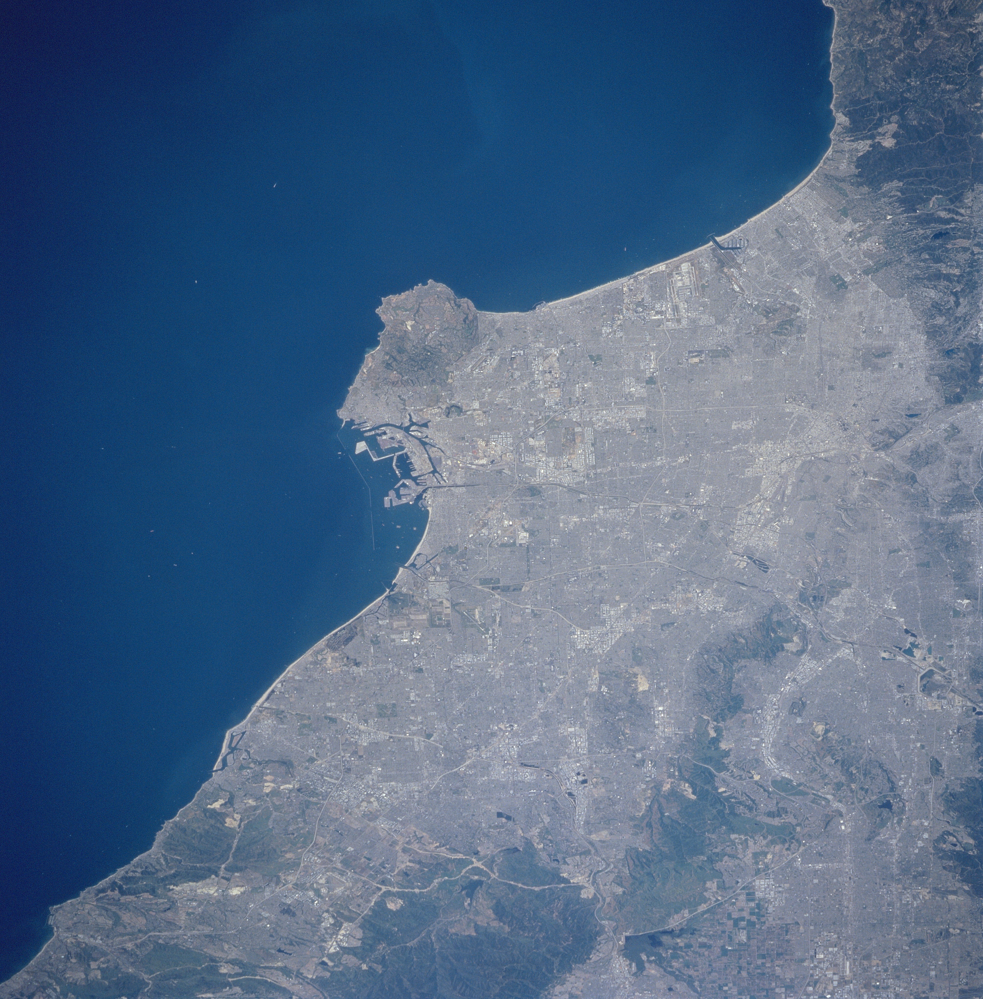
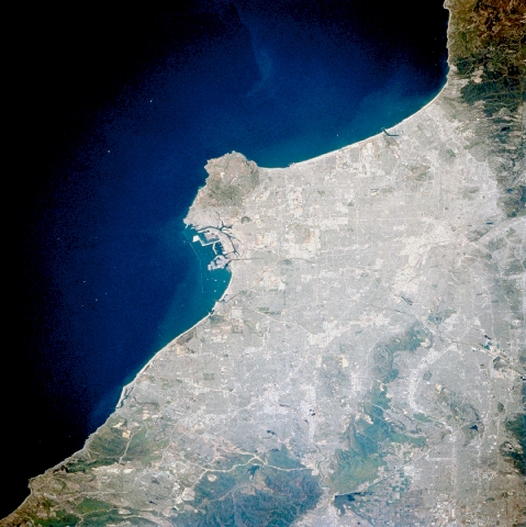
Image Caption: STS090-705-087 Los Angeles Basin, California, USA April 1998
The central part of the Los Angeles Basin, including downtown Los Angeles and the greater Los Angeles metropolitan region, can be identified by the gridded street pattern in this near vertical image. Several of the many interstate highways (lighter colored, linear features) that cross this densely populated landscape are visible. Notice that dark mountain features restrict the growth of the cities. The Santa Ana Mountains (darker feature eastern edge of the image), and the Puente Hills (linear, darker feature northwest of Santa Ana Mountains) stand out in contrast against the light-colored highly reflective urban surfaces (buildings, aquaducts, highways, etc.). The clustered light colored areas within the large urban complex shows concentrated business, industrial, and commercial sites. The extensive harbor facilities, including Terminal Island, are visible near the center of the image just east of the Palos Verde Peninsula, the large peninsula that juts into the Pacific Ocean.
The central part of the Los Angeles Basin, including downtown Los Angeles and the greater Los Angeles metropolitan region, can be identified by the gridded street pattern in this near vertical image. Several of the many interstate highways (lighter colored, linear features) that cross this densely populated landscape are visible. Notice that dark mountain features restrict the growth of the cities. The Santa Ana Mountains (darker feature eastern edge of the image), and the Puente Hills (linear, darker feature northwest of Santa Ana Mountains) stand out in contrast against the light-colored highly reflective urban surfaces (buildings, aquaducts, highways, etc.). The clustered light colored areas within the large urban complex shows concentrated business, industrial, and commercial sites. The extensive harbor facilities, including Terminal Island, are visible near the center of the image just east of the Palos Verde Peninsula, the large peninsula that juts into the Pacific Ocean.
