STS090-705-5
| NASA Photo ID | STS090-705-5 |
| Focal Length | 250mm |
| Date taken | 1998.04.17 |
| Time taken | 22:59:37 GMT |
Resolutions offered for this image:
3060 x 3105 pixels 1182 x 1200 pixels 4037 x 4096 pixels 630 x 640 pixels 3251 x 3353 pixels 513 x 501 pixels 479 x 479 pixels
3060 x 3105 pixels 1182 x 1200 pixels 4037 x 4096 pixels 630 x 640 pixels 3251 x 3353 pixels 513 x 501 pixels 479 x 479 pixels


Cloud masks available for this image:
Spacecraft nadir point: 37.6° N, 122.1° W
Photo center point: 37.0° N, 122.0° W
Photo center point by machine learning:
Photo center point: 37.0° N, 122.0° W
Photo center point by machine learning:
Nadir to Photo Center: South
Spacecraft Altitude: 140 nautical miles (259km)
Country or Geographic Name: | USA-CALIFORNIA |
Features: | MONTEREY BAY, SALINAS |
| Features Found Using Machine Learning: | |
Cloud Cover Percentage: | 0 (no clouds present) |
Sun Elevation Angle: | 43° |
Sun Azimuth: | 247° |
Camera: | Hasselblad |
Focal Length: | 250mm |
Camera Tilt: | 15 degrees |
Format: | 5069: Kodak Elite 100S, E6 Reversal, Replaces Lumiere, Warmer in tone vs. Lumiere |
Film Exposure: | Normal |
| Additional Information | |
| Width | Height | Annotated | Cropped | Purpose | Links |
|---|---|---|---|---|---|
| 3060 pixels | 3105 pixels | No | No | Cities collection | Download Image |
| 1182 pixels | 1200 pixels | No | No | Cities collection | Download Image |
| 4037 pixels | 4096 pixels | No | No | Earth From Space collection | Download Image |
| 630 pixels | 640 pixels | No | No | Earth From Space collection | Download Image |
| 3251 pixels | 3353 pixels | Download Image | |||
| 513 pixels | 501 pixels | No | No | Download Image | |
| 479 pixels | 479 pixels | Download Image |
Download Packaged File
Download a Google Earth KML for this Image
View photo footprint information
Download a GeoTIFF for this photo
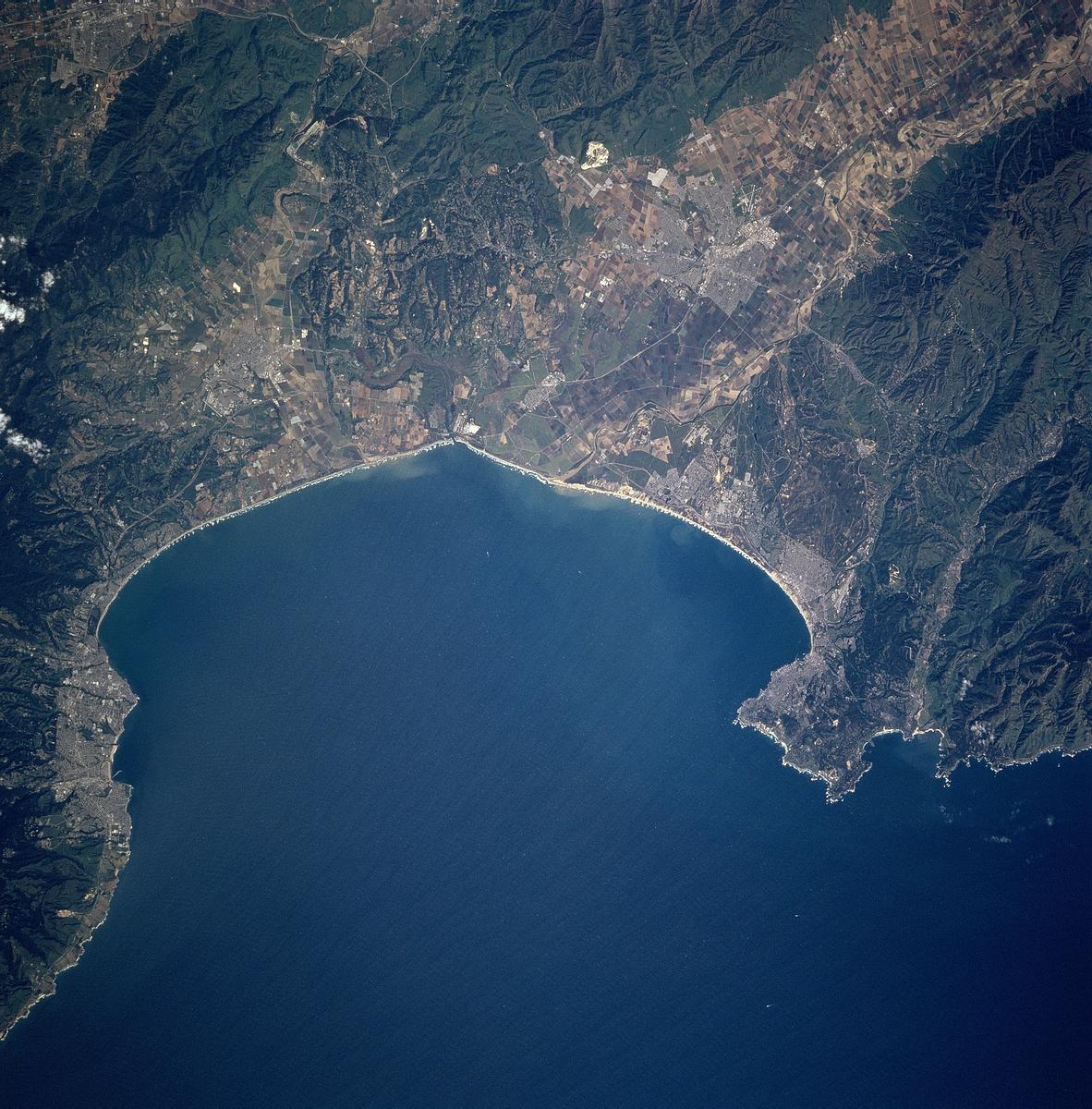
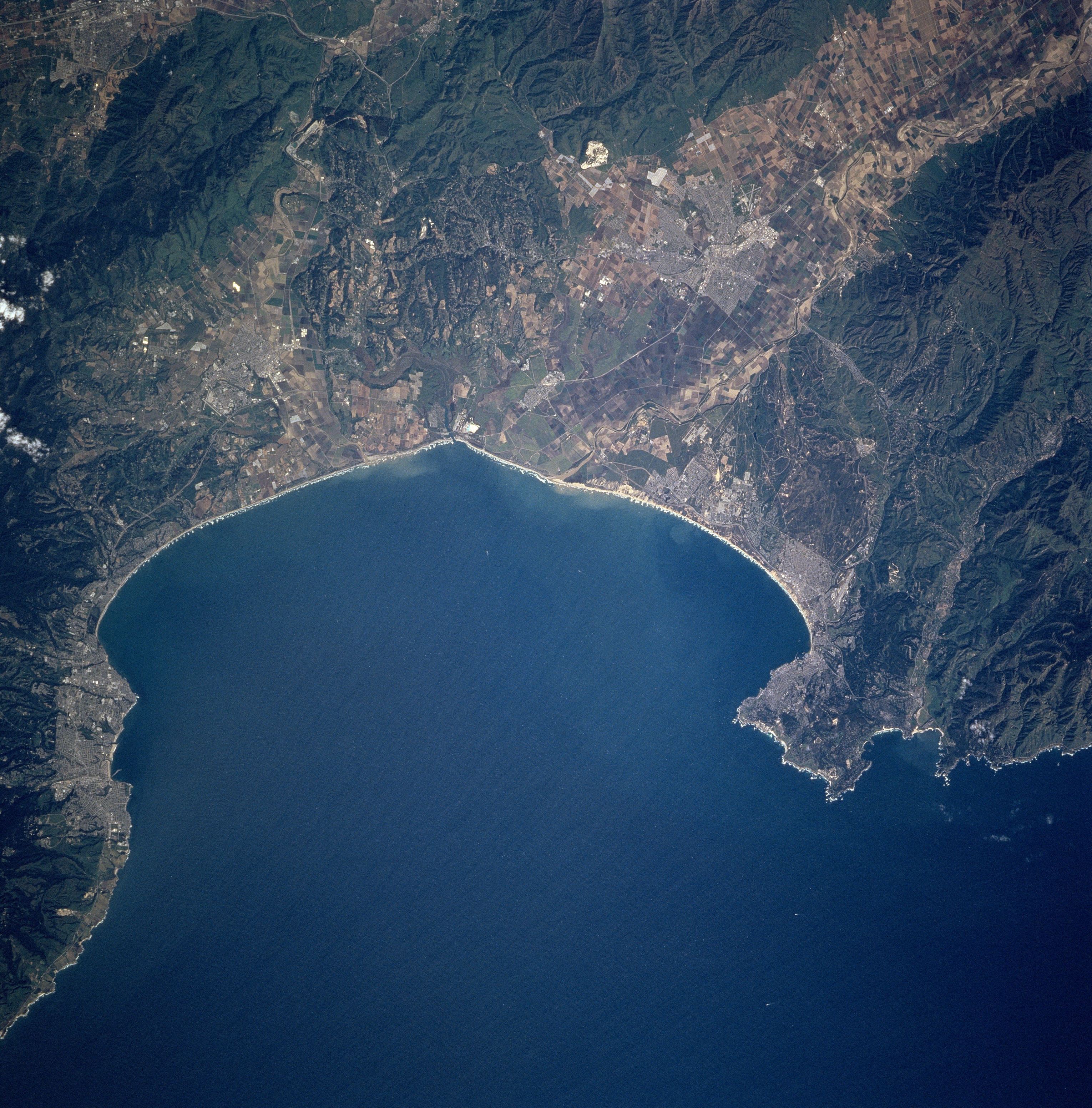
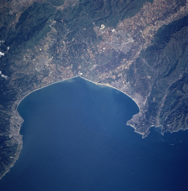
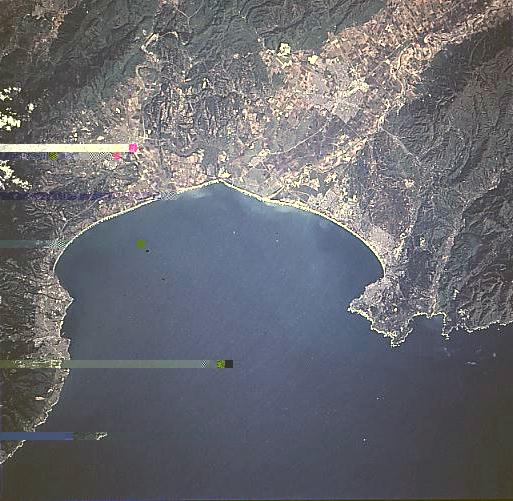
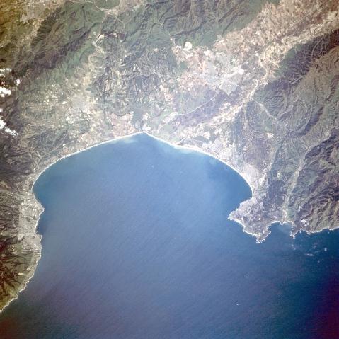
Image Caption: STS090-705-005 Monterey Bay, California April, 1998
An inlet of the Pacific Ocean, Monterey Bay can be seen in this east-northeast-looking view. Once home of the nation's largest fishing port, Monterey Bay is today the largest marine sanctuary in the United States. Its diversity of habitats and marine life makes it one of the richest temperate-zone marine regions on Earth. This region is also home to the world's greatest assemblage of marine research institutions. In the upper right portion of the image and extending to Monterey Bay is the Salinas River Valley. Just below the center-left of the image is the city of Santa Cruz, a seaside city with many fine beaches that is backed by rugged hills and redwood forests. Midway between the center and right center of the image is the city of Monterey. Point Pinos to the north and Cypress Point to the south are also visible. At the right center of the image are the northern portions of the Santa Lucia Mountains.
An inlet of the Pacific Ocean, Monterey Bay can be seen in this east-northeast-looking view. Once home of the nation's largest fishing port, Monterey Bay is today the largest marine sanctuary in the United States. Its diversity of habitats and marine life makes it one of the richest temperate-zone marine regions on Earth. This region is also home to the world's greatest assemblage of marine research institutions. In the upper right portion of the image and extending to Monterey Bay is the Salinas River Valley. Just below the center-left of the image is the city of Santa Cruz, a seaside city with many fine beaches that is backed by rugged hills and redwood forests. Midway between the center and right center of the image is the city of Monterey. Point Pinos to the north and Cypress Point to the south are also visible. At the right center of the image are the northern portions of the Santa Lucia Mountains.
