STS089-709-53

| NASA Photo ID | STS089-709-53 |
| Focal Length | 100mm |
| Date taken | 1998.01.30 |
| Time taken | 18:28:02 GMT |
Cloud masks available for this image:
Spacecraft nadir point: 38.7° S, 64.9° W
Photo center point: 40.5° S, 63.0° W
Photo center point by machine learning:
Photo center point: 40.5° S, 63.0° W
Photo center point by machine learning:
Nadir to Photo Center: Southeast
Spacecraft Altitude: 197 nautical miles (365km)
Country or Geographic Name: | ARGENTINA |
Features: | RIO NEGRO, POINT RASA |
| Features Found Using Machine Learning: | |
Cloud Cover Percentage: | 0 (no clouds present) |
Sun Elevation Angle: | 57° |
Sun Azimuth: | 302° |
Camera: | Hasselblad |
Focal Length: | 100mm |
Camera Tilt: | 39 degrees |
Format: | 5069: Kodak Elite 100S, E6 Reversal, Replaces Lumiere, Warmer in tone vs. Lumiere |
Film Exposure: | Normal |
| Additional Information | |
| Width | Height | Annotated | Cropped | Purpose | Links |
|---|---|---|---|---|---|
| 4096 pixels | 4096 pixels | No | No | Earth From Space collection | Download Image |
| 640 pixels | 640 pixels | No | No | Earth From Space collection | Download Image |
Download Packaged File
Download a Google Earth KML for this Image
View photo footprint information
Download a GeoTIFF for this photo
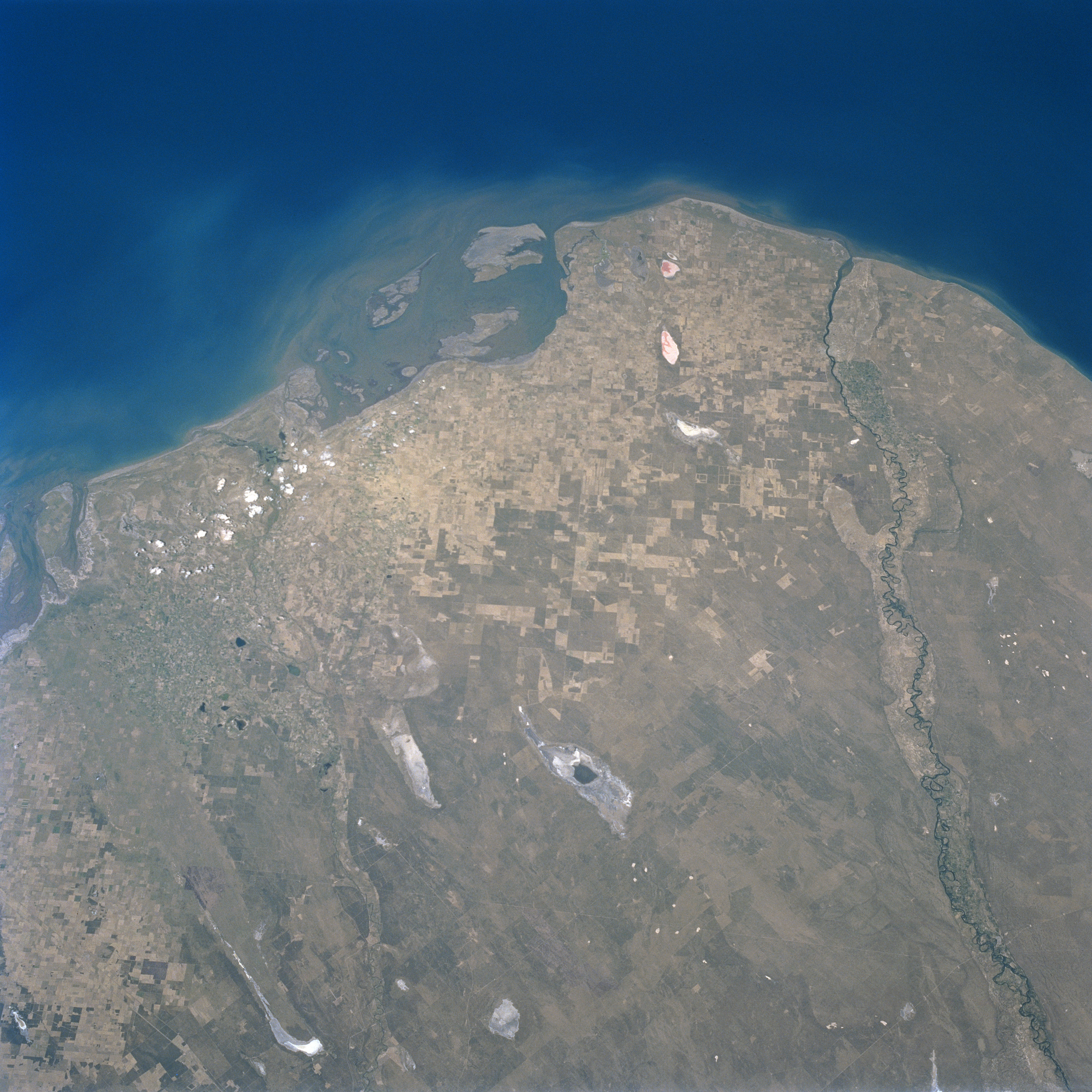
Image Caption: STS089-709-053 Rio Negro, Argentina January 1998
The mouths of the Rio Negro and its mouth can be seen in this southeast-looking view. The Rio Negro originates in central Argentina from the confluence of the Neuquen and Limay Rivers and then flows generally eastward 400 miles (645 km) passed the small city of Carmen De Patagones to the Atlantic Ocean. Through most of its course to the Atlantic Ocean, the Rio Negro is used for irrigation of farmland in the northern Patagonia Region. Agricultural field patterns are scattered throughout the scene. Numerous salt marshes (white-colored areas) are also discernible. The Salina Grande is visible just below the center portion of the image.
The mouths of the Rio Negro and its mouth can be seen in this southeast-looking view. The Rio Negro originates in central Argentina from the confluence of the Neuquen and Limay Rivers and then flows generally eastward 400 miles (645 km) passed the small city of Carmen De Patagones to the Atlantic Ocean. Through most of its course to the Atlantic Ocean, the Rio Negro is used for irrigation of farmland in the northern Patagonia Region. Agricultural field patterns are scattered throughout the scene. Numerous salt marshes (white-colored areas) are also discernible. The Salina Grande is visible just below the center portion of the image.
