STS089-707-91
| NASA Photo ID | STS089-707-91 |
| Focal Length | 100mm |
| Date taken | 1998.01.24 |
| Time taken | 21:14:17 GMT |
Cloud masks available for this image:
Spacecraft nadir point: 38.7° S, 70.9° W
Photo center point: 39.0° S, 71.5° W
Photo center point by machine learning:
Photo center point: 39.0° S, 71.5° W
Photo center point by machine learning:
Nadir to Photo Center: Southwest
Spacecraft Altitude: 208 nautical miles (385km)
Country or Geographic Name: | CHILE |
Features: | LAKE ALUMINE |
| Features Found Using Machine Learning: | |
Cloud Cover Percentage: | 0 (no clouds present) |
Sun Elevation Angle: | 31° |
Sun Azimuth: | 270° |
Camera: | Hasselblad |
Focal Length: | 100mm |
Camera Tilt: | 11 degrees |
Format: | 5069: Kodak Elite 100S, E6 Reversal, Replaces Lumiere, Warmer in tone vs. Lumiere |
Film Exposure: | Normal |
| Additional Information | |
| Width | Height | Annotated | Cropped | Purpose | Links |
|---|---|---|---|---|---|
| 4088 pixels | 4096 pixels | No | No | Earth From Space collection | Download Image |
| 638 pixels | 640 pixels | No | No | Earth From Space collection | Download Image |
Download Packaged File
Download a Google Earth KML for this Image
View photo footprint information
Download a GeoTIFF for this photo
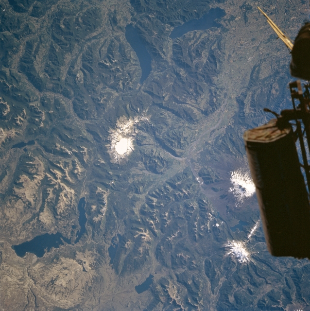
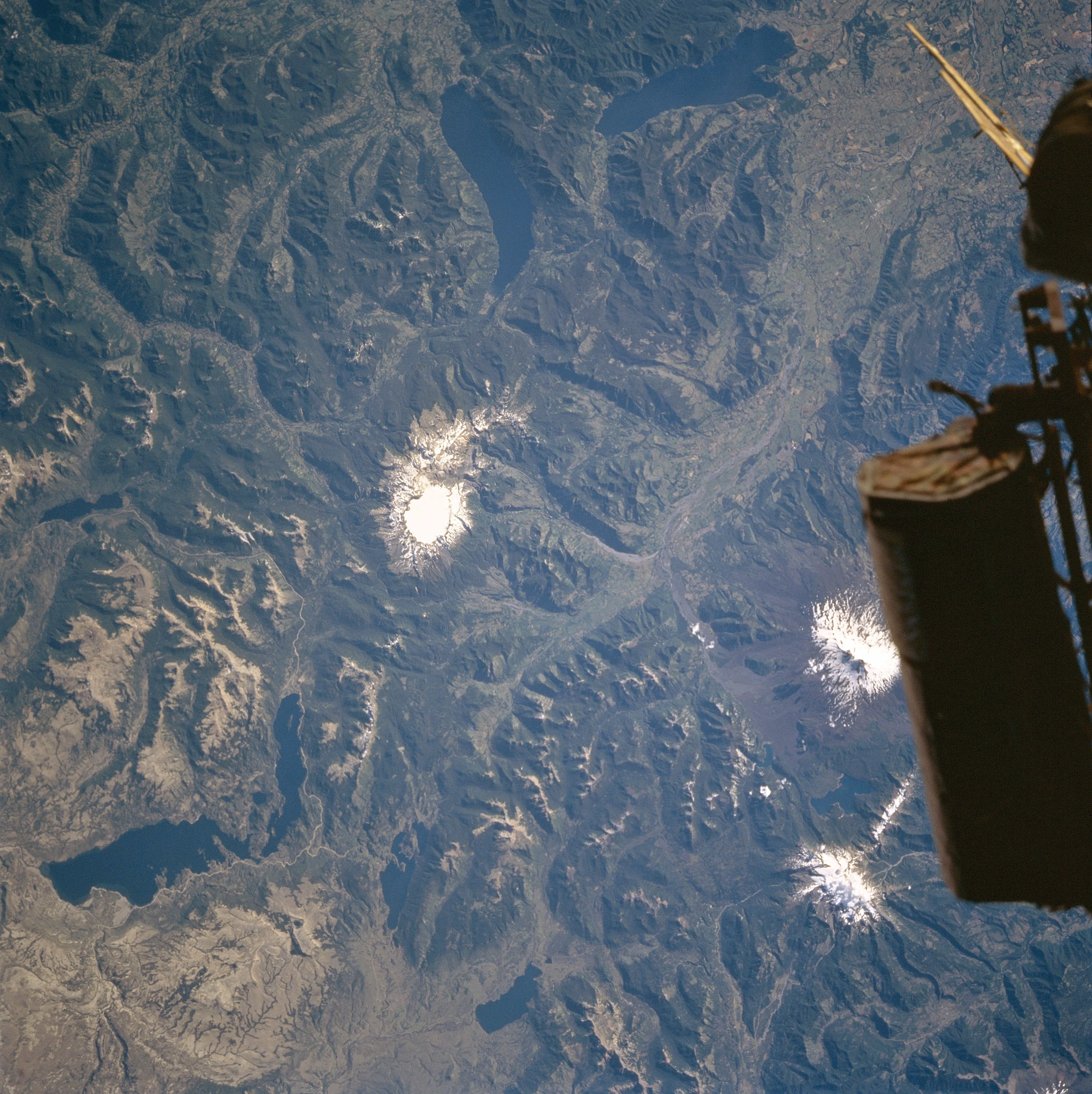
Image Caption: STS089-707-091 Lakes Alumine, Caburgua, and Colico, Chile January 1998
Surrounded by forested mountains, Lakes Caburgua and Colico formed inside glacial troughs that descended from the Andes Mountains into the forelands. Though Lake Alumine evolved the same way, its location is on the lee or dry side of the Andes Mountains prevents the growth of forests around the lake. The glaciers built terminal moraines, behind which the melting waters were dammed during deglaciation nearly 12000 years ago. All of the lakes enjoy a balanced water budget and clean water due to the snowmelt in the Andes. These lakes are also rich in sports fish, particularly trout which are stocked in the Andean lakes. The region is a renowned tourist attraction. The snow-capped peak near the bottom center portion of the image is Llaima Volcano. This 10252 foot (3124 meters) volcano is a stratovolcano that last erupted in late August early September, 1992. The volcano has been very active in historical times.
Surrounded by forested mountains, Lakes Caburgua and Colico formed inside glacial troughs that descended from the Andes Mountains into the forelands. Though Lake Alumine evolved the same way, its location is on the lee or dry side of the Andes Mountains prevents the growth of forests around the lake. The glaciers built terminal moraines, behind which the melting waters were dammed during deglaciation nearly 12000 years ago. All of the lakes enjoy a balanced water budget and clean water due to the snowmelt in the Andes. These lakes are also rich in sports fish, particularly trout which are stocked in the Andean lakes. The region is a renowned tourist attraction. The snow-capped peak near the bottom center portion of the image is Llaima Volcano. This 10252 foot (3124 meters) volcano is a stratovolcano that last erupted in late August early September, 1992. The volcano has been very active in historical times.
