STS088-739-91
| NASA Photo ID | STS088-739-91 |
| Focal Length | 250mm |
| Date taken | 1998.12.06 |
| Time taken | 08:55:18 GMT |
Resolutions offered for this image:
3060 x 3035 pixels 1200 x 1190 pixels 540 x 425 pixels 1057 x 1024 pixels 6000 x 5982 pixels 2080 x 2048 pixels 4130 x 4096 pixels 537 x 512 pixels 1214 x 956 pixels 400 x 314 pixels
3060 x 3035 pixels 1200 x 1190 pixels 540 x 425 pixels 1057 x 1024 pixels 6000 x 5982 pixels 2080 x 2048 pixels 4130 x 4096 pixels 537 x 512 pixels 1214 x 956 pixels 400 x 314 pixels


Cloud masks available for this image:
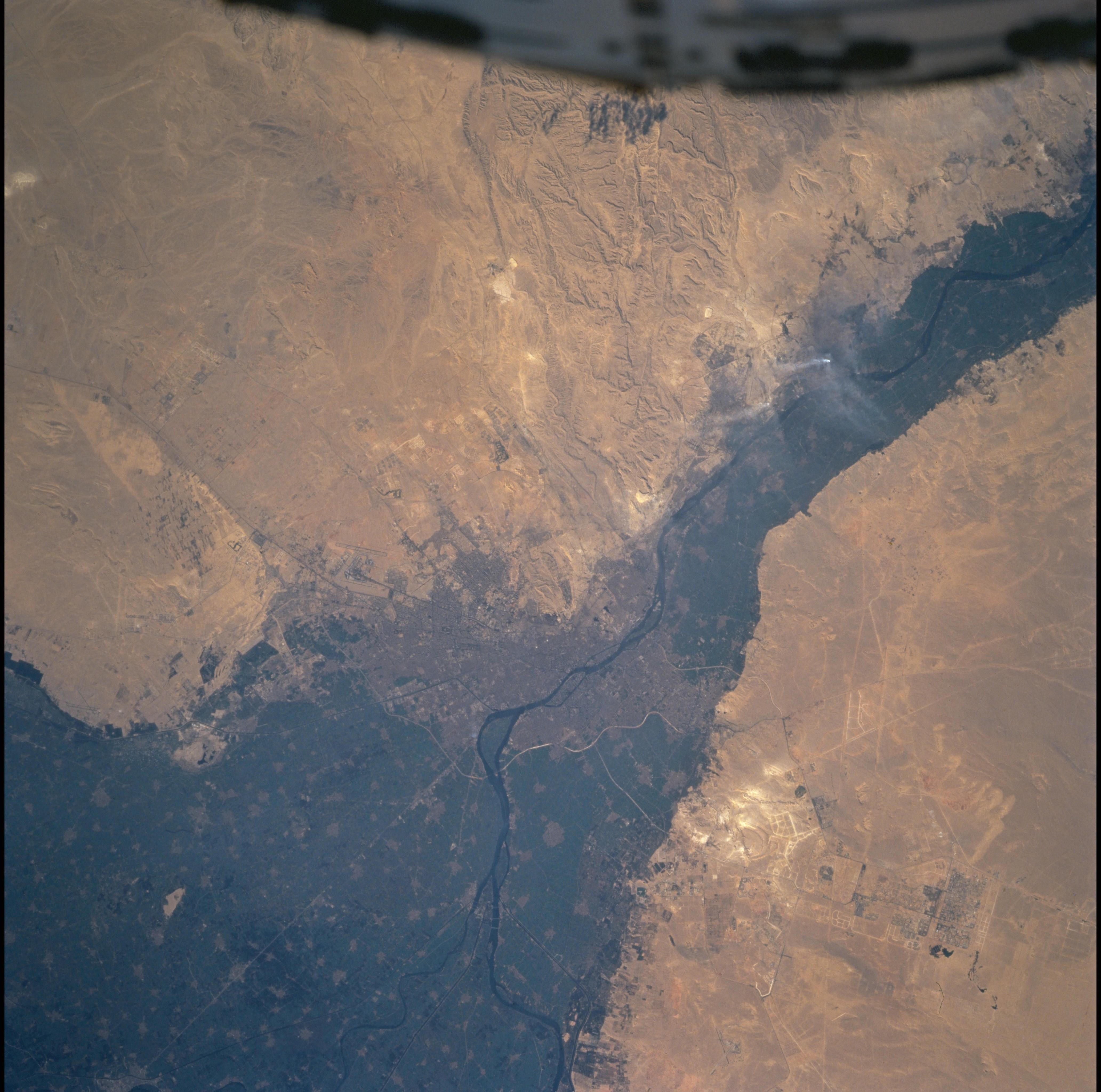
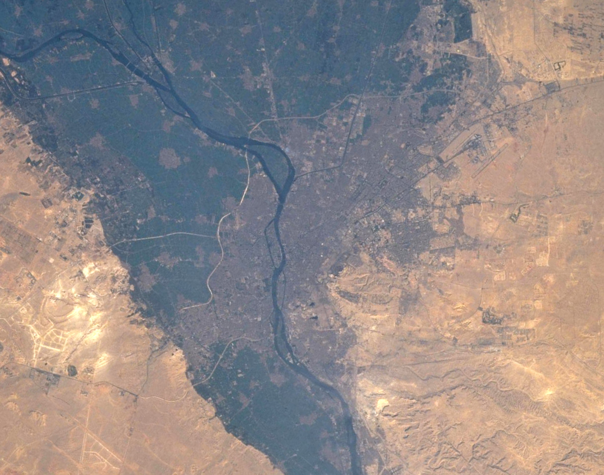
Spacecraft nadir point: 30.1° N, 30.6° E
Photo center point: 30.0° N, 31.5° E
Photo center point by machine learning:
Photo center point: 30.0° N, 31.5° E
Photo center point by machine learning:
Nadir to Photo Center: East
Spacecraft Altitude: 204 nautical miles (378km)
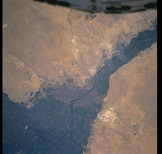
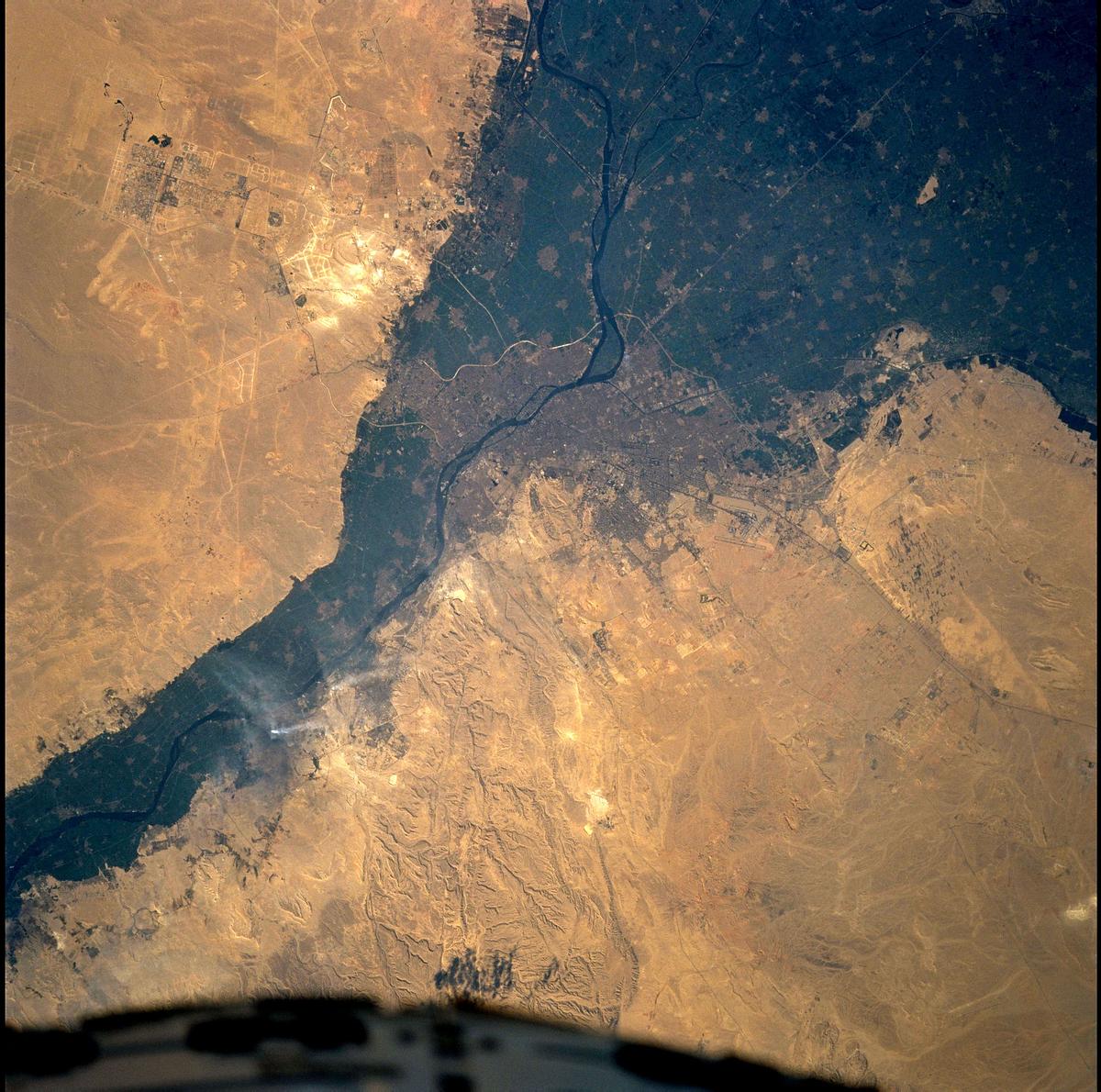
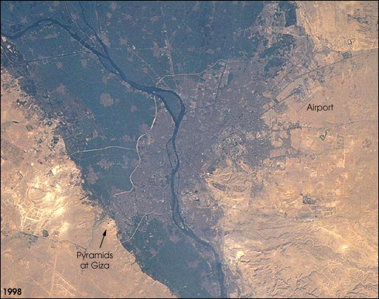
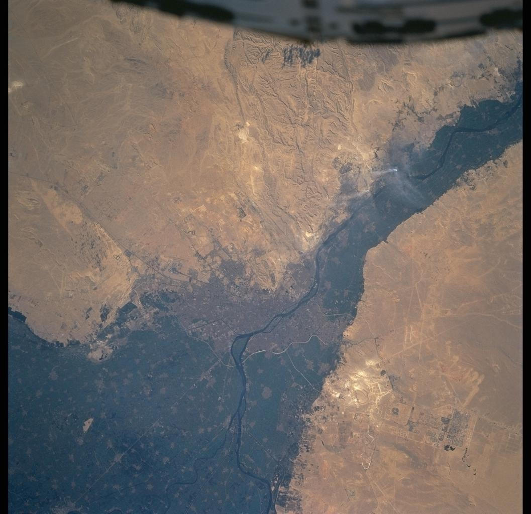
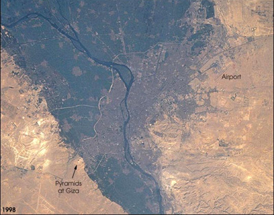
Country or Geographic Name: | EGYPT |
Features: | CAIRO, NILE DELTA, SMOKE |
| Features Found Using Machine Learning: | |
Cloud Cover Percentage: | 0 (no clouds present) |
Sun Elevation Angle: | 36° |
Sun Azimuth: | 165° |
Camera: | Hasselblad |
Focal Length: | 250mm |
Camera Tilt: | 15 degrees |
Format: | 5069: Kodak Elite 100S, E6 Reversal, Replaces Lumiere, Warmer in tone vs. Lumiere |
Film Exposure: | Normal |
| Additional Information | |
| Width | Height | Annotated | Cropped | Purpose | Links |
|---|---|---|---|---|---|
| 3060 pixels | 3035 pixels | No | No | Cities collection | Download Image |
| 1200 pixels | 1190 pixels | No | No | Cities collection | Download Image |
| 540 pixels | 425 pixels | Yes | Yes | NASA's Earth Observatory web site | Download Image |
| 1057 pixels | 1024 pixels | No | No | Download Image | |
| 6000 pixels | 5982 pixels | No | No | Download Image | |
| 2080 pixels | 2048 pixels | No | No | Download Image | |
| 4130 pixels | 4096 pixels | No | No | Download Image | |
| 537 pixels | 512 pixels | No | No | Download Image | |
| 1214 pixels | 956 pixels | No | Yes | Photographic Highlights | Download Image |
| 400 pixels | 314 pixels | Yes | Yes | Photographic Highlights | Download Image |
Download Packaged File
Download a Google Earth KML for this Image
View photo footprint information
Download a GeoTIFF for this photo
Image Caption: The population of the Cairo metropolitan area has increased from less than 6 million in 1965 (Gem05-1-45778) to more than 10 million in 1998 when this picture was taken (United Nations Population Division, World Urbanization Prospects, the 1999 revision). Population densities within the city are some of the highest in the world and the urban area has doubled to more than 400 square km during that period. Extraordinary rates of population growth are expected to continue, with a predicted population of around 14 million by 2015.
