STS088-725-P

| NASA Photo ID | STS088-725-P |
| Focal Length | 100mm |
| Date taken | 1998.12.__ |
| Time taken | GMT |
Resolutions offered for this image:
1029 x 1024 pixels 2050 x 2048 pixels 4102 x 4096 pixels 515 x 512 pixels
1029 x 1024 pixels 2050 x 2048 pixels 4102 x 4096 pixels 515 x 512 pixels


Cloud masks available for this image:
Spacecraft nadir point:
Photo center point: 42.5° S, 172.0° E
Photo center point by machine learning:
Photo center point: 42.5° S, 172.0° E
Photo center point by machine learning:
Nadir to Photo Center:
Spacecraft Altitude: nautical miles (0km)
Country or Geographic Name: | NEW ZEALAND-SI |
Features: | BANKS PEN., FAREWELL SPIT |
| Features Found Using Machine Learning: | |
Cloud Cover Percentage: | 25 (11-25)% |
Sun Elevation Angle: | ° |
Sun Azimuth: | ° |
Camera: | Hasselblad |
Focal Length: | 100mm |
Camera Tilt: | Low Oblique |
Format: | 5069: Kodak Elite 100S, E6 Reversal, Replaces Lumiere, Warmer in tone vs. Lumiere |
Film Exposure: | Normal |
| Additional Information | |
| Width | Height | Annotated | Cropped | Purpose | Links |
|---|---|---|---|---|---|
| 1029 pixels | 1024 pixels | No | No | Download Image | |
| 2050 pixels | 2048 pixels | No | No | Download Image | |
| 4102 pixels | 4096 pixels | No | No | Download Image | |
| 515 pixels | 512 pixels | No | No | Download Image |
Download Packaged File
Download a Google Earth KML for this Image
View photo footprint information
Download a GeoTIFF for this photo
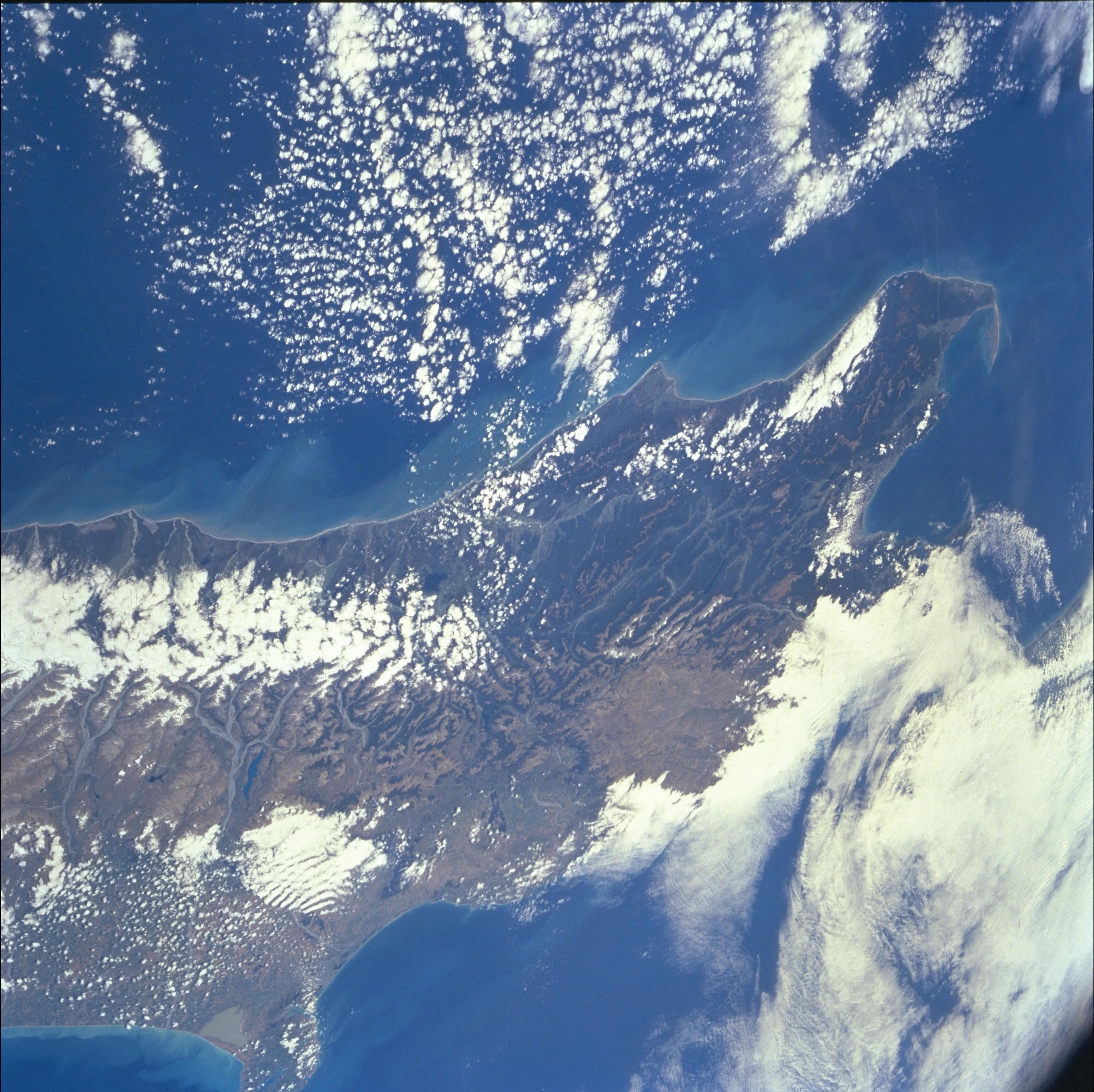
Image Caption: South Island, New Zealand. Cape Farewell, Southern Alps and northern
Alpine fault zone. New Zealand is on the tectonic plate boundary
between the Pacific and the Indian-Australian plates. Near the center
of view the near-vertical Alpine fault zone sharply defines the plate
edge. The coastal zone west of the fault is moving north relative to
the alpine country on the opposite side. The reddish mass of Dun
Mt. has been cut in two by the fault, and the other half of the mass
is some 480 km farther south. In northeastern South Island, the fault
zone begins to step northeastward from South Island over to North
Island.
