STS088-724-64
| NASA Photo ID | STS088-724-64 |
| Focal Length | 250mm |
| Date taken | 1998.12.11 |
| Time taken | 19:36:45 GMT |
Resolutions offered for this image:
1027 x 1024 pixels 2050 x 2048 pixels 4102 x 4096 pixels 514 x 512 pixels
1027 x 1024 pixels 2050 x 2048 pixels 4102 x 4096 pixels 514 x 512 pixels


Cloud masks available for this image:
Spacecraft nadir point: 11.1° N, 144.2° W
Photo center point: 34.5° N, 135.5° E
Photo center point by machine learning:
Photo center point: 34.5° N, 135.5° E
Photo center point by machine learning:
Nadir to Photo Center: West
Spacecraft Altitude: 211 nautical miles (391km)
Camera: | Hasselblad |
Focal Length: | 250mm |
Camera Tilt: | High Oblique |
Format: | 5069: Kodak Elite 100S, E6 Reversal, Replaces Lumiere, Warmer in tone vs. Lumiere |
Film Exposure: | Over Exposed |
| Additional Information | |
| Width | Height | Annotated | Cropped | Purpose | Links |
|---|---|---|---|---|---|
| 1027 pixels | 1024 pixels | No | No | Download Image | |
| 2050 pixels | 2048 pixels | No | No | Download Image | |
| 4102 pixels | 4096 pixels | No | No | Download Image | |
| 514 pixels | 512 pixels | No | No | Download Image |
Download Packaged File
Download a Google Earth KML for this Image
View photo footprint information
Download a GeoTIFF for this photo
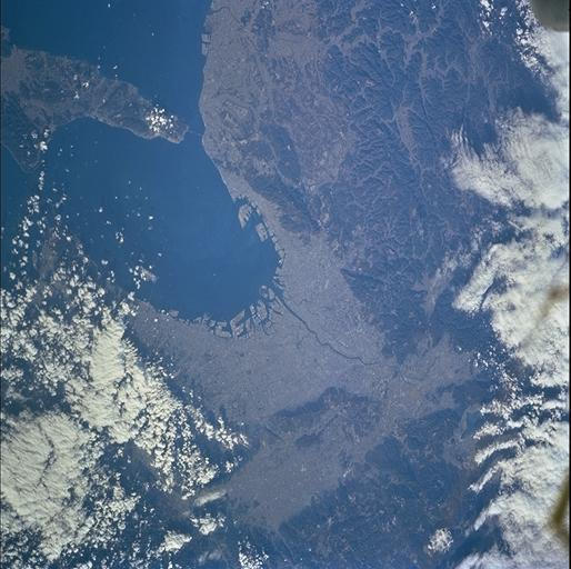
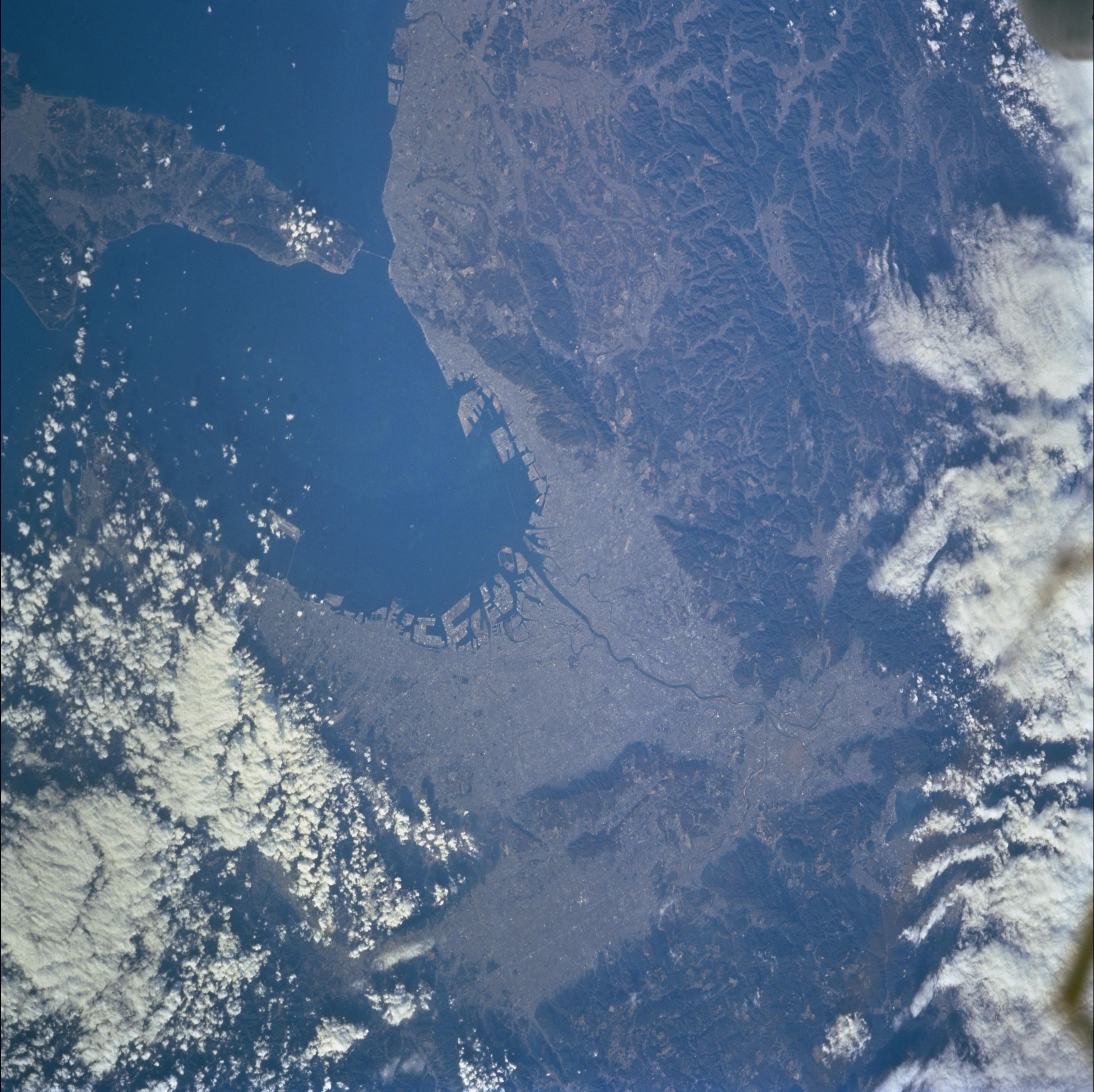
Image Caption: This photograph shows the major cities of the Kansai region which includes seven
Japanese prefectures. This area has been a political and cultural center of Japan
for many centuries. The cities of Kyoto, Osaka, and Kobe are all located in the
photograph. Centered at the mouth of the Yodagawa River on Osaka Bay, Osaka is
home to about 2.5 million people. Moving right (east) from the main river mouth,
the squared E-shaped landfills mark the port areas of Kobe, center of the tragic
Southern Hyogo Earthquake (Great Hanshin Earthquake) in January 1995. Across the
bay from Kobe, a bridge connects the mainland to Kansai International Airport.
