STS088-720-53
| NASA Photo ID | STS088-720-53 |
| Focal Length | 250mm |
| Date taken | 1998.12.13 |
| Time taken | 02:38:52 GMT |
Resolutions offered for this image:
1029 x 1024 pixels 2050 x 2048 pixels 4100 x 4096 pixels 517 x 512 pixels
1029 x 1024 pixels 2050 x 2048 pixels 4100 x 4096 pixels 517 x 512 pixels


Cloud masks available for this image:
Spacecraft nadir point: 33.4° S, 142.6° E
Photo center point: 31.0° S, 149.0° E
Photo center point by machine learning:
Photo center point: 31.0° S, 149.0° E
Photo center point by machine learning:
Nadir to Photo Center: East
Spacecraft Altitude: 211 nautical miles (391km)
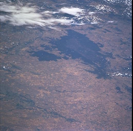
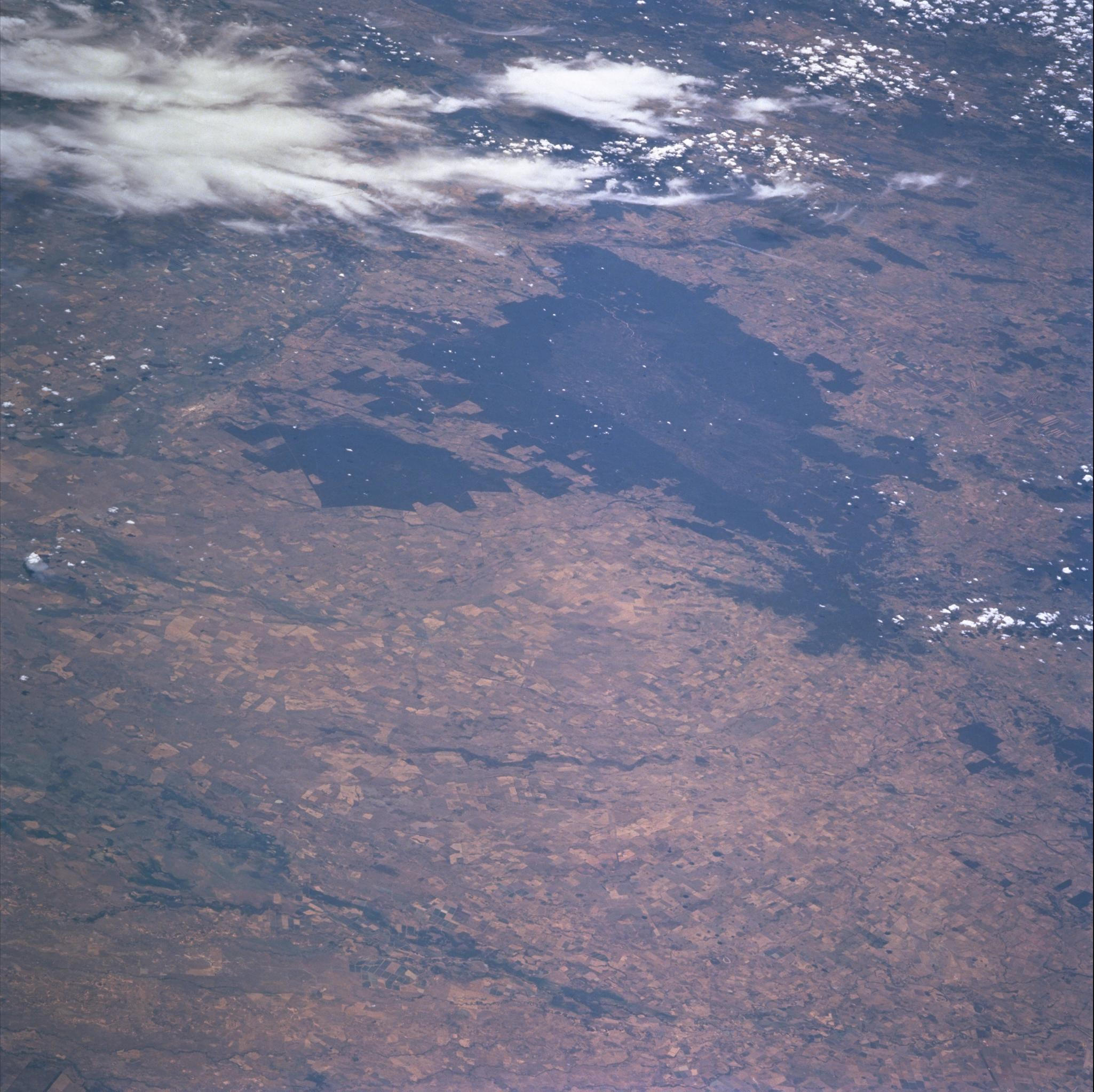
Country or Geographic Name: | AUSTRALIA-NSW |
Features: | FIRE SCAR, CASTLEREAGH RIVER |
| Features Found Using Machine Learning: | |
Cloud Cover Percentage: | 15 (11-25)% |
Sun Elevation Angle: | 79° |
Sun Azimuth: | 340° |
Camera: | Hasselblad |
Focal Length: | 250mm |
Camera Tilt: | High Oblique |
Format: | 5069: Kodak Elite 100S, E6 Reversal, Replaces Lumiere, Warmer in tone vs. Lumiere |
Film Exposure: | Normal |
| Additional Information | |
| Width | Height | Annotated | Cropped | Purpose | Links |
|---|---|---|---|---|---|
| 1029 pixels | 1024 pixels | No | No | Download Image | |
| 2050 pixels | 2048 pixels | No | No | Download Image | |
| 4100 pixels | 4096 pixels | No | No | Download Image | |
| 517 pixels | 512 pixels | No | No | Download Image |
Download Packaged File
Download a Google Earth KML for this Image
View photo footprint information
Download a GeoTIFF for this photo
Image Caption: According to the National Parks and Wildlife Service of the Coonabarabran Area, New South Wales, the large vegetated area is the Pilliga Scrub of New South Wales Australia. The large fire scar is from the Timmallallee Creek fire of 28 November - 10 December 1997, when about 143,000 hectares were burnt. Large fires are common in the Pilliga Scrub, the largest was in 1951 with 350,000 hectares burnt. The fastest fire was during the drought of 1982, when 62,000 hectares burned in one afternoon.
