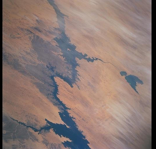
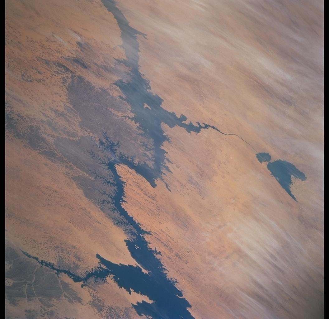
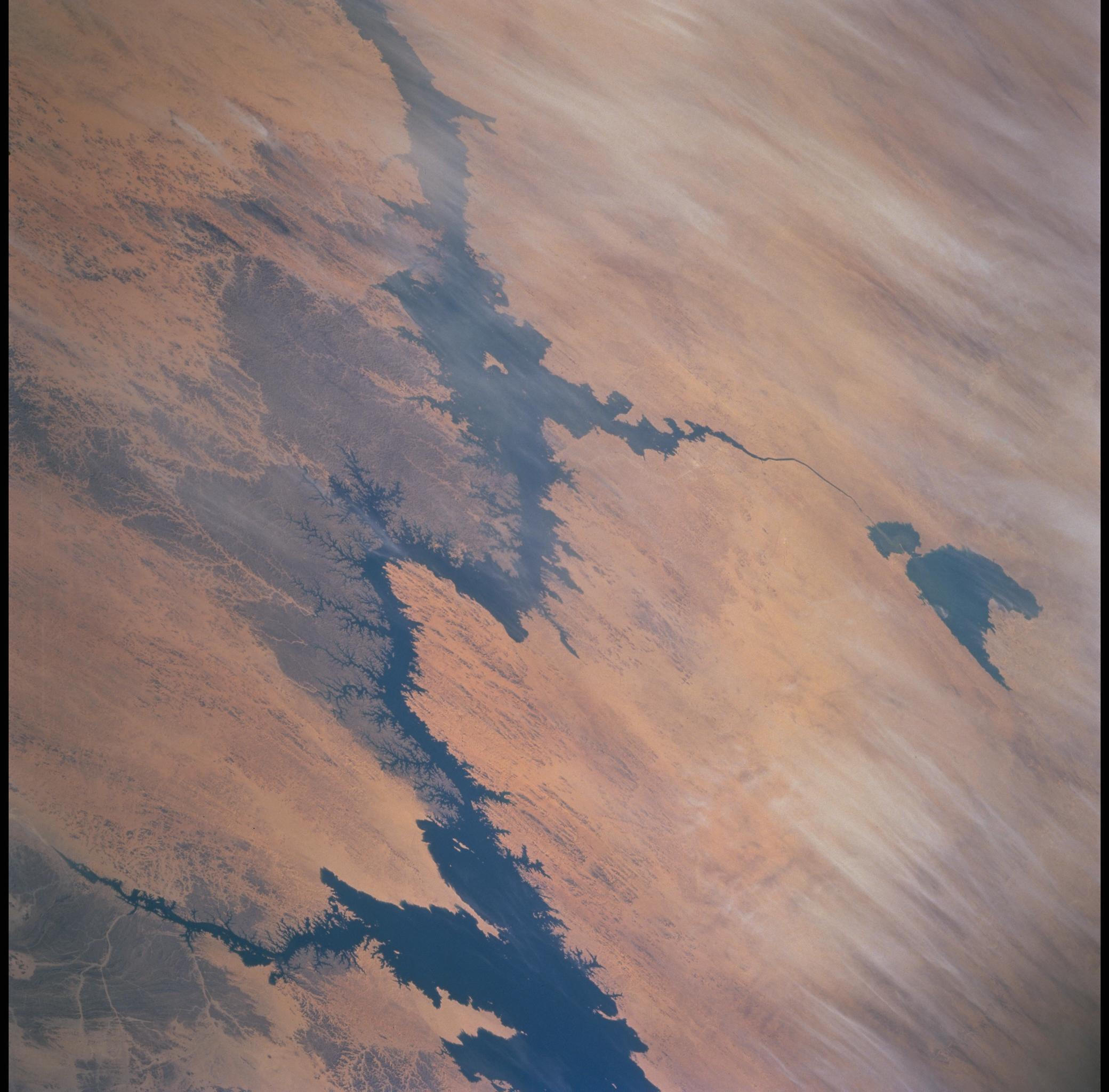
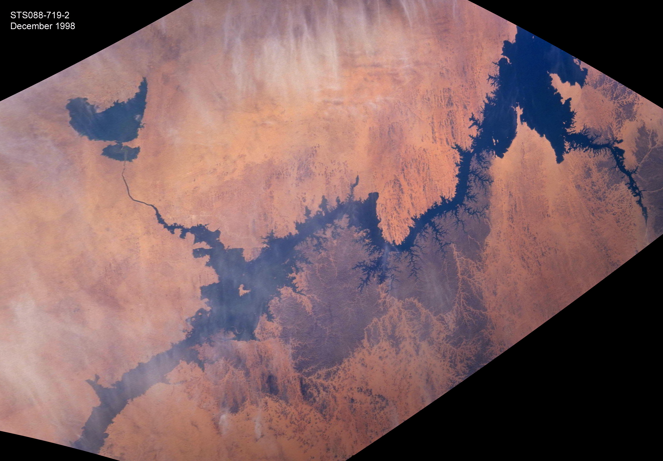
STS088-719-2
| NASA Photo ID | STS088-719-2 |
| Focal Length | 250mm |
| Date taken | 1998.12.06 |
| Time taken | 08:57:46 GMT |
Resolutions offered for this image:
1057 x 1024 pixels 2080 x 2048 pixels 4129 x 4096 pixels 536 x 512 pixels 2324 x 1615 pixels 1241 x 1239 pixels
1057 x 1024 pixels 2080 x 2048 pixels 4129 x 4096 pixels 536 x 512 pixels 2324 x 1615 pixels 1241 x 1239 pixels


Cloud masks available for this image:
Spacecraft nadir point: 23.2° N, 37.5° E
Photo center point: 22.5° N, 33.0° E
Photo center point by machine learning:
Photo center point: 22.5° N, 33.0° E
Photo center point by machine learning:
Nadir to Photo Center: West
Spacecraft Altitude: 207 nautical miles (383km)
Country or Geographic Name: | EGYPT |
Features: | LAKE NASSER, DUST |
| Features Found Using Machine Learning: | |
Cloud Cover Percentage: | 10 (1-10)% |
Sun Elevation Angle: | 44° |
Sun Azimuth: | 173° |
Camera: | Hasselblad |
Focal Length: | 250mm |
Camera Tilt: | 53 degrees |
Format: | 5069: Kodak Elite 100S, E6 Reversal, Replaces Lumiere, Warmer in tone vs. Lumiere |
Film Exposure: | Normal |
| Additional Information | |
| Width | Height | Annotated | Cropped | Purpose | Links |
|---|---|---|---|---|---|
| 1057 pixels | 1024 pixels | No | No | Download Image | |
| 2080 pixels | 2048 pixels | No | No | Download Image | |
| 4129 pixels | 4096 pixels | No | No | Download Image | |
| 536 pixels | 512 pixels | No | No | Download Image | |
| 2324 pixels | 1615 pixels | Yes | NASA's Earth Observatory web site | Download Image | |
| 1241 pixels | 1239 pixels | Download Image |
Download Packaged File
Download a Google Earth KML for this Image
View photo footprint information
Download a GeoTIFF for this photo
Image Caption: New lakes forming in the Toshka depression of southern Egypt have been monitored by astronauts since 1998. The flooding was first documented in early November 1998 and this photograph was taken in December 1998. Subsequently, three additional lakes were created by Lake Nasser overflow, as shown in an animation posted to NASA's Earth Observatory. Estimates of areas of the lakes were made after the images were registered to a common image base. The region will be the location of large Egyptian agricultural developments that will support millions of people.
