STS088-707-6

| NASA Photo ID | STS088-707-6 |
| Focal Length | 250mm |
| Date taken | 1998.12.14 |
| Time taken | 21:32:18 GMT |
1057 x 1024 pixels 2081 x 2048 pixels 4145 x 4096 pixels 545 x 512 pixels
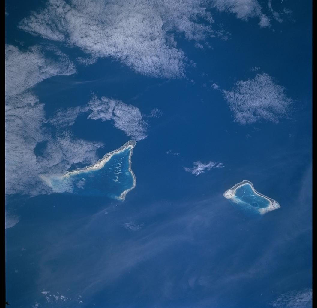
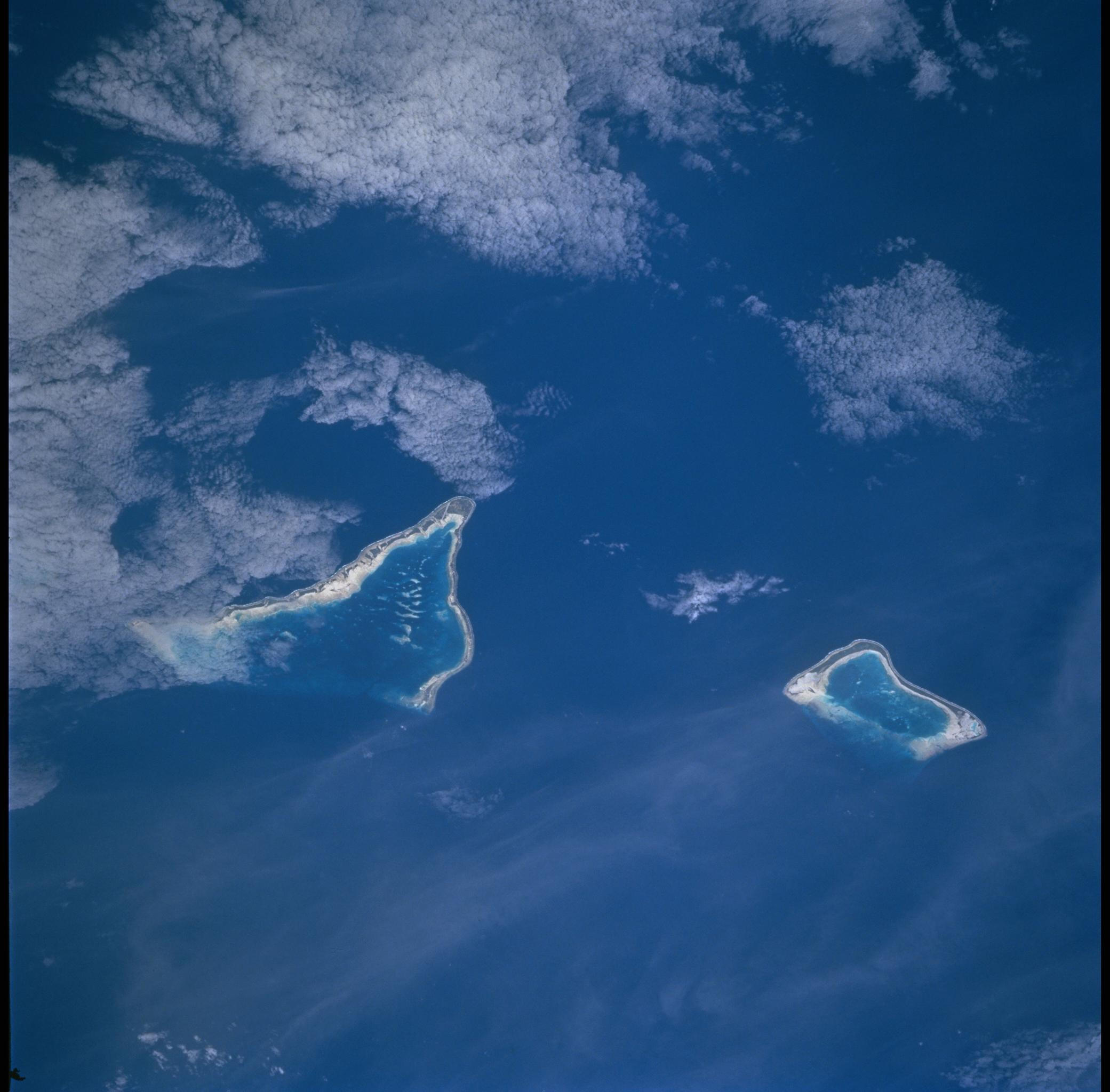

Photo center point: 1.0° N, 173.0° E
Photo center point by machine learning:
Country or Geographic Name: | KIRIBATI |
Features: | TARAWA ATOLL, MAIANA AT. |
| Features Found Using Machine Learning: | |
Cloud Cover Percentage: | 25 (11-25)% |
Sun Elevation Angle: | 44° |
Sun Azimuth: | 125° |
Camera: | Hasselblad |
Focal Length: | 250mm |
Camera Tilt: | 41 degrees |
Format: | 5069: Kodak Elite 100S, E6 Reversal, Replaces Lumiere, Warmer in tone vs. Lumiere |
Film Exposure: | |
| Additional Information | |
| Width | Height | Annotated | Cropped | Purpose | Links |
|---|---|---|---|---|---|
| 1057 pixels | 1024 pixels | No | No | Download Image | |
| 2081 pixels | 2048 pixels | No | No | Download Image | |
| 4145 pixels | 4096 pixels | No | No | Download Image | |
| 545 pixels | 512 pixels | No | No | Download Image |
The Republic of Kiribati is an island nation consisting of some 33 atolls near the equator in the central Pacific. Before Europeans found the islands, they had been inhabited for two millennia by indigenous Micronesians. In 1820, the British named the islands the Gilbert Islands, after Captain Thomas Gilbert, who discovered some of the atolls in 1788. The islands eventually gained their independence in the 1970s.
Two of Kiribati's atolls, Tarawa and Maiana, appear in this image. Tarawa--remembered as the site of a brutal World War II battle--is the larger island. Each island consists of a ring of coral around a central lagoon. This photo shows calm conditions, with clear, still water in each central lagoon, and a light spray of clouds overhead.
Scientists have debated the formation process of coral atolls for many years. Today, coral atolls are appreciated for the insights they provide about climate change. As corals grow, the density of their skeletons varies with the seasons, forming datable layers. Depending on salinity, temperature, and water clarity conditions, the thickness of those growth layers can vary, providing a record of conditions in the tropics.
