STS088-706-46
| NASA Photo ID | STS088-706-46 |
| Focal Length | 250mm |
| Date taken | 1998.12.05 |
| Time taken | 01:24:57 GMT |
Resolutions offered for this image:
1028 x 1024 pixels 2050 x 2048 pixels 4102 x 4096 pixels 513 x 512 pixels
1028 x 1024 pixels 2050 x 2048 pixels 4102 x 4096 pixels 513 x 512 pixels


Cloud masks available for this image:
Spacecraft nadir point: 45.1° N, 126.4° E
Photo center point: 46.0° N, 126.5° E
Photo center point by machine learning:
Photo center point: 46.0° N, 126.5° E
Photo center point by machine learning:
Nadir to Photo Center: North
Spacecraft Altitude: 144 nautical miles (267km)
Country or Geographic Name: | CHINA |
Features: | SONGHUA RIVER, HARBIN |
| Features Found Using Machine Learning: | |
Cloud Cover Percentage: | 0 (no clouds present) |
Sun Elevation Angle: | 17° |
Sun Azimuth: | 151° |
Camera: | Hasselblad |
Focal Length: | 250mm |
Camera Tilt: | 21 degrees |
Format: | 5069: Kodak Elite 100S, E6 Reversal, Replaces Lumiere, Warmer in tone vs. Lumiere |
Film Exposure: | Normal |
| Additional Information | |
| Width | Height | Annotated | Cropped | Purpose | Links |
|---|---|---|---|---|---|
| 1028 pixels | 1024 pixels | No | No | Download Image | |
| 2050 pixels | 2048 pixels | No | No | Download Image | |
| 4102 pixels | 4096 pixels | No | No | Download Image | |
| 513 pixels | 512 pixels | No | No | Download Image |
Download Packaged File
Download a Google Earth KML for this Image
View photo footprint information
Download a GeoTIFF for this photo
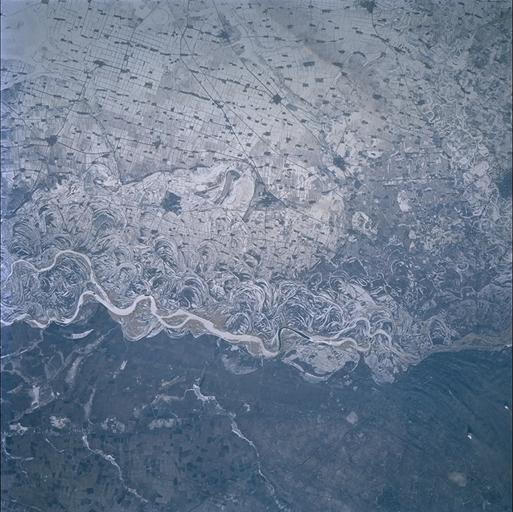
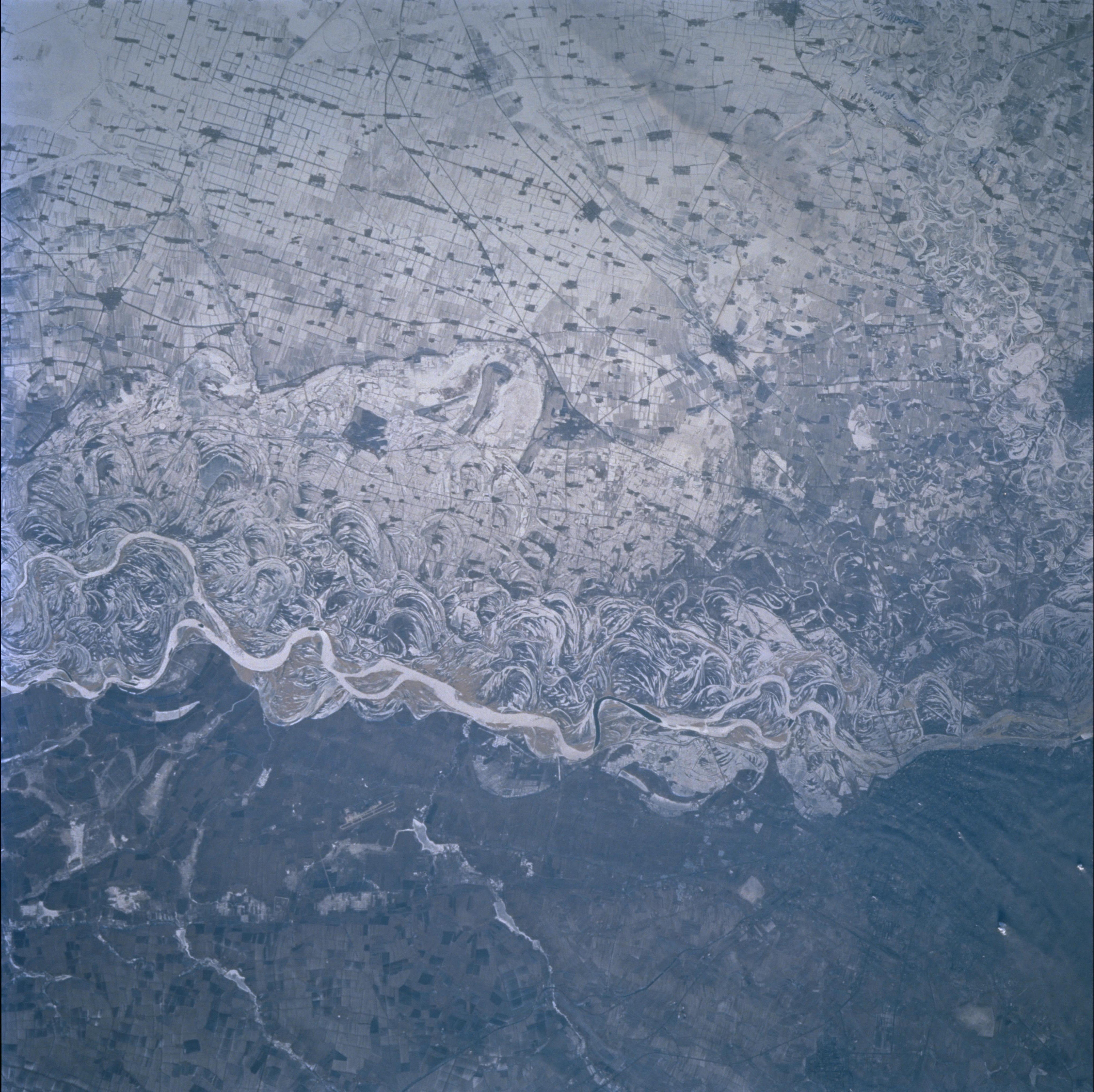
Image Caption: This early December (1998) view of the Songhua River shows snow in the floodplain of
the river, with its numerous meandering scroll-bar features, and numerous, angular farms
on the flat country to the north of the river (top). The smaller Tongken River enters the
picture top right and joins the Songhua on the right margin (center). The major industrial
and coal mining city of Harbin lies just outside the view center right. It is not clear why
small rectangular communities in the farmland are consistently snow-free, although the
existence of trees in these small centers may explain why the snow is less apparent. It
appears that the snow-free lower part of the view lay immediately beyond the track of the
snow storm which affected the rest of the scene.
