STS088-706-20
| NASA Photo ID | STS088-706-20 |
| Focal Length | 250mm |
| Date taken | 1998.12.04 |
| Time taken | 21:28:09 GMT |
Resolutions offered for this image:
1026 x 1024 pixels 2049 x 2048 pixels 4100 x 4096 pixels 513 x 512 pixels
1026 x 1024 pixels 2049 x 2048 pixels 4100 x 4096 pixels 513 x 512 pixels

Cloud masks available for this image:
Spacecraft nadir point: 43.9° S, 71.6° W
Photo center point: 41.0° S, 71.0° W
Photo center point by machine learning:
Photo center point: 41.0° S, 71.0° W
Photo center point by machine learning:
Nadir to Photo Center: North
Spacecraft Altitude: 163 nautical miles (302km)
Country or Geographic Name: | ARGENTINA |
Features: | LAKE NAHUEL HUAPI, ANDES |
| Features Found Using Machine Learning: | |
Cloud Cover Percentage: | 0 (no clouds present) |
Sun Elevation Angle: | 27° |
Sun Azimuth: | 264° |
Camera: | Hasselblad |
Focal Length: | 250mm |
Camera Tilt: | 47 degrees |
Format: | 5069: Kodak Elite 100S, E6 Reversal, Replaces Lumiere, Warmer in tone vs. Lumiere |
Film Exposure: | Normal |
| Additional Information | |
| Width | Height | Annotated | Cropped | Purpose | Links |
|---|---|---|---|---|---|
| 1026 pixels | 1024 pixels | No | No | Download Image | |
| 2049 pixels | 2048 pixels | No | No | Download Image | |
| 4100 pixels | 4096 pixels | No | No | Download Image | |
| 513 pixels | 512 pixels | No | No | Download Image |
Download Packaged File
Download a Google Earth KML for this Image
View photo footprint information
Download a GeoTIFF for this photo
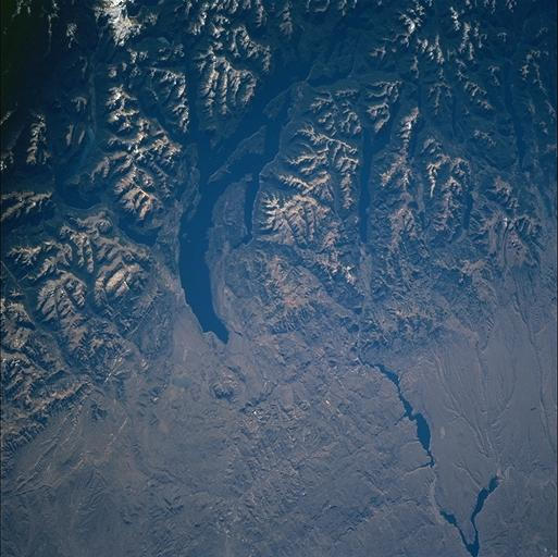
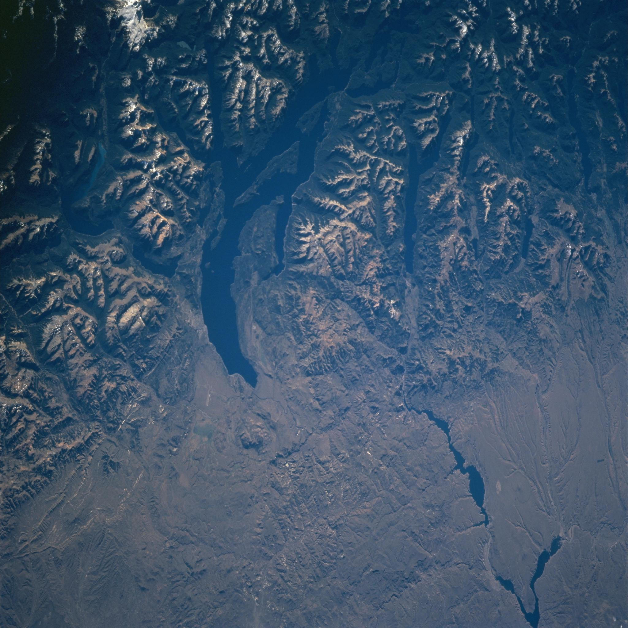
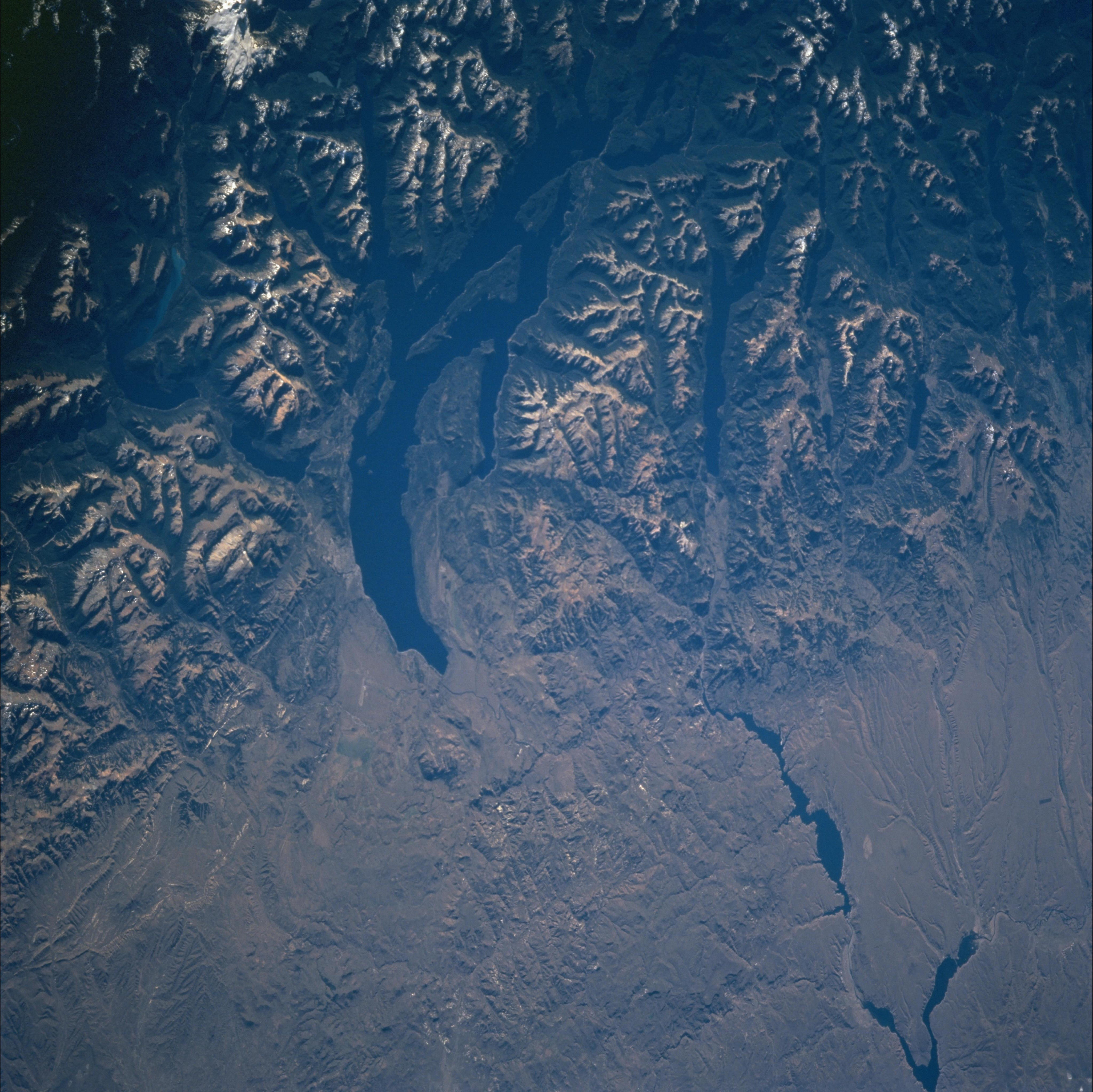
Image Caption: The top half of the view shows the ridge crests and valleys of the southern Andes
Mountains. This part of the view appears dark due to shadow in the valleys. The
summits appear as angular, light-colored treeless ridges, with a patch of white snow top
left. Curved Lake Nahuel Huapi is the dark finger top center. This lake depression was
eroded by glacier ice moving east (from the mountains at the top of the view towards the
Patagonian plains bottom) during the geologically recent ice ages when the Andes were
covered with snow and ice caps far larger than those of today. The small gray city on the
left (south) side edge of the lake (left center) is the well-known resort of San Carlos de
Bariloche. The Rio Limay appears bottom right, and flows off the southern
Andes Mts., through the arid lands of Patagonia to the Atlantic Ocean.
