STS088-705-64
| NASA Photo ID | STS088-705-64 |
| Focal Length | 250mm |
| Date taken | 1998.12.05 |
| Time taken | 19:48:30 GMT |
Resolutions offered for this image:
1026 x 1024 pixels 2050 x 2048 pixels 4100 x 4096 pixels 513 x 512 pixels
1026 x 1024 pixels 2050 x 2048 pixels 4100 x 4096 pixels 513 x 512 pixels


Cloud masks available for this image:
Spacecraft nadir point: 36.7° S, 66.0° W
Photo center point: 38.5° S, 68.5° W
Photo center point by machine learning:
Photo center point: 38.5° S, 68.5° W
Photo center point by machine learning:
Nadir to Photo Center: Southwest
Spacecraft Altitude: 169 nautical miles (313km)
Country or Geographic Name: | ARGENTINA |
Features: | CERROS COLORADO RES. |
| Features Found Using Machine Learning: | |
Cloud Cover Percentage: | 0 (no clouds present) |
Sun Elevation Angle: | 42° |
Sun Azimuth: | 272° |
Camera: | Hasselblad |
Focal Length: | 250mm |
Camera Tilt: | 48 degrees |
Format: | 5069: Kodak Elite 100S, E6 Reversal, Replaces Lumiere, Warmer in tone vs. Lumiere |
Film Exposure: | Normal |
| Additional Information | |
| Width | Height | Annotated | Cropped | Purpose | Links |
|---|---|---|---|---|---|
| 1026 pixels | 1024 pixels | No | No | Download Image | |
| 2050 pixels | 2048 pixels | No | No | Download Image | |
| 4100 pixels | 4096 pixels | No | No | Download Image | |
| 513 pixels | 512 pixels | No | No | Download Image |
Download Packaged File
Download a Google Earth KML for this Image
View photo footprint information
Download a GeoTIFF for this photo
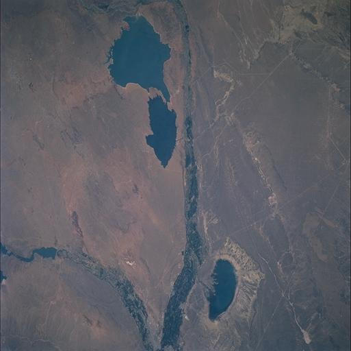
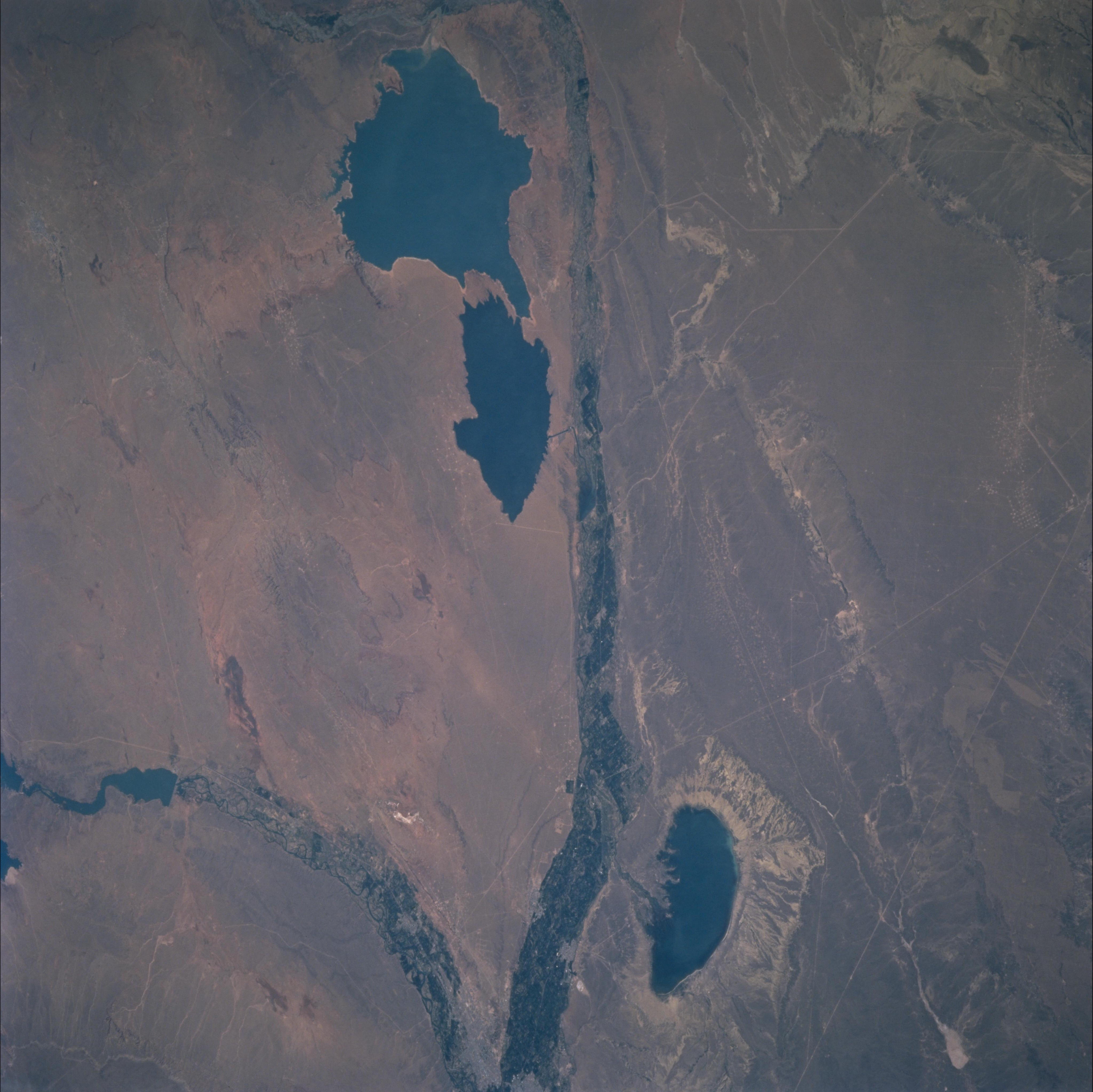
Image Caption: Most of the views show the arid landscapes of windswept Patagonia. The only places
where agriculture can be practiced are the valley bottoms where irrigation water is
available. The green swaths crossing the view are fields in the floodplains of the
Neuquen River (top to bottom) and the Limay River (lower right-should be lower left).
The prominent lakes are Lake Pellegrini, a natural depression (bottom) probably
hollowed out by the persistent and strong winds for which Patagonia is so well known;
and Lake Cerro Colorado, a manmade lake (top). This lake has a waist so narrow that
water barely circulates between each half. This accounts for the different colors in each
side of the lake, a feature which allows crews to tell this lake apart from others.
