STS088-705-40
| NASA Photo ID | STS088-705-40 |
| Focal Length | 40mm |
| Date taken | 1998.12.05 |
| Time taken | 06:03:39 GMT |
Resolutions offered for this image:
1058 x 1024 pixels 2080 x 2048 pixels 4145 x 4096 pixels 545 x 512 pixels
1058 x 1024 pixels 2080 x 2048 pixels 4145 x 4096 pixels 545 x 512 pixels
Cloud masks available for this image:
Spacecraft nadir point: 19.1° N, 92.1° E
Photo center point: 19.0° N, 94.0° E
Photo center point by machine learning:
Photo center point: 19.0° N, 94.0° E
Photo center point by machine learning:
Nadir to Photo Center: East
Spacecraft Altitude: 166 nautical miles (307km)
Country or Geographic Name: | MYANMAR (BURMA) |
Features: | RAMREE I., CHEDUBA ISLAND |
| Features Found Using Machine Learning: | |
Cloud Cover Percentage: | 5 (1-10)% |
Sun Elevation Angle: | 48° |
Sun Azimuth: | 187° |
Camera: | Hasselblad |
Focal Length: | 40mm |
Camera Tilt: | 35 degrees |
Format: | 5069: Kodak Elite 100S, E6 Reversal, Replaces Lumiere, Warmer in tone vs. Lumiere |
Film Exposure: | Normal |
| Additional Information | |
| Width | Height | Annotated | Cropped | Purpose | Links |
|---|---|---|---|---|---|
| 1058 pixels | 1024 pixels | No | No | Download Image | |
| 2080 pixels | 2048 pixels | No | No | Download Image | |
| 4145 pixels | 4096 pixels | No | No | Download Image | |
| 545 pixels | 512 pixels | No | No | Download Image |
Download Packaged File
Download a Google Earth KML for this Image
View photo footprint information
Download a GeoTIFF for this photo
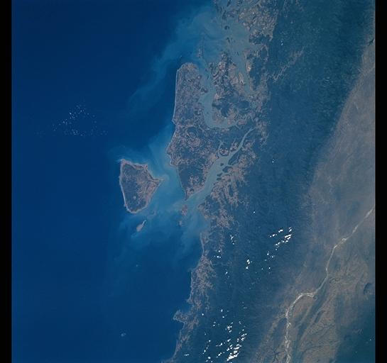
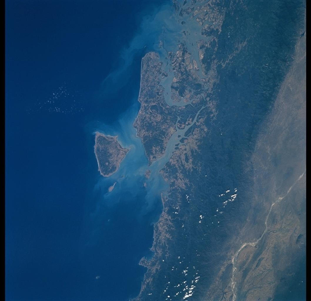
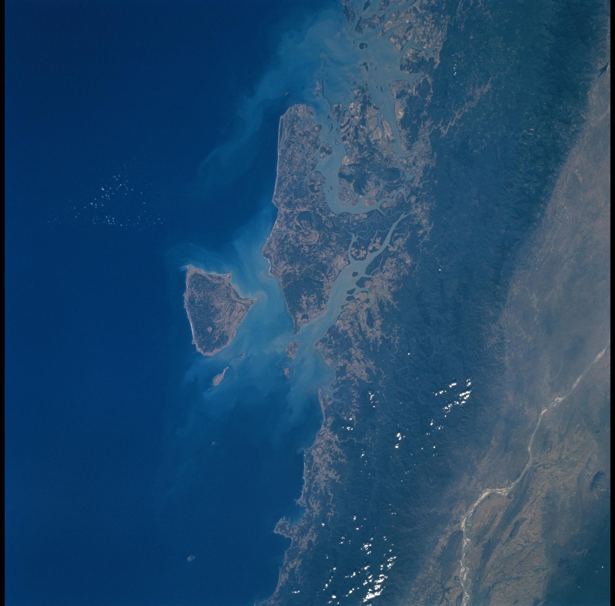
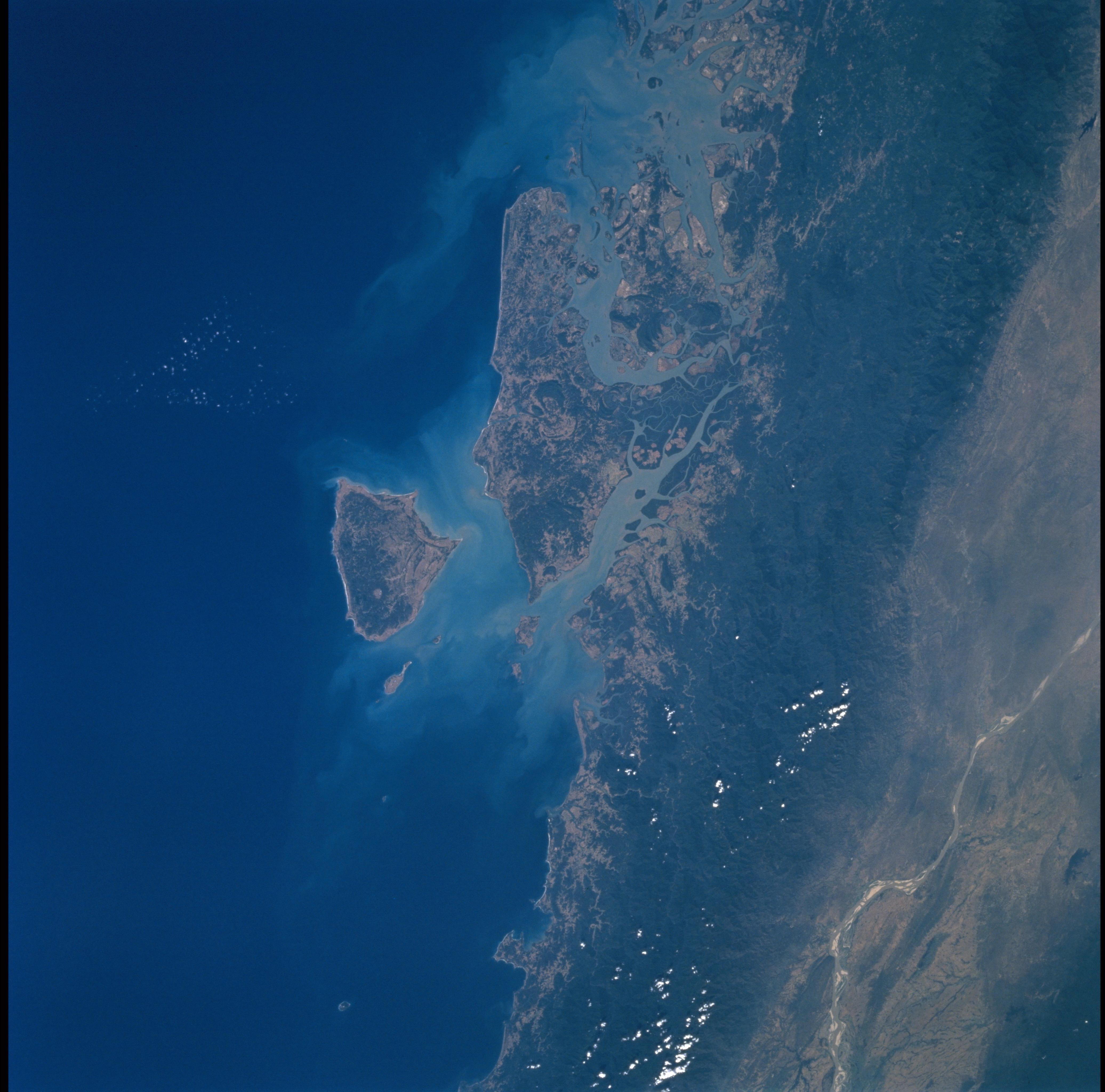
Image Caption: This image shows Cheduba Island (the round, offshore island ) and
Ramree Island on the rugged west coast of Burma. Cheduba Island was
part of an historical Indian trade route between Rangoon and
Chittagong, Bangladesh. Tidal inlets along this part of the coast
created a good harbor, and allowed development of the port city of
Kjaukpyu on the northern tip of Ramree I. Across the mountains
(dark, forested area along the shore), the riverbed of the Irrawaddy
River shows up as a curved line.
