STS087-724-43

| NASA Photo ID | STS087-724-43 |
| Focal Length | 100mm |
| Date taken | 1997.11.30 |
| Time taken | 06:33:44 GMT |
Cloud masks available for this image:
Spacecraft nadir point: 3.5° N, 112.9° E
Photo center point: 3.0° N, 113.0° E
Photo center point by machine learning:
Photo center point: 3.0° N, 113.0° E
Photo center point by machine learning:
Nadir to Photo Center: South
Spacecraft Altitude: 151 nautical miles (280km)
Country or Geographic Name: | MALAYSIA |
Features: | BINTULU |
| Features Found Using Machine Learning: | |
Cloud Cover Percentage: | 30 (26-50)% |
Sun Elevation Angle: | 48° |
Sun Azimuth: | 231° |
Camera: | Hasselblad |
Focal Length: | 100mm |
Camera Tilt: | 11 degrees |
Format: | 5069: Kodak Elite 100S, E6 Reversal, Replaces Lumiere, Warmer in tone vs. Lumiere |
Film Exposure: | Normal |
| Additional Information | |
| Width | Height | Annotated | Cropped | Purpose | Links |
|---|---|---|---|---|---|
| 4080 pixels | 4079 pixels | No | No | Earth From Space collection | Download Image |
| 640 pixels | 639 pixels | No | No | Earth From Space collection | Download Image |
| 634 pixels | 619 pixels | No | No | Download Image |
Download Packaged File
Download a Google Earth KML for this Image
View photo footprint information
Download a GeoTIFF for this photo
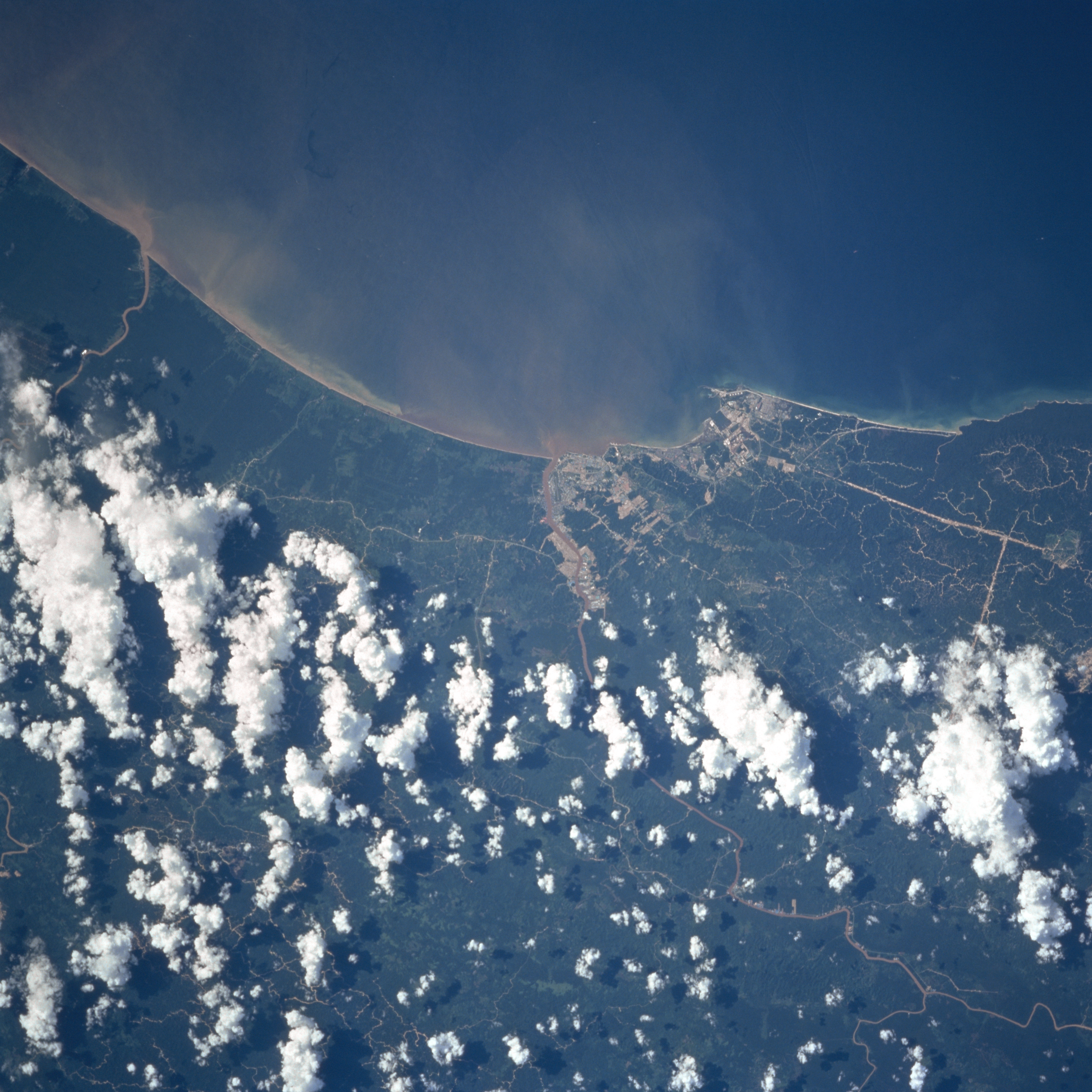
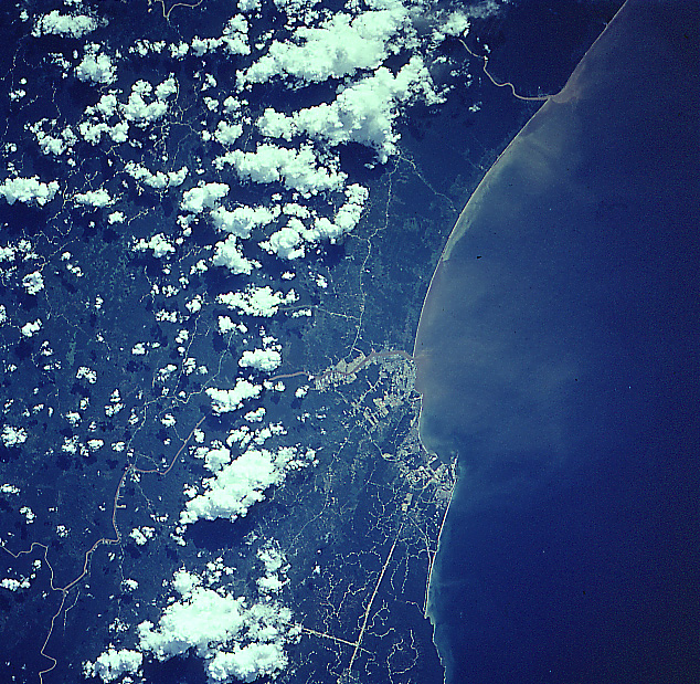
Image Caption: STS087-724-043 Bintulu, Malaysia November 1997
Located on the central west coast of Malaysia on the island of Borneo, the growing industrial city of Bintulu can be seen in this near-nadir view. The city is situated on the coast at the mouths of the Sebiew and Kemena Rivers. The region is hot and rainy all year long. Large reserves of oil and gas were discovered offshore of Bintulu in the 1960's. This discovery has brought an influx of heavy industries. Bintulu has one of the most modern and efficient multipurpose ports in Southeast Asia. The timber industry is also a major economic factor for the city. Forest clearing is discernible scattered throughout the lower half of the image. The South China Sea covers the upper portion of the image.
Located on the central west coast of Malaysia on the island of Borneo, the growing industrial city of Bintulu can be seen in this near-nadir view. The city is situated on the coast at the mouths of the Sebiew and Kemena Rivers. The region is hot and rainy all year long. Large reserves of oil and gas were discovered offshore of Bintulu in the 1960's. This discovery has brought an influx of heavy industries. Bintulu has one of the most modern and efficient multipurpose ports in Southeast Asia. The timber industry is also a major economic factor for the city. Forest clearing is discernible scattered throughout the lower half of the image. The South China Sea covers the upper portion of the image.
