STS087-722-76

| NASA Photo ID | STS087-722-76 |
| Focal Length | 100mm |
| Date taken | 1997.11.27 |
| Time taken | 07:59:21 GMT |
Cloud masks available for this image:
Spacecraft nadir point: 16.0° N, 91.5° E
Photo center point: 16.0° N, 95.0° E
Photo center point by machine learning:
Photo center point: 16.0° N, 95.0° E
Photo center point by machine learning:
Nadir to Photo Center: East
Spacecraft Altitude: 151 nautical miles (280km)
Country or Geographic Name: | MYANMAR (BURMA) |
Features: | IRRAWADDY RIVER |
| Features Found Using Machine Learning: | |
Cloud Cover Percentage: | 0 (no clouds present) |
Sun Elevation Angle: | 40° |
Sun Azimuth: | 223° |
Camera: | Hasselblad |
Focal Length: | 100mm |
Camera Tilt: | 54 degrees |
Format: | 5069: Kodak Elite 100S, E6 Reversal, Replaces Lumiere, Warmer in tone vs. Lumiere |
Film Exposure: | Normal |
| Additional Information | |
| Width | Height | Annotated | Cropped | Purpose | Links |
|---|---|---|---|---|---|
| 4096 pixels | 4096 pixels | No | No | Earth From Space collection | Download Image |
| 640 pixels | 640 pixels | No | No | Earth From Space collection | Download Image |
| 633 pixels | 636 pixels | No | No | Download Image |
Download Packaged File
Download a Google Earth KML for this Image
View photo footprint information
Download a GeoTIFF for this photo
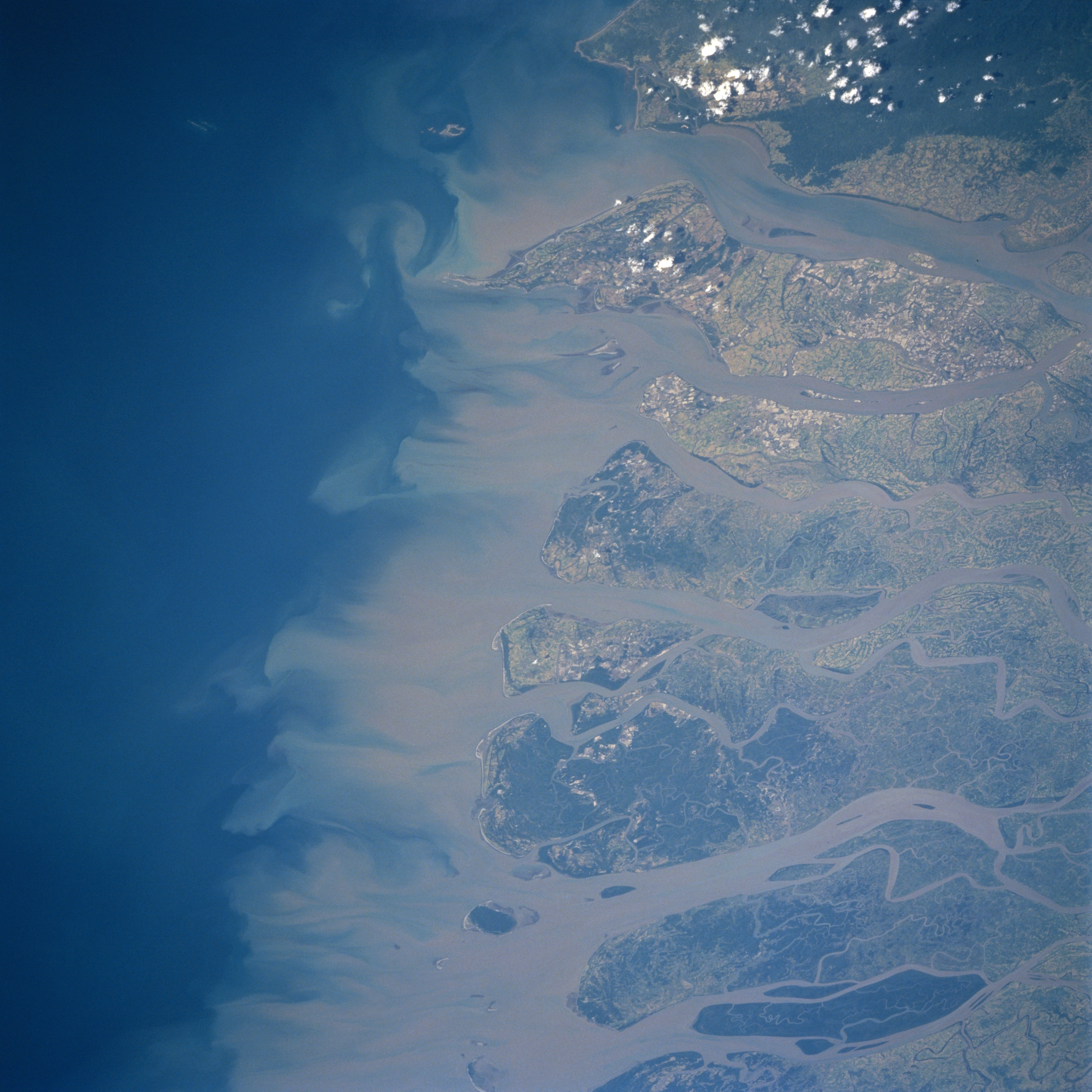
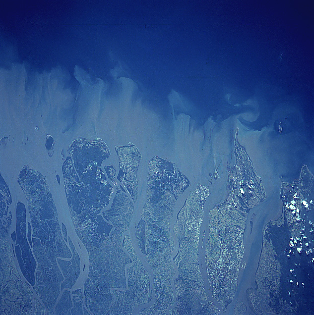
Image Caption: STS087-722-076 Irrawaddy River Delta, Myanmar November 1997
Sediment plumes from the mouths of the Irrawaddy River can be seen in this west-looking view. The Irrawaddy is the principal river of Myanmar (Burma) and rises in the folded ranges of northern Myanmar and flows generally south for 1300 miles (2100 km). The river branches into several distributary channels that form an extensive delta as it empties into the Andaman Sea (left half of the image). The Irrawaddy River Delta is one of the major rice growing regions in the world. The delta's fine alluvial soils also produce sugarcane, beans, and an assortment of vegetables. The darker areas seen in this view are the remains of mangrove swamps. Monsoon rains blanket the delta from mid-June through the end of September. Tropical cyclones are rare in the region.
Sediment plumes from the mouths of the Irrawaddy River can be seen in this west-looking view. The Irrawaddy is the principal river of Myanmar (Burma) and rises in the folded ranges of northern Myanmar and flows generally south for 1300 miles (2100 km). The river branches into several distributary channels that form an extensive delta as it empties into the Andaman Sea (left half of the image). The Irrawaddy River Delta is one of the major rice growing regions in the world. The delta's fine alluvial soils also produce sugarcane, beans, and an assortment of vegetables. The darker areas seen in this view are the remains of mangrove swamps. Monsoon rains blanket the delta from mid-June through the end of September. Tropical cyclones are rare in the region.
