STS087-718-29
| NASA Photo ID | STS087-718-29 |
| Focal Length | 250mm |
| Date taken | 1997.11.24 |
| Time taken | 09:17:53 GMT |
Resolutions offered for this image:
540 x 528 pixels 6886 x 6781 pixels 639 x 630 pixels 1350 x 1320 pixels 3261 x 3189 pixels 612 x 636 pixels
540 x 528 pixels 6886 x 6781 pixels 639 x 630 pixels 1350 x 1320 pixels 3261 x 3189 pixels 612 x 636 pixels


Cloud masks available for this image:
Spacecraft nadir point: 28.5° N, 33.2° E
Photo center point: 29.0° N, 34.0° E
Photo center point by machine learning:
Photo center point: 29.0° N, 34.0° E
Photo center point by machine learning:
Nadir to Photo Center: Northeast
Spacecraft Altitude: 148 nautical miles (274km)
Country or Geographic Name: | EGYPT |
Features: | SINAI PENINSULA |
| Features Found Using Machine Learning: | |
Cloud Cover Percentage: | 0 (no clouds present) |
Sun Elevation Angle: | 41° |
Sun Azimuth: | 175° |
Camera: | Hasselblad |
Focal Length: | 250mm |
Camera Tilt: | 21 degrees |
Format: | 5069: Kodak Elite 100S, E6 Reversal, Replaces Lumiere, Warmer in tone vs. Lumiere |
Film Exposure: | Normal |
| Additional Information | |
| Width | Height | Annotated | Cropped | Purpose | Links |
|---|---|---|---|---|---|
| 540 pixels | 528 pixels | Photographic Highlights | Download Image | ||
| 6886 pixels | 6781 pixels | No | No | Earth From Space collection | Download Image |
| 639 pixels | 630 pixels | No | No | Earth From Space collection | Download Image |
| 1350 pixels | 1320 pixels | No | No | Photographic Highlights | Download Image |
| 3261 pixels | 3189 pixels | Download Image | |||
| 612 pixels | 636 pixels | No | No | Download Image |
Download Packaged File
Download a Google Earth KML for this Image
View photo footprint information
Download a GeoTIFF for this photo
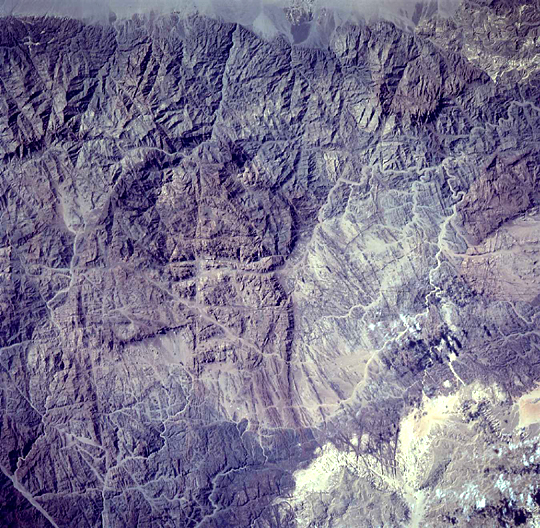
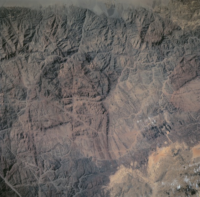
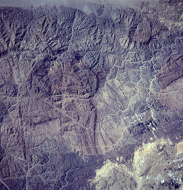
Image Caption: Viewing the mountainous region of the St. Katherine Protectorate from space, a gray patch is visible on top
of a heavily visited mountain. This might prompt conservationists to visit the area and determine whether
the erosion is natural or anthropogenic.
of a heavily visited mountain. This might prompt conservationists to visit the area and determine whether
the erosion is natural or anthropogenic.
