STS085-721-64

| NASA Photo ID | STS085-721-64 |
| Focal Length | 250mm |
| Date taken | 1997.08.13 |
| Time taken | 12:37:18 GMT |
Resolutions offered for this image:
4043 x 4043 pixels 640 x 640 pixels 5700 x 5900 pixels 483 x 500 pixels
4043 x 4043 pixels 640 x 640 pixels 5700 x 5900 pixels 483 x 500 pixels
Cloud masks available for this image:
Spacecraft nadir point: 53.9° N, 15.6° E
Photo center point: 55.0° N, 15.0° E
Photo center point by machine learning:
Photo center point: 55.0° N, 15.0° E
Photo center point by machine learning:
Nadir to Photo Center: Northwest
Spacecraft Altitude: 156 nautical miles (289km)
Country or Geographic Name: | DENMARK |
Features: | BORNHOLM |
| Features Found Using Machine Learning: | |
Cloud Cover Percentage: | 0 (no clouds present) |
Sun Elevation Angle: | 47° |
Sun Azimuth: | 215° |
Camera: | Hasselblad |
Focal Length: | 250mm |
Camera Tilt: | 26 degrees |
Format: | 5069: Kodak Elite 100S, E6 Reversal, Replaces Lumiere, Warmer in tone vs. Lumiere |
Film Exposure: | Normal |
| Additional Information | |
| Width | Height | Annotated | Cropped | Purpose | Links |
|---|---|---|---|---|---|
| 4043 pixels | 4043 pixels | No | No | Earth From Space collection | Download Image |
| 640 pixels | 640 pixels | No | No | Earth From Space collection | Download Image |
| 5700 pixels | 5900 pixels | No | No | Download Image | |
| 483 pixels | 500 pixels | No | No | Download Image |
Download Packaged File
Download a Google Earth KML for this Image
View photo footprint information
Download a GeoTIFF for this photo
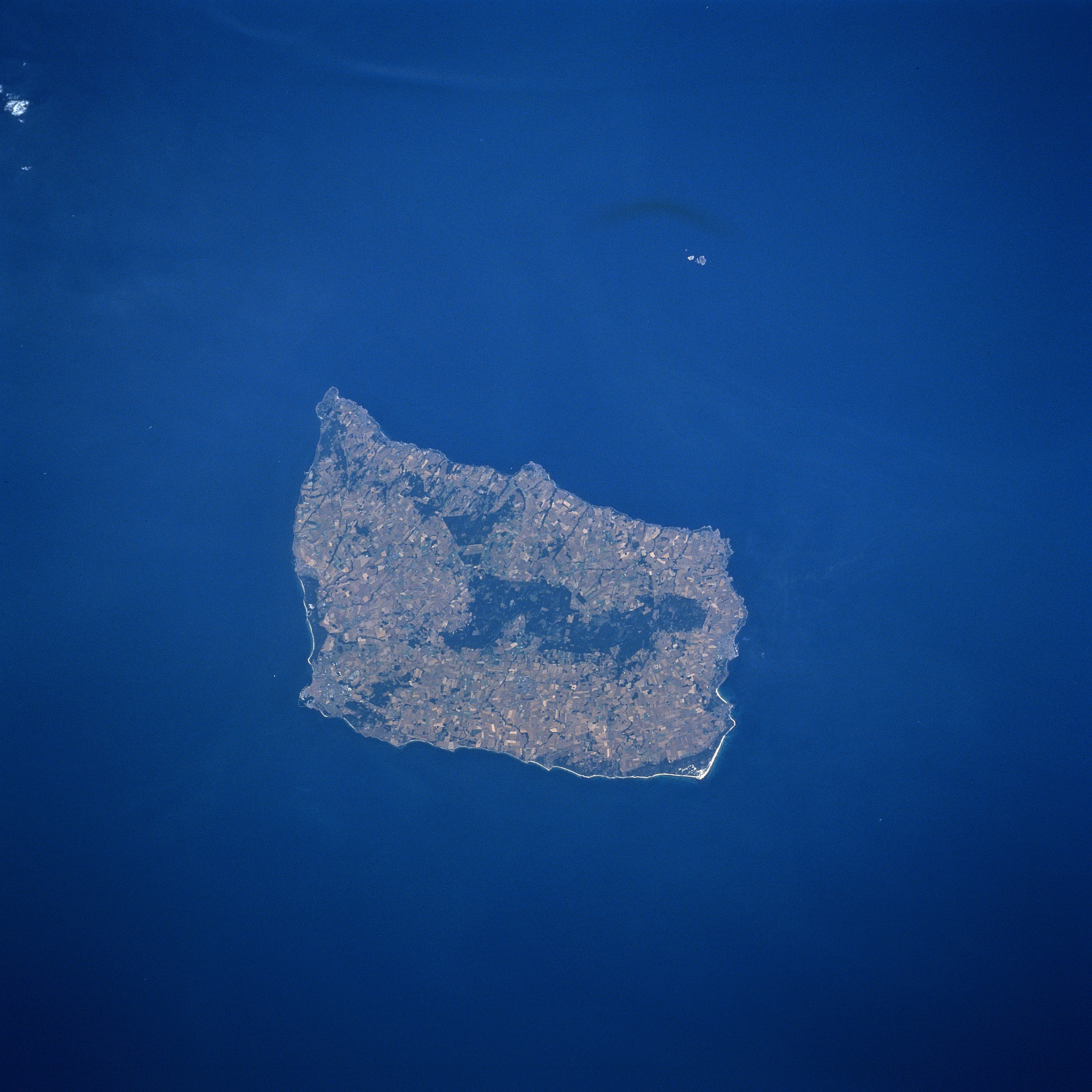
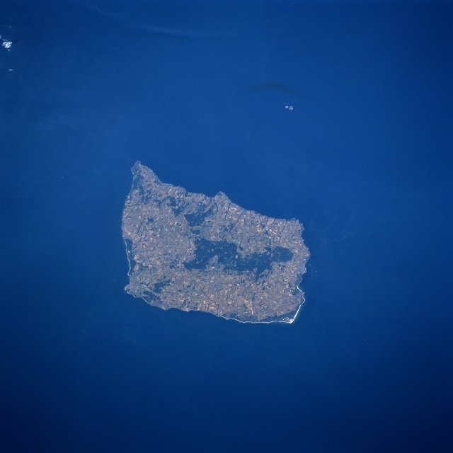
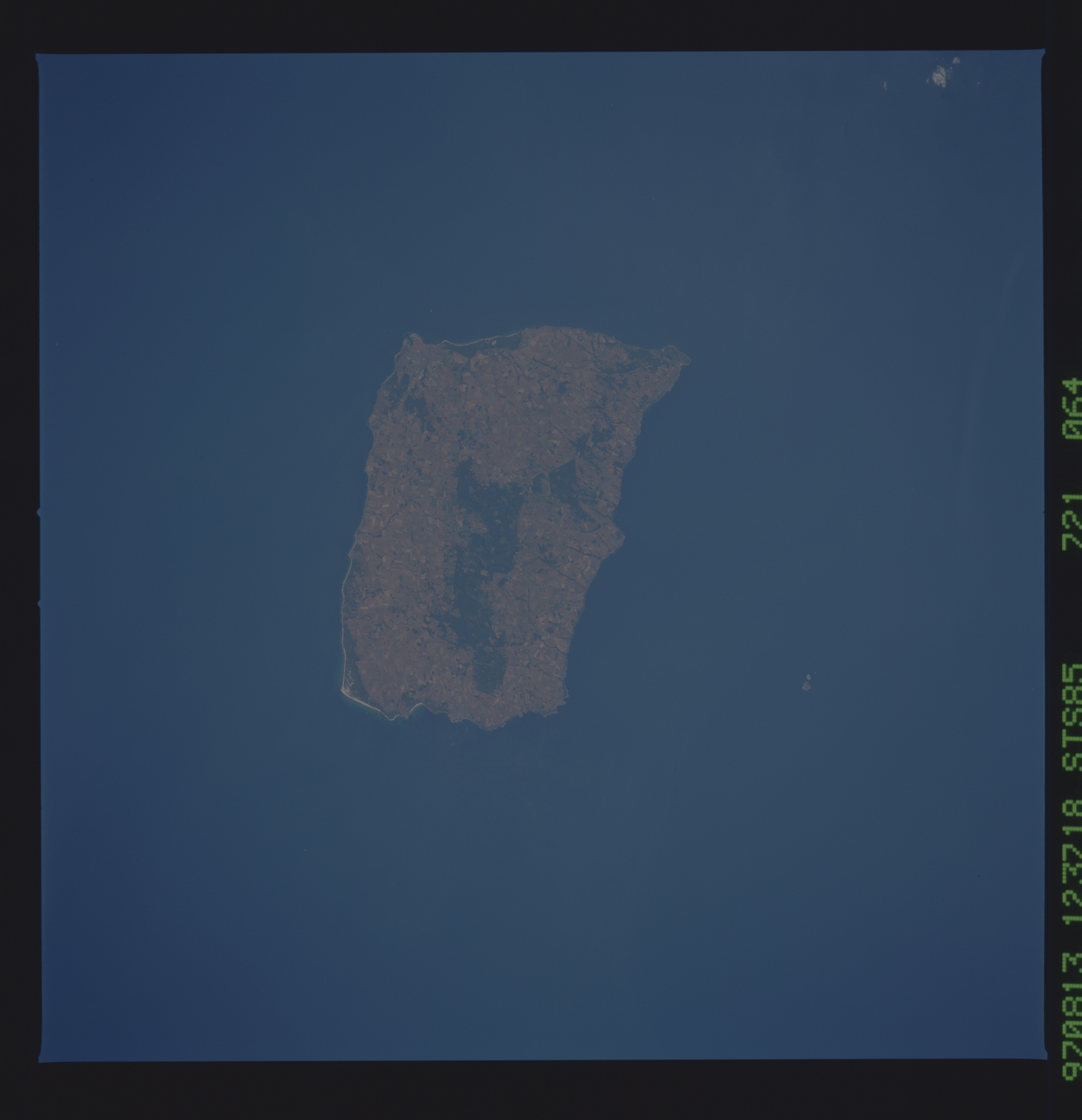
Image Caption: STS085-721-064 Bornholm Island, Denmark August 1997
Located in the Baltic Sea between Sweden and Poland, Bornholm Island is the easternmost and smallest county of Denmark. Although relatively small in size (226 square miles-587 square km), this Danish island offers a variety of scenic landforms and land use activities that includes sandy beaches, rocky cliffs, forests (mainly darker areas near the center of the island), and an extensive area of cultivated field patterns (lighter colored terrain). Because of the moderating influence of the Baltic Sea, Bornholm has a relatively mild climate in comparison with the Scandinavian countries north of the island. As a result of the moderate temperatures and the scenic beauty of the island, tourism has become one of the major economic activities for islanders since World War II. The small islands of Christians and Frederiks, which are controlled by the Danish Ministry of Defense, are visible as light colored features northeast of Bornholm Island.
Located in the Baltic Sea between Sweden and Poland, Bornholm Island is the easternmost and smallest county of Denmark. Although relatively small in size (226 square miles-587 square km), this Danish island offers a variety of scenic landforms and land use activities that includes sandy beaches, rocky cliffs, forests (mainly darker areas near the center of the island), and an extensive area of cultivated field patterns (lighter colored terrain). Because of the moderating influence of the Baltic Sea, Bornholm has a relatively mild climate in comparison with the Scandinavian countries north of the island. As a result of the moderate temperatures and the scenic beauty of the island, tourism has become one of the major economic activities for islanders since World War II. The small islands of Christians and Frederiks, which are controlled by the Danish Ministry of Defense, are visible as light colored features northeast of Bornholm Island.
