STS085-721-44

| NASA Photo ID | STS085-721-44 |
| Focal Length | 250mm |
| Date taken | 1997.08.13 |
| Time taken | 12:25:03 GMT |
Resolutions offered for this image:
4049 x 4085 pixels 634 x 640 pixels 5700 x 5900 pixels 483 x 500 pixels 498 x 508 pixels 480 x 479 pixels
4049 x 4085 pixels 634 x 640 pixels 5700 x 5900 pixels 483 x 500 pixels 498 x 508 pixels 480 x 479 pixels
Cloud masks available for this image:
Spacecraft nadir point: 45.0° N, 58.9° W
Photo center point: 46.0° N, 60.0° W
Photo center point by machine learning:
Photo center point: 46.0° N, 60.0° W
Photo center point by machine learning:
Nadir to Photo Center: Northwest
Spacecraft Altitude: 155 nautical miles (287km)
Country or Geographic Name: | CANADA-Q |
Features: | CAPE BRETON ISLAND |
| Features Found Using Machine Learning: | |
Cloud Cover Percentage: | 10 (1-10)% |
Sun Elevation Angle: | 36° |
Sun Azimuth: | 106° |
Camera: | Hasselblad |
Focal Length: | 250mm |
Camera Tilt: | 30 degrees |
Format: | 5069: Kodak Elite 100S, E6 Reversal, Replaces Lumiere, Warmer in tone vs. Lumiere |
Film Exposure: | Normal |
| Additional Information | |
| Width | Height | Annotated | Cropped | Purpose | Links |
|---|---|---|---|---|---|
| 4049 pixels | 4085 pixels | No | No | Earth From Space collection | Download Image |
| 634 pixels | 640 pixels | No | No | Earth From Space collection | Download Image |
| 5700 pixels | 5900 pixels | No | No | Download Image | |
| 483 pixels | 500 pixels | No | No | Download Image | |
| 498 pixels | 508 pixels | No | No | Download Image | |
| 480 pixels | 479 pixels | Download Image |
Download Packaged File
Download a Google Earth KML for this Image
View photo footprint information
Download a GeoTIFF for this photo
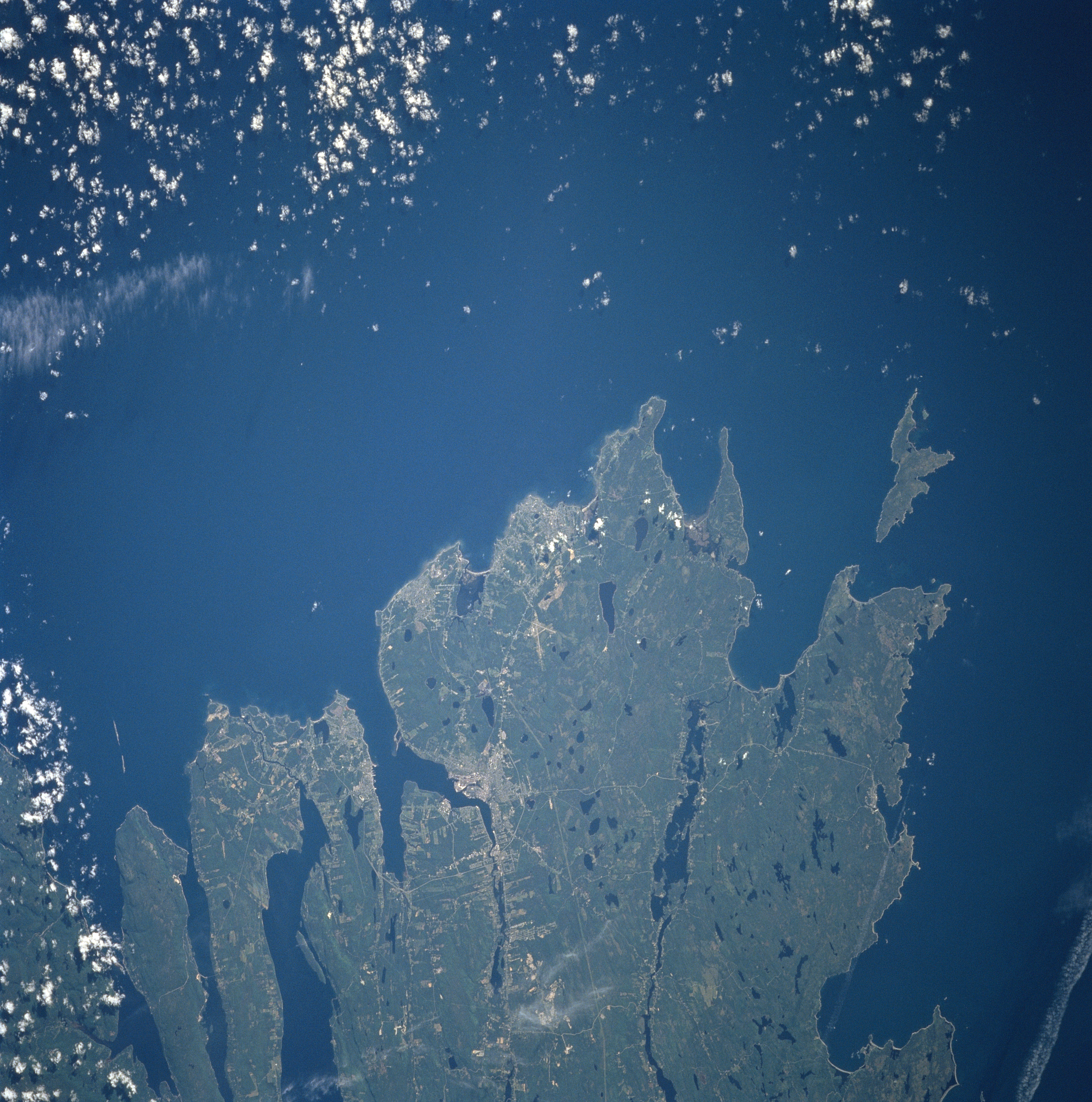
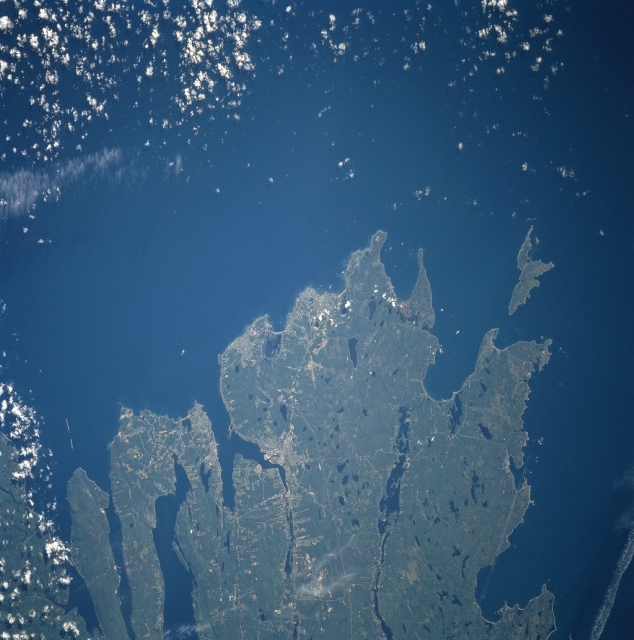
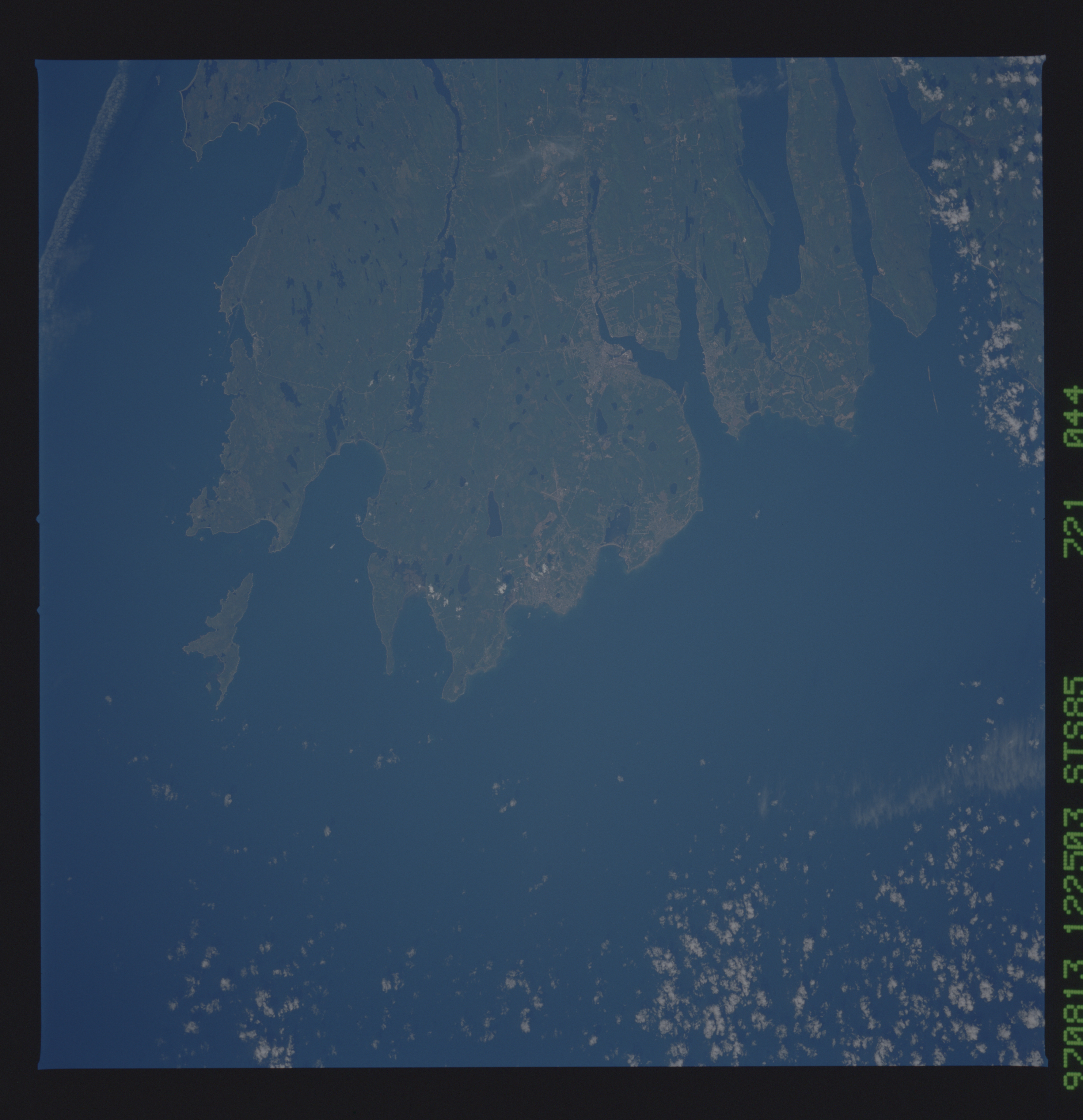
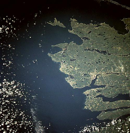
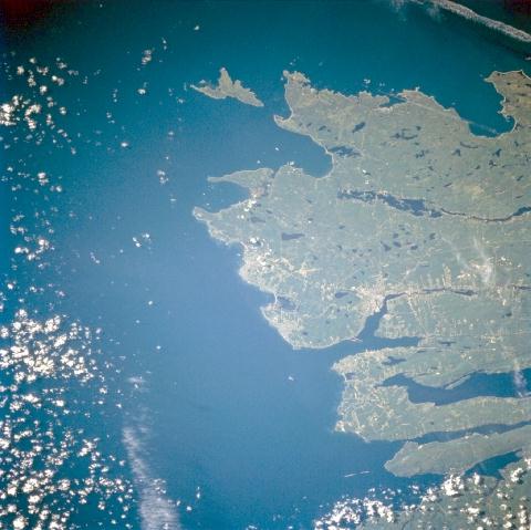
Image Caption: STS085-721-044 Sydney Area, Nova Scotia, Canada August 1997
The northeast tip of Cape Breton Island shows a densely forested landscape. The lakes (small, dark features) in the scene were created by glaciers during the last Ice Age. In this southeast looking view of Sydney and its environs, the lighter-colored terrain shows the distribution of the populated urban areas along the coast. Sydney, third largest city in Nova Scotia, is located along the eastern branch of the Y-shaped bay. Other towns include New Waterford, Glace Bay and Sydney Mines. Several of the interconnecting highways (thin, light-colored lines) can be traced through the wooded countryside.
The northeast tip of Cape Breton Island shows a densely forested landscape. The lakes (small, dark features) in the scene were created by glaciers during the last Ice Age. In this southeast looking view of Sydney and its environs, the lighter-colored terrain shows the distribution of the populated urban areas along the coast. Sydney, third largest city in Nova Scotia, is located along the eastern branch of the Y-shaped bay. Other towns include New Waterford, Glace Bay and Sydney Mines. Several of the interconnecting highways (thin, light-colored lines) can be traced through the wooded countryside.
