STS085-713-74
| NASA Photo ID | STS085-713-74 |
| Focal Length | 100mm |
| Date taken | 1997.08.12 |
| Time taken | 15:29:47 GMT |
Resolutions offered for this image:
4073 x 4073 pixels 639 x 639 pixels 5700 x 5900 pixels 483 x 500 pixels
4073 x 4073 pixels 639 x 639 pixels 5700 x 5900 pixels 483 x 500 pixels

Cloud masks available for this image:
Spacecraft nadir point: 57.0° N, 43.8° W
Photo center point: 61.0° N, 44.5° W
Photo center point by machine learning:
Photo center point: 61.0° N, 44.5° W
Photo center point by machine learning:
Nadir to Photo Center: North
Spacecraft Altitude: 156 nautical miles (289km)
Country or Geographic Name: | GREENLAND |
Features: | ICEBERGS |
| Features Found Using Machine Learning: | |
Cloud Cover Percentage: | 40 (26-50)% |
Sun Elevation Angle: | 48° |
Sun Azimuth: | 191° |
Camera: | Hasselblad |
Focal Length: | 100mm |
Camera Tilt: | Low Oblique |
Format: | 5069: Kodak Elite 100S, E6 Reversal, Replaces Lumiere, Warmer in tone vs. Lumiere |
Film Exposure: | Normal |
| Additional Information | |
| Width | Height | Annotated | Cropped | Purpose | Links |
|---|---|---|---|---|---|
| 4073 pixels | 4073 pixels | No | No | Earth From Space collection | Download Image |
| 639 pixels | 639 pixels | No | No | Earth From Space collection | Download Image |
| 5700 pixels | 5900 pixels | No | No | Download Image | |
| 483 pixels | 500 pixels | No | No | Download Image |
Download Packaged File
Download a Google Earth KML for this Image
View photo footprint information
Download a GeoTIFF for this photo
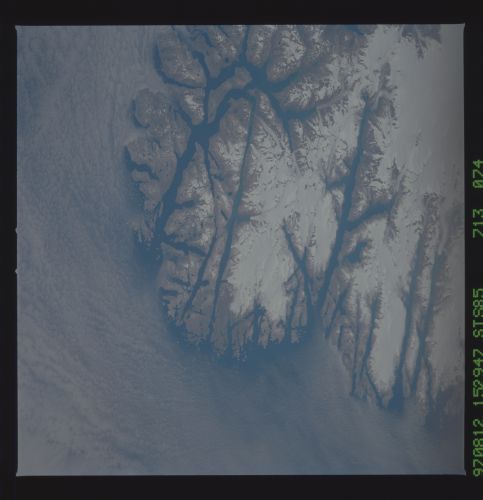
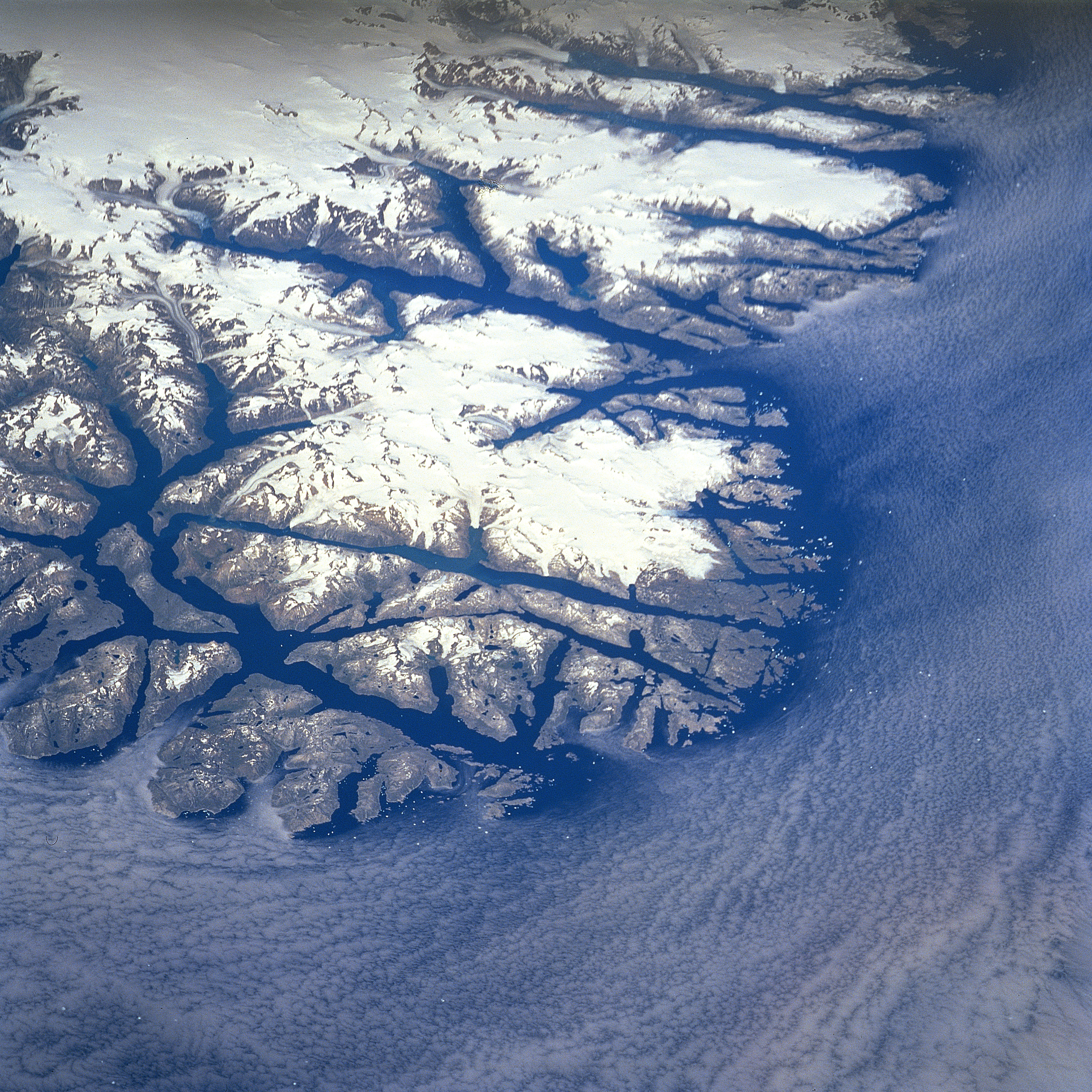
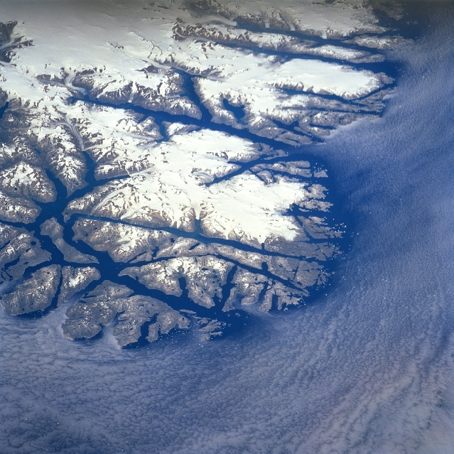
Image Caption: STS085-713-074 Fjorded Coastline, Greenland (Denmark) August 1997
This low oblique, northeast view of the south, southeast tip of Greenland shows the glaciated coastline of the world's largest island. The elongated, dark fingers of the open water from the North Atlantic Ocean that extend towards the interior are fjords. These deep, glacial troughs along the coastline are eroded valleys that once were occupied by valley glaciers. Several valley glaciers can be seen at the head of some of the fjords. The large concentrations of white on the image show the location of the prominent ice fields. The elevated ice fields shown on this image are located between 60 and 61 degrees north latitude.
This low oblique, northeast view of the south, southeast tip of Greenland shows the glaciated coastline of the world's largest island. The elongated, dark fingers of the open water from the North Atlantic Ocean that extend towards the interior are fjords. These deep, glacial troughs along the coastline are eroded valleys that once were occupied by valley glaciers. Several valley glaciers can be seen at the head of some of the fjords. The large concentrations of white on the image show the location of the prominent ice fields. The elevated ice fields shown on this image are located between 60 and 61 degrees north latitude.
