STS085-713-58
| NASA Photo ID | STS085-713-58 |
| Focal Length | 100mm |
| Date taken | 1997.08.12 |
| Time taken | 15:20:38 GMT |
Resolutions offered for this image:
4085 x 4073 pixels 640 x 638 pixels 5700 x 5900 pixels 483 x 500 pixels 507 x 514 pixels
4085 x 4073 pixels 640 x 638 pixels 5700 x 5900 pixels 483 x 500 pixels 507 x 514 pixels

Cloud masks available for this image:
Spacecraft nadir point: 44.9° N, 97.9° W
Photo center point: 45.0° N, 100.5° W
Photo center point by machine learning:
Photo center point: 45.0° N, 100.5° W
Photo center point by machine learning:
Nadir to Photo Center: West
Spacecraft Altitude: 155 nautical miles (287km)
Country or Geographic Name: | USA-SOUTH DAKOTA |
Features: | OAHE RESERVOIR |
| Features Found Using Machine Learning: | |
Cloud Cover Percentage: | 5 (1-10)% |
Sun Elevation Angle: | 39° |
Sun Azimuth: | 110° |
Camera: | Hasselblad |
Focal Length: | 100mm |
Camera Tilt: | 45 degrees |
Format: | 5069: Kodak Elite 100S, E6 Reversal, Replaces Lumiere, Warmer in tone vs. Lumiere |
Film Exposure: | Normal |
| Additional Information | |
| Width | Height | Annotated | Cropped | Purpose | Links |
|---|---|---|---|---|---|
| 4085 pixels | 4073 pixels | No | No | Earth From Space collection | Download Image |
| 640 pixels | 638 pixels | No | No | Earth From Space collection | Download Image |
| 5700 pixels | 5900 pixels | No | No | Download Image | |
| 483 pixels | 500 pixels | No | No | Download Image | |
| 507 pixels | 514 pixels | No | No | Download Image |
Download Packaged File
Download a Google Earth KML for this Image
View photo footprint information
Download a GeoTIFF for this photo
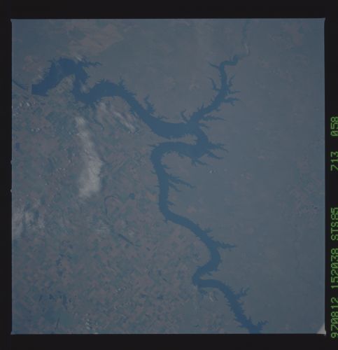
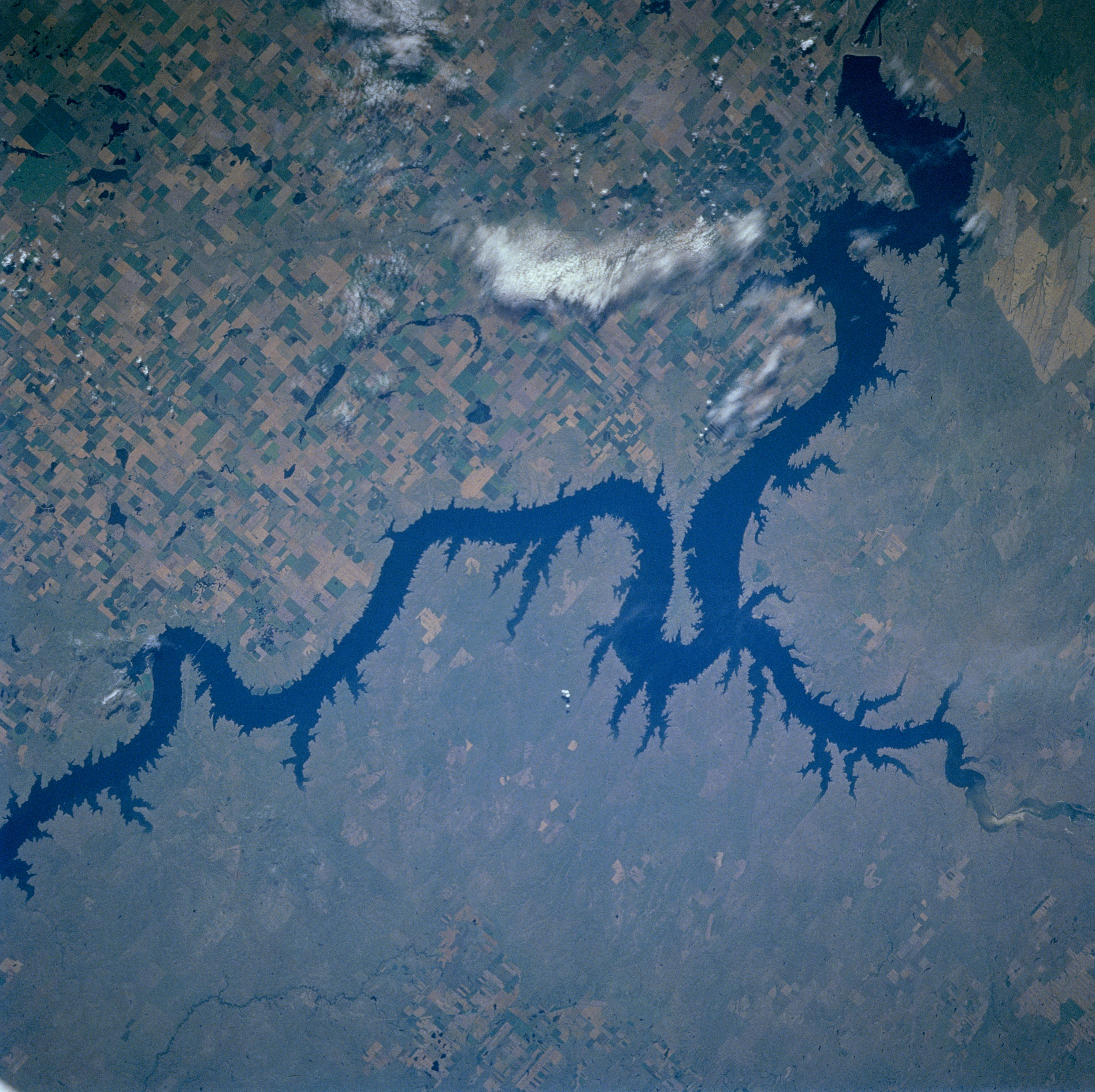
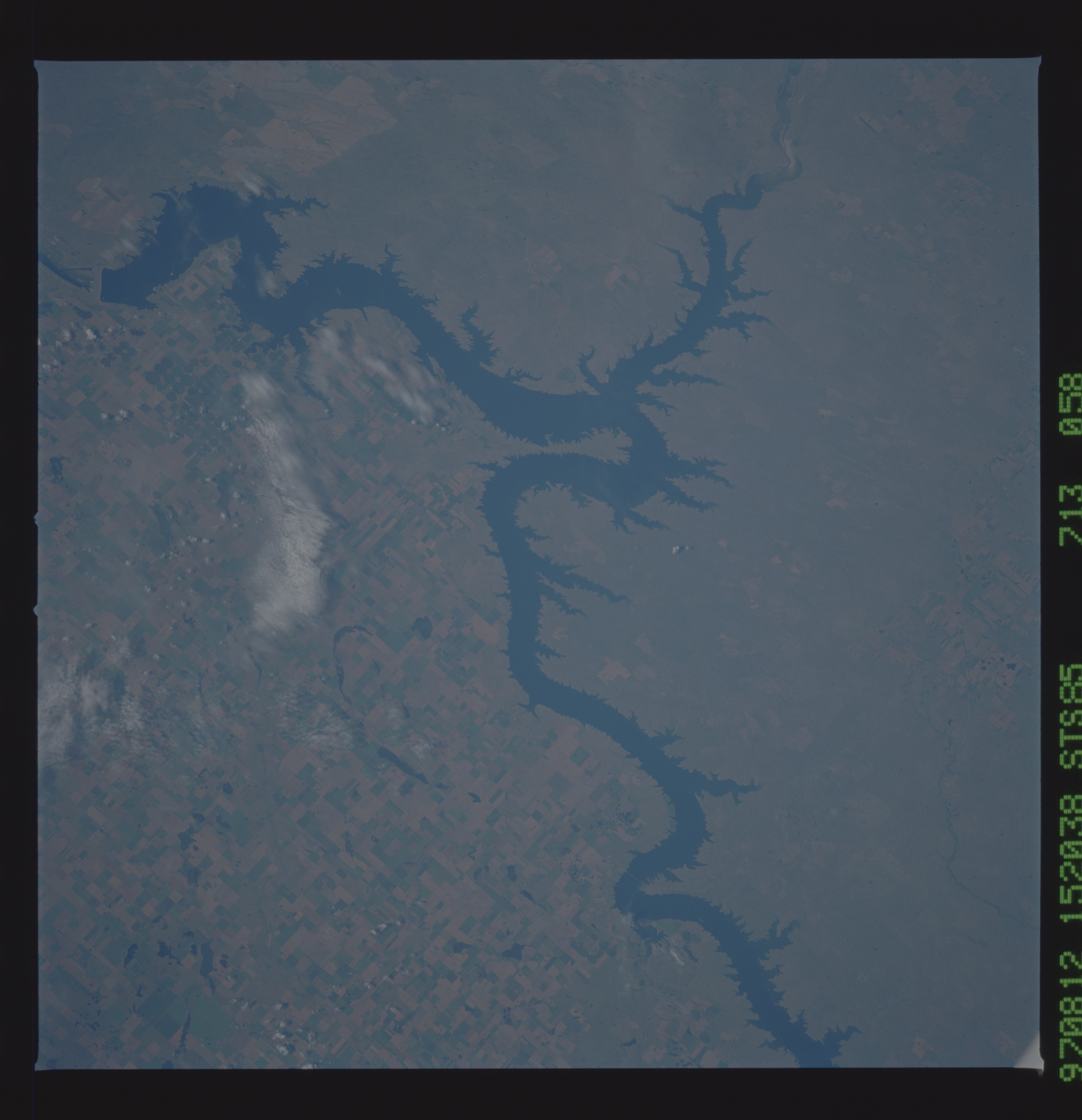
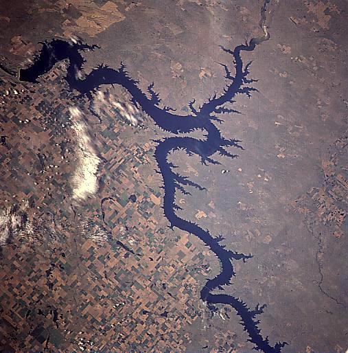
Image Caption: STS085-713-058 Oahe Reservoir, South Dakota August, 1997
The fourth largest in the United States, the Oahe Reservoir can be seen in this southwest-looking low-oblique view. Located on the Missouri River 5 miles (8 km) north of Pierre, South Dakota, the Oahe Reservoir stretches 231 miles (371 km) northward to just south of Bismarck, North Dakota (not visible on the image). The Oahe Dam is the second largest earthfill structure of its kind in the world. The lake has nearly 2250 miles (3523 km) of shoreline and is a very popular recreational area known for its excellent fishing. The dam also provides flood control, hydroelectric power, and irrigation. Numerous agricultural field patterns can be seen to the east of the reservoir. The Cheyenne River enters the scene near the upper right of the image and it joins Oahe Reservoir near the Fort Sully Game Refuge (peninsula jutting out into lake).
The fourth largest in the United States, the Oahe Reservoir can be seen in this southwest-looking low-oblique view. Located on the Missouri River 5 miles (8 km) north of Pierre, South Dakota, the Oahe Reservoir stretches 231 miles (371 km) northward to just south of Bismarck, North Dakota (not visible on the image). The Oahe Dam is the second largest earthfill structure of its kind in the world. The lake has nearly 2250 miles (3523 km) of shoreline and is a very popular recreational area known for its excellent fishing. The dam also provides flood control, hydroelectric power, and irrigation. Numerous agricultural field patterns can be seen to the east of the reservoir. The Cheyenne River enters the scene near the upper right of the image and it joins Oahe Reservoir near the Fort Sully Game Refuge (peninsula jutting out into lake).
