STS085-710-48
| NASA Photo ID | STS085-710-48 |
| Focal Length | 100mm |
| Date taken | 1997.08.11 |
| Time taken | 18:18:45 GMT |
Resolutions offered for this image:
4073 x 4096 pixels 636 x 640 pixels 5700 x 5900 pixels 483 x 500 pixels 512 x 523 pixels 478 x 479 pixels
4073 x 4096 pixels 636 x 640 pixels 5700 x 5900 pixels 483 x 500 pixels 512 x 523 pixels 478 x 479 pixels

Cloud masks available for this image:
Spacecraft nadir point: 51.2° N, 124.2° W
Photo center point: 50.5° N, 118.0° W
Photo center point by machine learning:
Photo center point: 50.5° N, 118.0° W
Photo center point by machine learning:
Nadir to Photo Center: East
Spacecraft Altitude: 156 nautical miles (289km)
Country or Geographic Name: | CANADA-BC |
Features: | COLUMBIA RIVER |
| Features Found Using Machine Learning: | |
Cloud Cover Percentage: | 0 (no clouds present) |
Sun Elevation Angle: | 46° |
Sun Azimuth: | 134° |
Camera: | Hasselblad |
Focal Length: | 100mm |
Camera Tilt: | Low Oblique |
Format: | 5069: Kodak Elite 100S, E6 Reversal, Replaces Lumiere, Warmer in tone vs. Lumiere |
Film Exposure: | Normal |
| Additional Information | |
| Width | Height | Annotated | Cropped | Purpose | Links |
|---|---|---|---|---|---|
| 4073 pixels | 4096 pixels | No | No | Earth From Space collection | Download Image |
| 636 pixels | 640 pixels | No | No | Earth From Space collection | Download Image |
| 5700 pixels | 5900 pixels | No | No | Download Image | |
| 483 pixels | 500 pixels | No | No | Download Image | |
| 512 pixels | 523 pixels | No | No | Download Image | |
| 478 pixels | 479 pixels | Download Image |
Download Packaged File
Download a Google Earth KML for this Image
View photo footprint information
Download a GeoTIFF for this photo
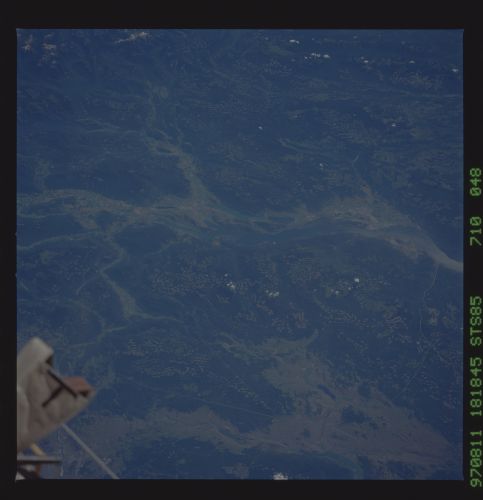
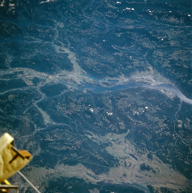
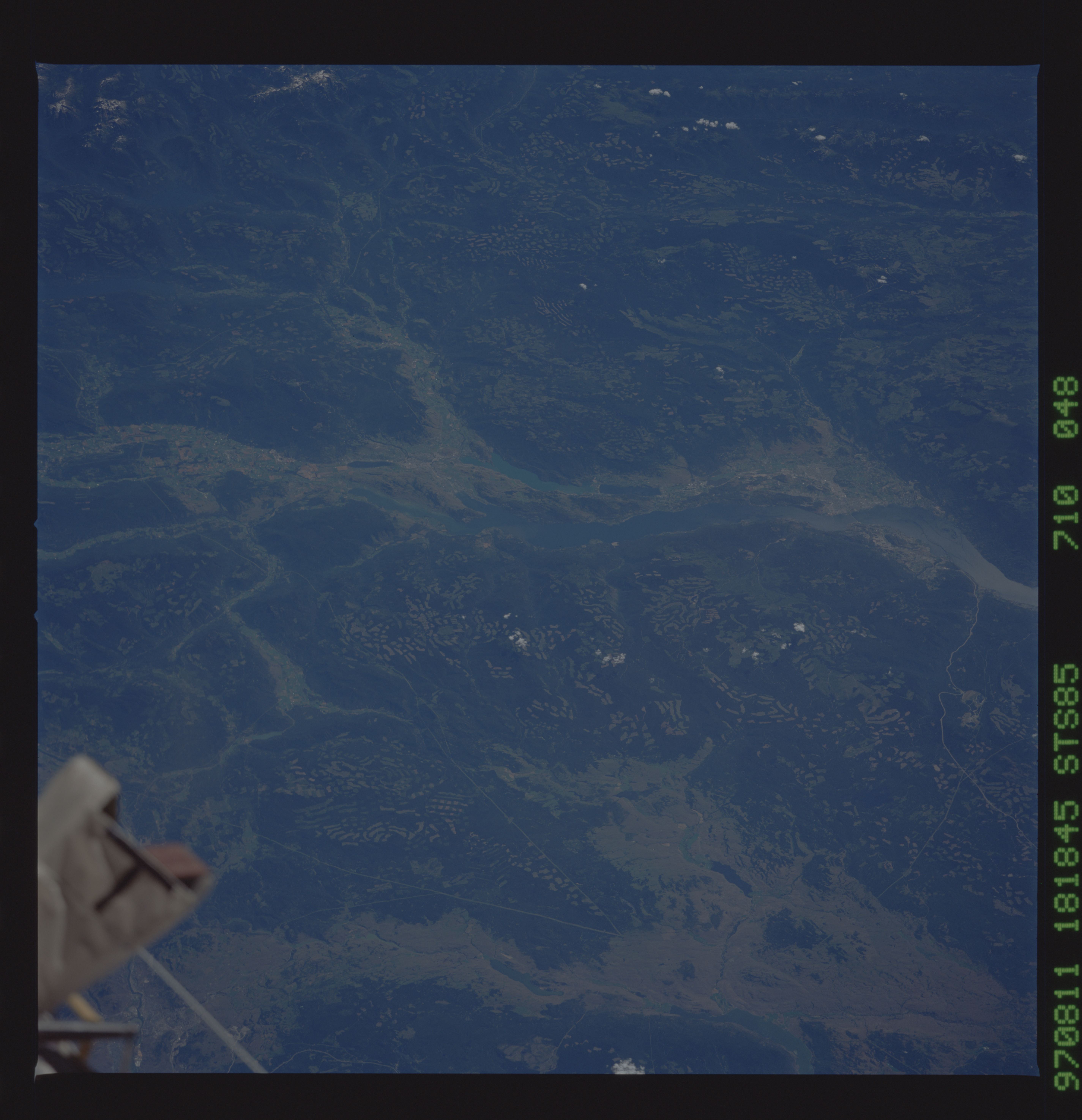
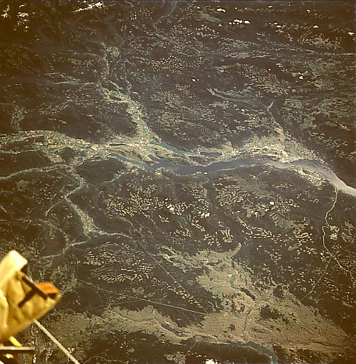
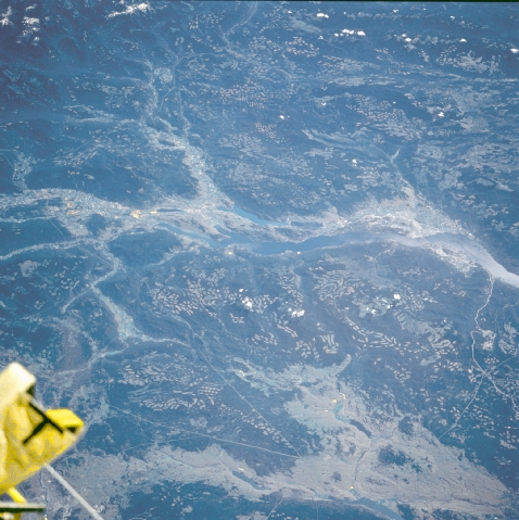
Image Caption: STS085-710-048 Okanagan Lake, British Columbia, Canada August 1997
The northern half of Lake Okanagan (elongate bluish feature) is in the center of this east-looking oblique image. The checkered landscape east and west of Lake Okanagan (small, light colored angular patches) is a result of extensive timber clear-cutting. The valley is technically classified as a desert, receiving less than 10 inches (25 centimeters) of precipitation per year. The verges of the grassy area in the lower third of the image are sharply linear (hence the lighter, more uniform looking terrain at the bottom of the image). Nicola and Douglas Lakes are two of the smaller lakes near bottom center of the picture. The two thin converging lines (light colored) are power-line right of ways that have been cut through the heavily forested slopes. Part of the Space Shuttle orbiter can be seen in the lower left corner of the image.
The northern half of Lake Okanagan (elongate bluish feature) is in the center of this east-looking oblique image. The checkered landscape east and west of Lake Okanagan (small, light colored angular patches) is a result of extensive timber clear-cutting. The valley is technically classified as a desert, receiving less than 10 inches (25 centimeters) of precipitation per year. The verges of the grassy area in the lower third of the image are sharply linear (hence the lighter, more uniform looking terrain at the bottom of the image). Nicola and Douglas Lakes are two of the smaller lakes near bottom center of the picture. The two thin converging lines (light colored) are power-line right of ways that have been cut through the heavily forested slopes. Part of the Space Shuttle orbiter can be seen in the lower left corner of the image.
