STS085-709-28
| NASA Photo ID | STS085-709-28 |
| Focal Length | 100mm |
| Date taken | 1997.08.10 |
| Time taken | 21:18:55 GMT |
Resolutions offered for this image:
4013 x 4085 pixels 628 x 640 pixels 5700 x 5900 pixels 483 x 500 pixels 512 x 519 pixels 479 x 479 pixels
4013 x 4085 pixels 628 x 640 pixels 5700 x 5900 pixels 483 x 500 pixels 512 x 519 pixels 479 x 479 pixels


Cloud masks available for this image:
Spacecraft nadir point: 57.1° N, 131.6° W
Photo center point: 56.5° N, 132.5° W
Photo center point by machine learning:
Photo center point: 56.5° N, 132.5° W
Photo center point by machine learning:
Nadir to Photo Center: Southwest
Spacecraft Altitude: 157 nautical miles (291km)
Country or Geographic Name: | USA-ALASKA |
Features: | CLARENCE STRAIT |
| Features Found Using Machine Learning: | |
Cloud Cover Percentage: | 5 (1-10)% |
Sun Elevation Angle: | 48° |
Sun Azimuth: | 190° |
Camera: | Hasselblad |
Focal Length: | 100mm |
Camera Tilt: | 23 degrees |
Format: | 5069: Kodak Elite 100S, E6 Reversal, Replaces Lumiere, Warmer in tone vs. Lumiere |
Film Exposure: | Normal |
| Additional Information | |
| Width | Height | Annotated | Cropped | Purpose | Links |
|---|---|---|---|---|---|
| 4013 pixels | 4085 pixels | No | No | Earth From Space collection | Download Image |
| 628 pixels | 640 pixels | No | No | Earth From Space collection | Download Image |
| 5700 pixels | 5900 pixels | No | No | Download Image | |
| 483 pixels | 500 pixels | No | No | Download Image | |
| 512 pixels | 519 pixels | No | No | Download Image | |
| 479 pixels | 479 pixels | Download Image |
Download Packaged File
Download a Google Earth KML for this Image
View photo footprint information
Download a GeoTIFF for this photo
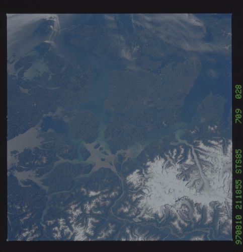
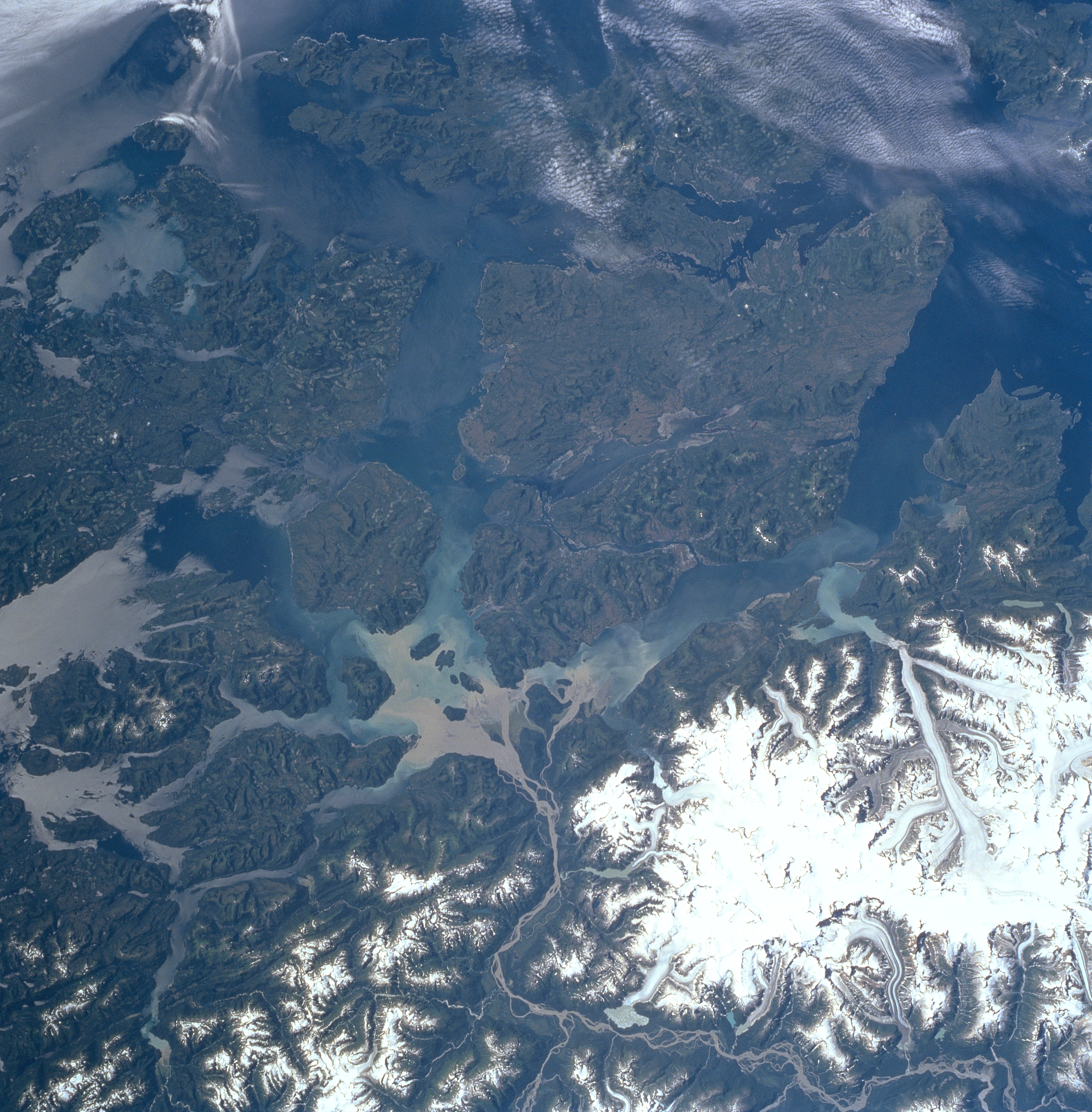
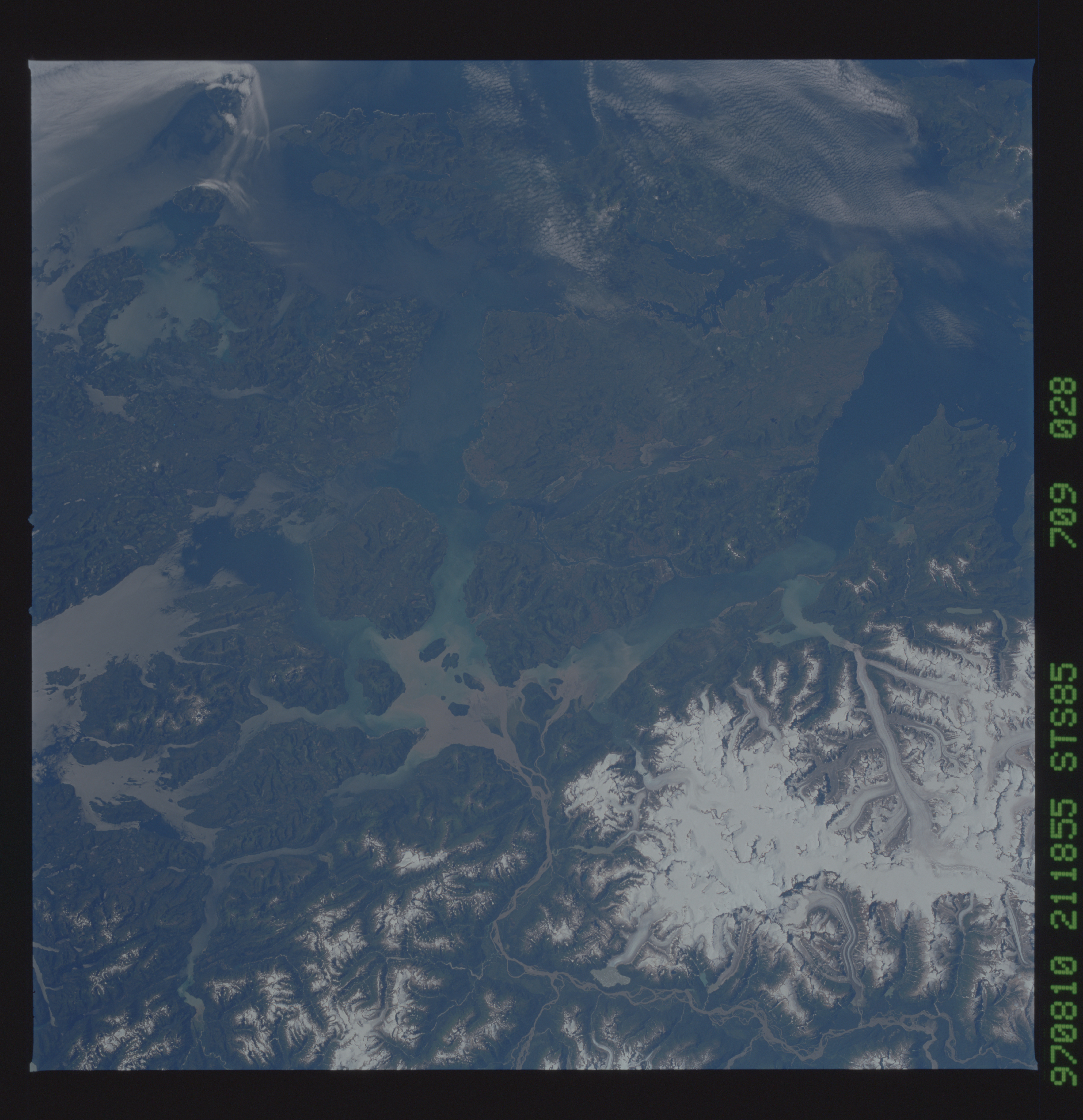
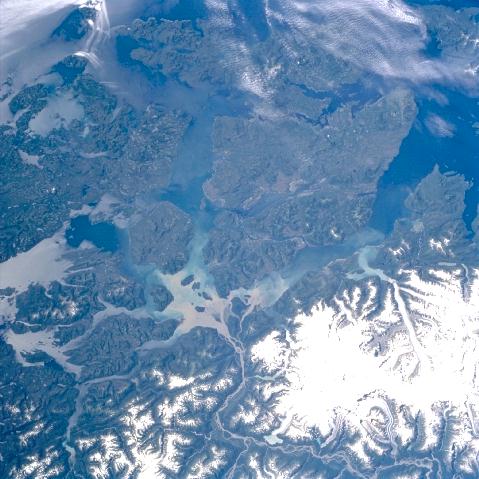
Image Caption: STS085-709-028 Stikine River, Alexander Archipelago, Alaska August, 1997
Some of the islands of the Alexander Archipelago of southeastern Alaska can be seen in this southwest-looking low-oblique view. The islands of the Alexander Archipelago are the exposed tops of the submerged coastal mountains that rise steeply from the Pacific Ocean. Deep, fjord-like channels separate the islands and cut them off from the mainland. All of the islands are rugged, densely forested, and have an abundance of wildlife. Some of the islands seen in this view are Prince of Wales Island (near left center of the image), Kuiu Island (upper center), and Kupreanof Island (near the center of the image). The Stikine River enters the scene at the bottom right of the image. The river rises in the Stikine Mountains (not visible on the image) in northwest British Columbia, Canada, and flows in an arc west and southwest 335 miles (539 km), crosses southeast Alaska, and enters the Pacific Ocean (see sediment from river mouth just below the center of the image). The Stikine River was one of many routes used by prospectors during the Klondike Gold Rush in 1897 and 1898. The river is a noted salmon stream. The glaciers of Mount Ratz (10290 feet--3138 meters) in the Coast Mountains are visible in the lower right portion of the image.
Some of the islands of the Alexander Archipelago of southeastern Alaska can be seen in this southwest-looking low-oblique view. The islands of the Alexander Archipelago are the exposed tops of the submerged coastal mountains that rise steeply from the Pacific Ocean. Deep, fjord-like channels separate the islands and cut them off from the mainland. All of the islands are rugged, densely forested, and have an abundance of wildlife. Some of the islands seen in this view are Prince of Wales Island (near left center of the image), Kuiu Island (upper center), and Kupreanof Island (near the center of the image). The Stikine River enters the scene at the bottom right of the image. The river rises in the Stikine Mountains (not visible on the image) in northwest British Columbia, Canada, and flows in an arc west and southwest 335 miles (539 km), crosses southeast Alaska, and enters the Pacific Ocean (see sediment from river mouth just below the center of the image). The Stikine River was one of many routes used by prospectors during the Klondike Gold Rush in 1897 and 1898. The river is a noted salmon stream. The glaciers of Mount Ratz (10290 feet--3138 meters) in the Coast Mountains are visible in the lower right portion of the image.
