STS085-708-34

| NASA Photo ID | STS085-708-34 |
| Focal Length | 100mm |
| Date taken | 1997.08.10 |
| Time taken | 13:51:50 GMT |
Resolutions offered for this image:
4031 x 4031 pixels 639 x 639 pixels 5700 x 5900 pixels 483 x 500 pixels
4031 x 4031 pixels 639 x 639 pixels 5700 x 5900 pixels 483 x 500 pixels

Cloud masks available for this image:
Spacecraft nadir point: 53.9° N, 13.7° E
Photo center point: 55.0° N, 12.0° E
Photo center point by machine learning:
Photo center point: 55.0° N, 12.0° E
Photo center point by machine learning:
Nadir to Photo Center: Northwest
Spacecraft Altitude: 158 nautical miles (293km)
Country or Geographic Name: | DENMARK |
Features: | LOLLAND |
| Features Found Using Machine Learning: | |
Cloud Cover Percentage: | 0 (no clouds present) |
Sun Elevation Angle: | 41° |
Sun Azimuth: | 235° |
Camera: | Hasselblad |
Focal Length: | 100mm |
Camera Tilt: | 38 degrees |
Format: | 5069: Kodak Elite 100S, E6 Reversal, Replaces Lumiere, Warmer in tone vs. Lumiere |
Film Exposure: | Normal |
| Additional Information | |
| Width | Height | Annotated | Cropped | Purpose | Links |
|---|---|---|---|---|---|
| 4031 pixels | 4031 pixels | No | No | Earth From Space collection | Download Image |
| 639 pixels | 639 pixels | No | No | Earth From Space collection | Download Image |
| 5700 pixels | 5900 pixels | No | No | Download Image | |
| 483 pixels | 500 pixels | No | No | Download Image |
Download Packaged File
Download a Google Earth KML for this Image
View photo footprint information
Download a GeoTIFF for this photo
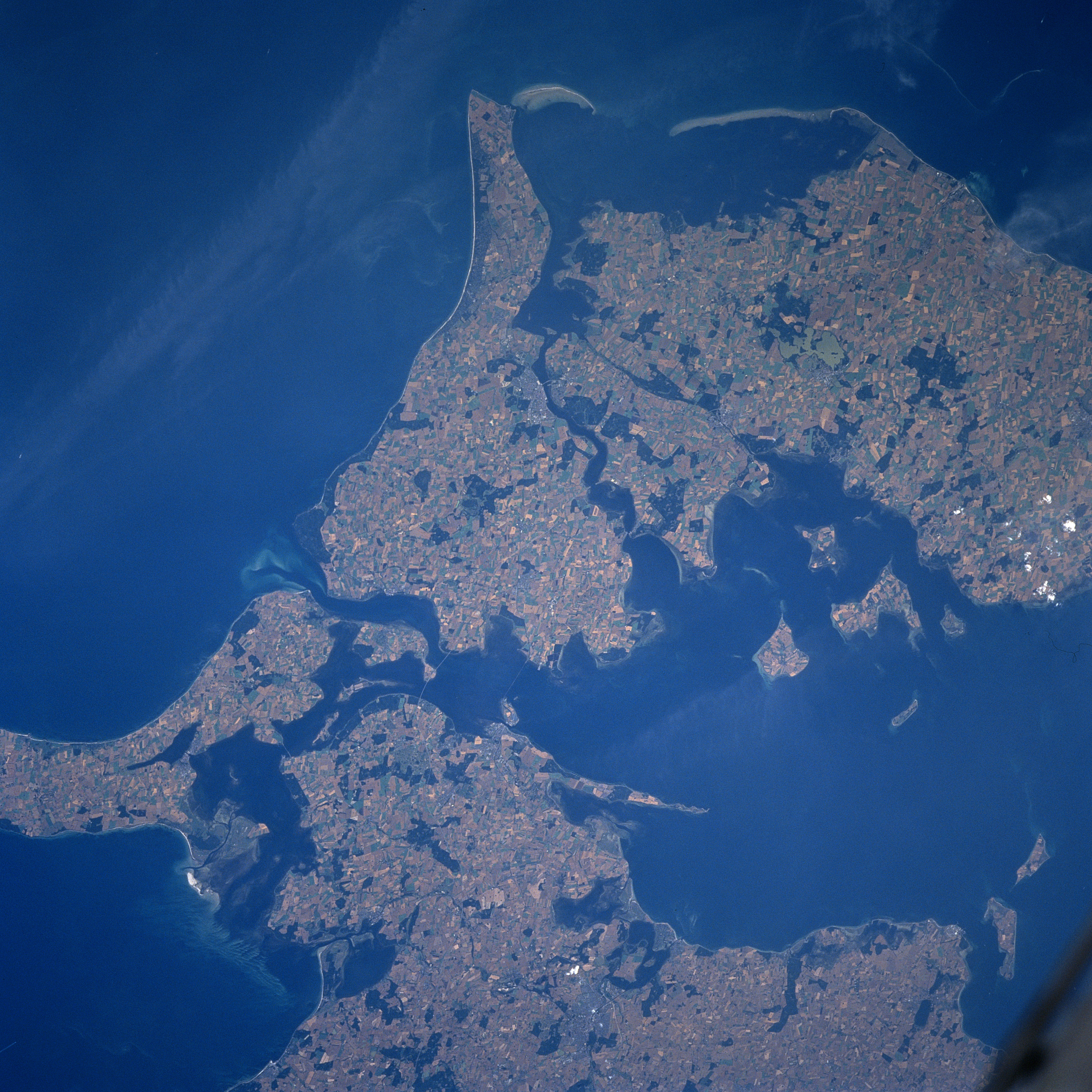
Image Caption: STS085-708-034 Lolland, Denmark August 1997
Denmark's unusually fragmented shape is shown in this near nadir look of several of the medium sized islands of eastern Denmark. While most of the 400 plus islands that make up Denmark are uninhabited, the medium sized islands (southern end of Zealand--bottom; Lolland--upper right; Falster--center; and Mon--lower left) shown in this picture display an extensive agricultural landscape. In addition to almost ideal topography (relatively flat to gently rolling hills) for most of the county, Denmark has a good climate and fertile soils. Over 60% of the open land is dominated by intensive agriculture. The favorable landscape is the result of glacial activity. The coastal areas around the islands are constantly changing as a result of erosion and shifting sands (notice the elongated, sandy-looking features off of the southern coast of Lolland). There are even sediment patterns (lighter colored water) in the shore off coastal waters.
Denmark's unusually fragmented shape is shown in this near nadir look of several of the medium sized islands of eastern Denmark. While most of the 400 plus islands that make up Denmark are uninhabited, the medium sized islands (southern end of Zealand--bottom; Lolland--upper right; Falster--center; and Mon--lower left) shown in this picture display an extensive agricultural landscape. In addition to almost ideal topography (relatively flat to gently rolling hills) for most of the county, Denmark has a good climate and fertile soils. Over 60% of the open land is dominated by intensive agriculture. The favorable landscape is the result of glacial activity. The coastal areas around the islands are constantly changing as a result of erosion and shifting sands (notice the elongated, sandy-looking features off of the southern coast of Lolland). There are even sediment patterns (lighter colored water) in the shore off coastal waters.
