STS085-708-28
| NASA Photo ID | STS085-708-28 |
| Focal Length | 100mm |
| Date taken | 1997.08.10 |
| Time taken | 13:51:32 GMT |
Resolutions offered for this image:
4031 x 4031 pixels 639 x 639 pixels 5700 x 5900 pixels 483 x 500 pixels
4031 x 4031 pixels 639 x 639 pixels 5700 x 5900 pixels 483 x 500 pixels

Cloud masks available for this image:
Spacecraft nadir point: 54.3° N, 11.9° E
Photo center point: 55.5° N, 11.0° E
Photo center point by machine learning:
Photo center point: 55.5° N, 11.0° E
Photo center point by machine learning:
Nadir to Photo Center: Northwest
Spacecraft Altitude: 158 nautical miles (293km)
Country or Geographic Name: | DENMARK |
Features: | LANGELANDS STRAIT |
| Features Found Using Machine Learning: | |
Cloud Cover Percentage: | 5 (1-10)% |
Sun Elevation Angle: | 41° |
Sun Azimuth: | 233° |
Camera: | Hasselblad |
Focal Length: | 100mm |
Camera Tilt: | 30 degrees |
Format: | 5069: Kodak Elite 100S, E6 Reversal, Replaces Lumiere, Warmer in tone vs. Lumiere |
Film Exposure: | Normal |
| Additional Information | |
| Width | Height | Annotated | Cropped | Purpose | Links |
|---|---|---|---|---|---|
| 4031 pixels | 4031 pixels | No | No | Earth From Space collection | Download Image |
| 639 pixels | 639 pixels | No | No | Earth From Space collection | Download Image |
| 5700 pixels | 5900 pixels | No | No | Download Image | |
| 483 pixels | 500 pixels | No | No | Download Image |
Download Packaged File
Download a Google Earth KML for this Image
View photo footprint information
Download a GeoTIFF for this photo
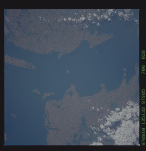
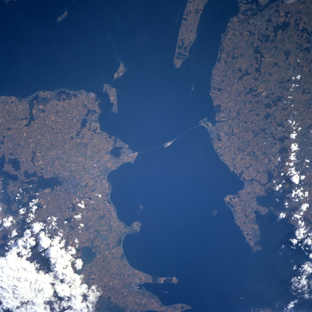
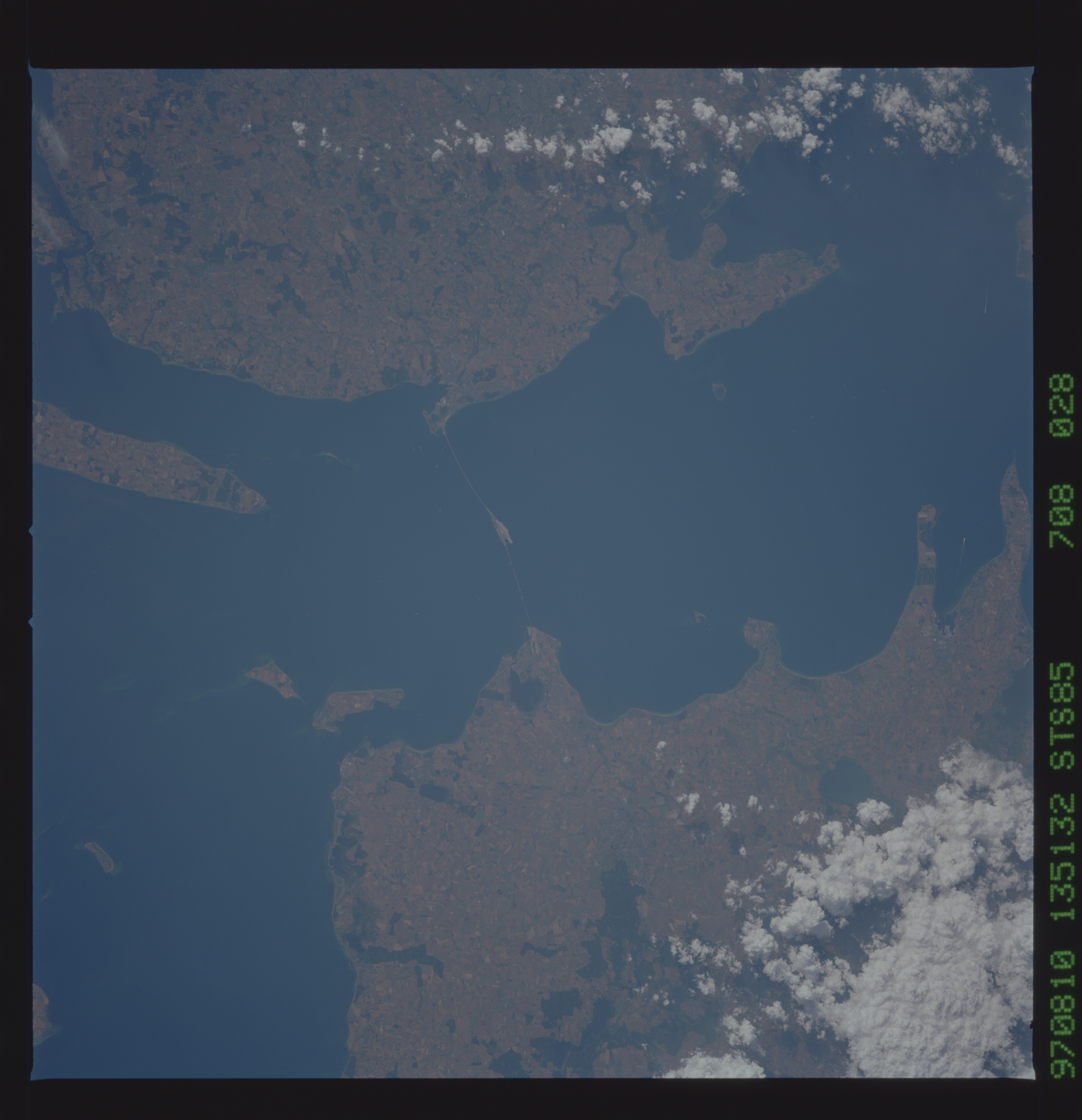
Image Caption: STS085-708-028 Store Strait, Denmark August 1997
The Store Strait separates two of Denmark's largest islands: Fyn to the west and Zealand to the east. The light colored, linear feature that seemingly connects these two islands appears to be a highway or railroad bridge and tunnel combination. Most of the total land area of Denmark is characterized as low and flat to gently rolling plains and over sixty percent of it is used for agriculture (lighter colored terrain). The randomly spaced darker patterns are forested areas and several lakes are also discernible as darker colored features.
The Store Strait separates two of Denmark's largest islands: Fyn to the west and Zealand to the east. The light colored, linear feature that seemingly connects these two islands appears to be a highway or railroad bridge and tunnel combination. Most of the total land area of Denmark is characterized as low and flat to gently rolling plains and over sixty percent of it is used for agriculture (lighter colored terrain). The randomly spaced darker patterns are forested areas and several lakes are also discernible as darker colored features.
