STS085-506-98
| NASA Photo ID | STS085-506-98 |
| Focal Length | 250mm |
| Date taken | 1997.08.12 |
| Time taken | 14:03:42 GMT |
Resolutions offered for this image:
801 x 1000 pixels 5248 x 4096 pixels 640 x 499 pixels 801 x 1000 pixels
801 x 1000 pixels 5248 x 4096 pixels 640 x 499 pixels 801 x 1000 pixels


Cloud masks available for this image:
Spacecraft nadir point: 52.0° N, 5.8° E
Photo center point: 52.0° N, 4.0° E
Photo center point by machine learning:
Photo center point: 52.0° N, 4.0° E
Photo center point by machine learning:
Nadir to Photo Center: West
Spacecraft Altitude: 157 nautical miles (291km)
Camera: | Linhof |
Focal Length: | 250mm |
Camera Tilt: | 35 degrees |
Format: | 5046: Kodak, natural color positive, Lumiere 100/5046, ASA 100, standard base |
Film Exposure: | Normal |
| Additional Information | |
| Width | Height | Annotated | Cropped | Purpose | Links |
|---|---|---|---|---|---|
| 801 pixels | 1000 pixels | No | No | Cities collection | Download Image |
| 5248 pixels | 4096 pixels | No | No | Earth From Space collection | Download Image |
| 640 pixels | 499 pixels | No | No | Earth From Space collection | Download Image |
| 801 pixels | 1000 pixels | Download Image |
Download Packaged File
Download a Google Earth KML for this Image
View photo footprint information
Download a GeoTIFF for this photo
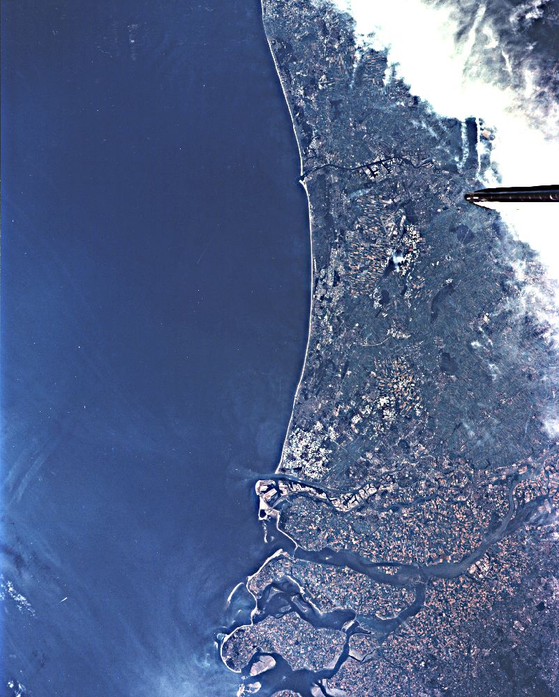
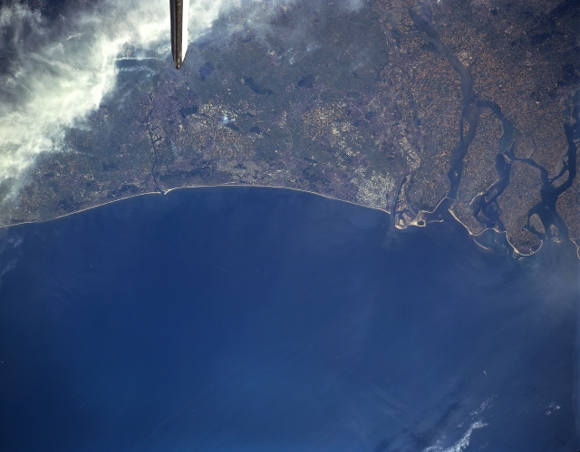
Image Caption: STS085-506-98 The Hague, Rotterdam, Netherlands August 1997
The delta of the Rhine River (right center) and the locations of the cities of The Hague and Rotterdam can be identified in this near-nadir view. The Hague is located on the coast of the North Sea northeast (left) of the Rhine River Delta. The city is the seat of the government of the kingdom of the Netherlands. Although, The Hague has some industries (clothing, metal goods, printed materials, and food products), the city's economy revolves around government administration. The International Court of Justice is located in The Hague. Rotterdam is located on the Nievwe Maas River, a distributary of the Rhine River, several miles (km) inland from the North Sea. Rotterdam is the major foreign-trade center in the Netherlands and boasts one of the world's major seaports. The city has shipyards, oil refineries, automobile assembly plants, and factories that manufacture electronic equipment and clothing. Agricultural field patterns are visible throughout the scene, but are especially noted on the islands in the delta area.
The delta of the Rhine River (right center) and the locations of the cities of The Hague and Rotterdam can be identified in this near-nadir view. The Hague is located on the coast of the North Sea northeast (left) of the Rhine River Delta. The city is the seat of the government of the kingdom of the Netherlands. Although, The Hague has some industries (clothing, metal goods, printed materials, and food products), the city's economy revolves around government administration. The International Court of Justice is located in The Hague. Rotterdam is located on the Nievwe Maas River, a distributary of the Rhine River, several miles (km) inland from the North Sea. Rotterdam is the major foreign-trade center in the Netherlands and boasts one of the world's major seaports. The city has shipyards, oil refineries, automobile assembly plants, and factories that manufacture electronic equipment and clothing. Agricultural field patterns are visible throughout the scene, but are especially noted on the islands in the delta area.
