STS085-501-116

| NASA Photo ID | STS085-501-116 |
| Focal Length | 250mm |
| Date taken | 1997.08.__ |
| Time taken | GMT |
Resolutions offered for this image:
5225 x 4049 pixels 639 x 495 pixels 1117 x 881 pixels 479 x 379 pixels 609 x 480 pixels
5225 x 4049 pixels 639 x 495 pixels 1117 x 881 pixels 479 x 379 pixels 609 x 480 pixels


Cloud masks available for this image:
Spacecraft nadir point:
Photo center point: 35.5° N, 117.0° W
Photo center point by machine learning:
Photo center point: 35.5° N, 117.0° W
Photo center point by machine learning:
Nadir to Photo Center:
Spacecraft Altitude: nautical miles (0km)
Camera: | Linhof |
Focal Length: | 250mm |
Camera Tilt: | Low Oblique |
Format: | 5046: Kodak, natural color positive, Lumiere 100/5046, ASA 100, standard base |
Film Exposure: | Normal |
| Additional Information | |
| Width | Height | Annotated | Cropped | Purpose | Links |
|---|---|---|---|---|---|
| 5225 pixels | 4049 pixels | No | No | Earth From Space collection | Download Image |
| 639 pixels | 495 pixels | No | No | Earth From Space collection | Download Image |
| 1117 pixels | 881 pixels | Download Image | |||
| 479 pixels | 379 pixels | Download Image | |||
| 609 pixels | 480 pixels | No | No | Download Image |
Download Packaged File
Download a Google Earth KML for this Image
View photo footprint information
Download a GeoTIFF for this photo
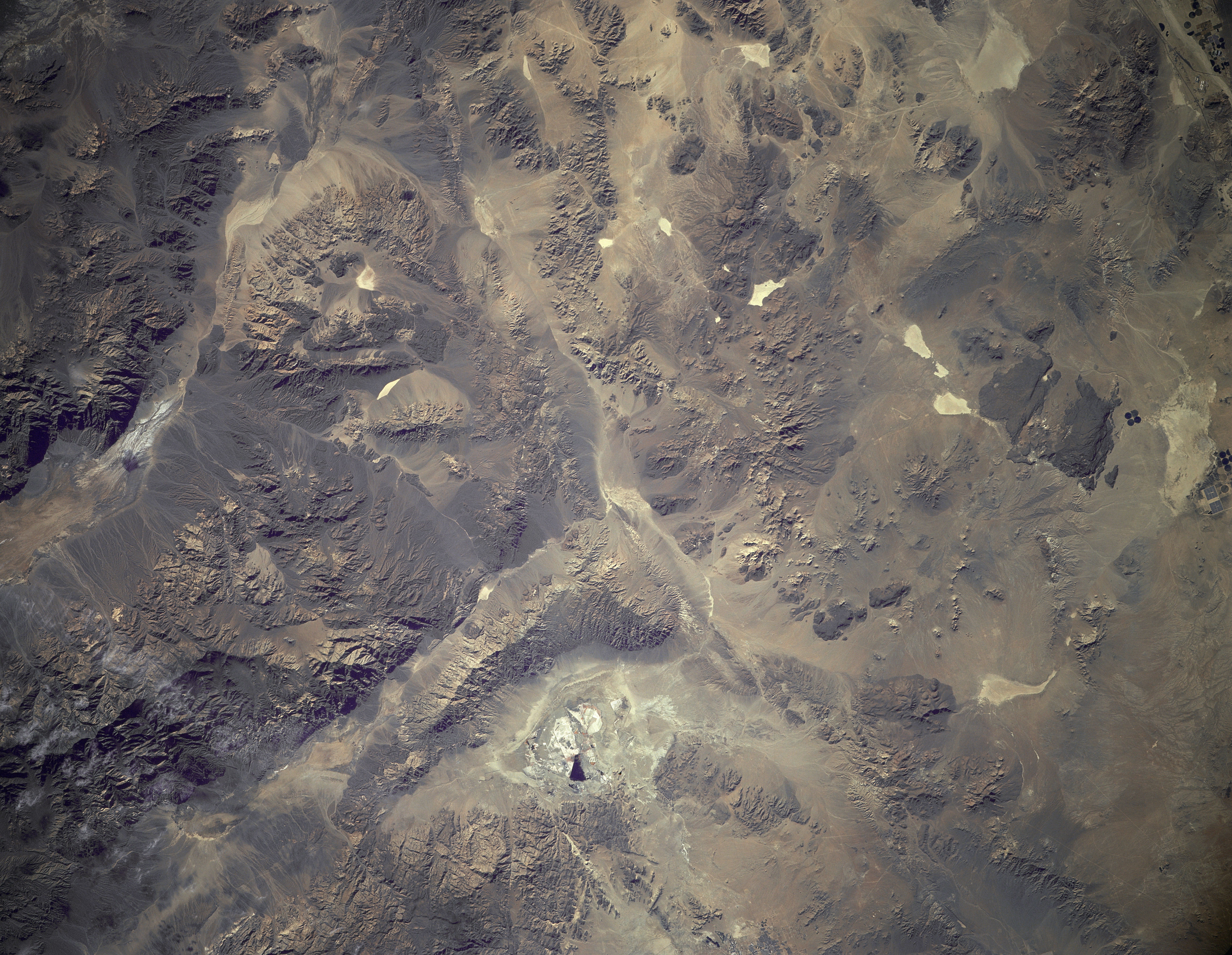
Image Caption: STS085-501-116 Mojave Desert, California, USA August 1997
The highly reflective features are dry lakes that are found in the valleys between the assorted mountains and numerous hills that make up this northern part of the Mojave Desert. Specific identifiable features in this synoptic scene include Harper Lake at the southwest edge of the image; Searles Lake (the whitish looking area on the picture--bottom center); and Death Valley (elongated valley near the northeast edge of the frame). The Panamint Mountains are the massive, rugged looking structure between Searles Lake and Death Valley. This frame of photography overlaps with STS085-501-114 in the vicinity of Harper Lake.
The highly reflective features are dry lakes that are found in the valleys between the assorted mountains and numerous hills that make up this northern part of the Mojave Desert. Specific identifiable features in this synoptic scene include Harper Lake at the southwest edge of the image; Searles Lake (the whitish looking area on the picture--bottom center); and Death Valley (elongated valley near the northeast edge of the frame). The Panamint Mountains are the massive, rugged looking structure between Searles Lake and Death Valley. This frame of photography overlaps with STS085-501-114 in the vicinity of Harper Lake.
