STS084-727-53
| NASA Photo ID | STS084-727-53 |
| Focal Length | 250mm |
| Date taken | 1997.05.18 |
| Time taken | 17:35:14 GMT |
Resolutions offered for this image:
3060 x 2855 pixels 1200 x 1119 pixels 4096 x 4096 pixels 640 x 640 pixels 5700 x 5900 pixels 483 x 500 pixels 5161 x 4816 pixels 639 x 597 pixels
3060 x 2855 pixels 1200 x 1119 pixels 4096 x 4096 pixels 640 x 640 pixels 5700 x 5900 pixels 483 x 500 pixels 5161 x 4816 pixels 639 x 597 pixels

Cloud masks available for this image:
Spacecraft nadir point: 11.2° S, 77.5° W
Photo center point: 12.0° S, 77.0° W
Photo center point by machine learning:
Photo center point: 12.0° S, 77.0° W
Photo center point by machine learning:
Nadir to Photo Center: Southeast
Spacecraft Altitude: 214 nautical miles (396km)
Country or Geographic Name: | PERU |
Features: | COAST, LIMA/CALLAO |
| Features Found Using Machine Learning: | |
Cloud Cover Percentage: | 5 (1-10)% |
Sun Elevation Angle: | 58° |
Sun Azimuth: | 347° |
Camera: | Hasselblad |
Focal Length: | 250mm |
Camera Tilt: | 15 degrees |
Format: | 5069: Kodak Elite 100S, E6 Reversal, Replaces Lumiere, Warmer in tone vs. Lumiere |
Film Exposure: | Normal |
| Additional Information | |
| Width | Height | Annotated | Cropped | Purpose | Links |
|---|---|---|---|---|---|
| 3060 pixels | 2855 pixels | No | No | Cities collection | Download Image |
| 1200 pixels | 1119 pixels | No | No | Cities collection | Download Image |
| 4096 pixels | 4096 pixels | No | No | Earth From Space collection | Download Image |
| 640 pixels | 640 pixels | No | No | Earth From Space collection | Download Image |
| 5700 pixels | 5900 pixels | No | No | Download Image | |
| 483 pixels | 500 pixels | No | No | Download Image | |
| 5161 pixels | 4816 pixels | Download Image | |||
| 639 pixels | 597 pixels | Download Image |
Download Packaged File
Download a Google Earth KML for this Image
View photo footprint information
Download a GeoTIFF for this photo
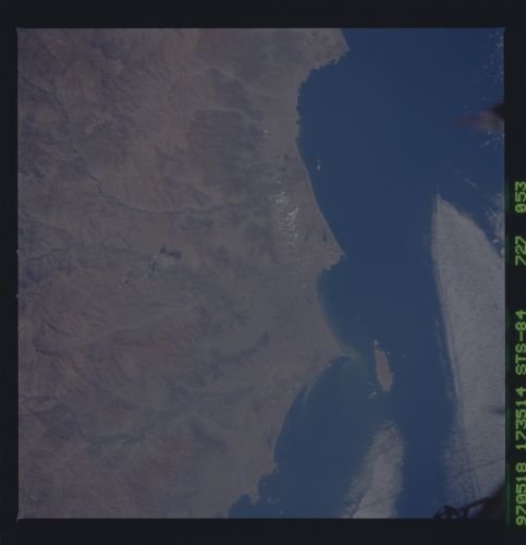
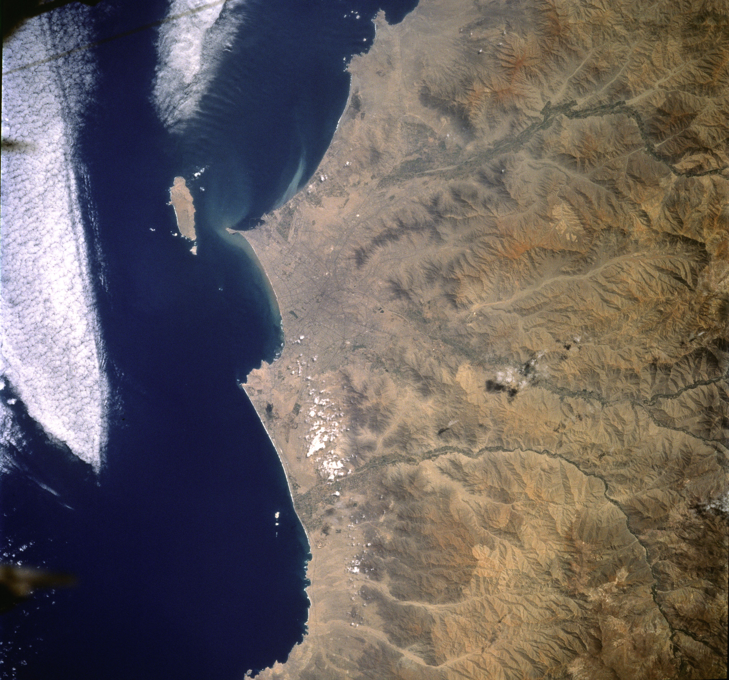
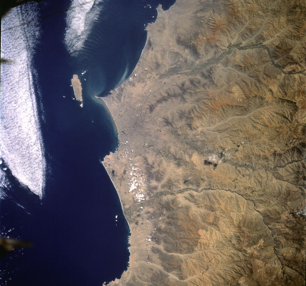
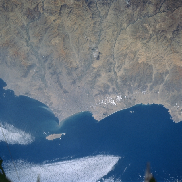
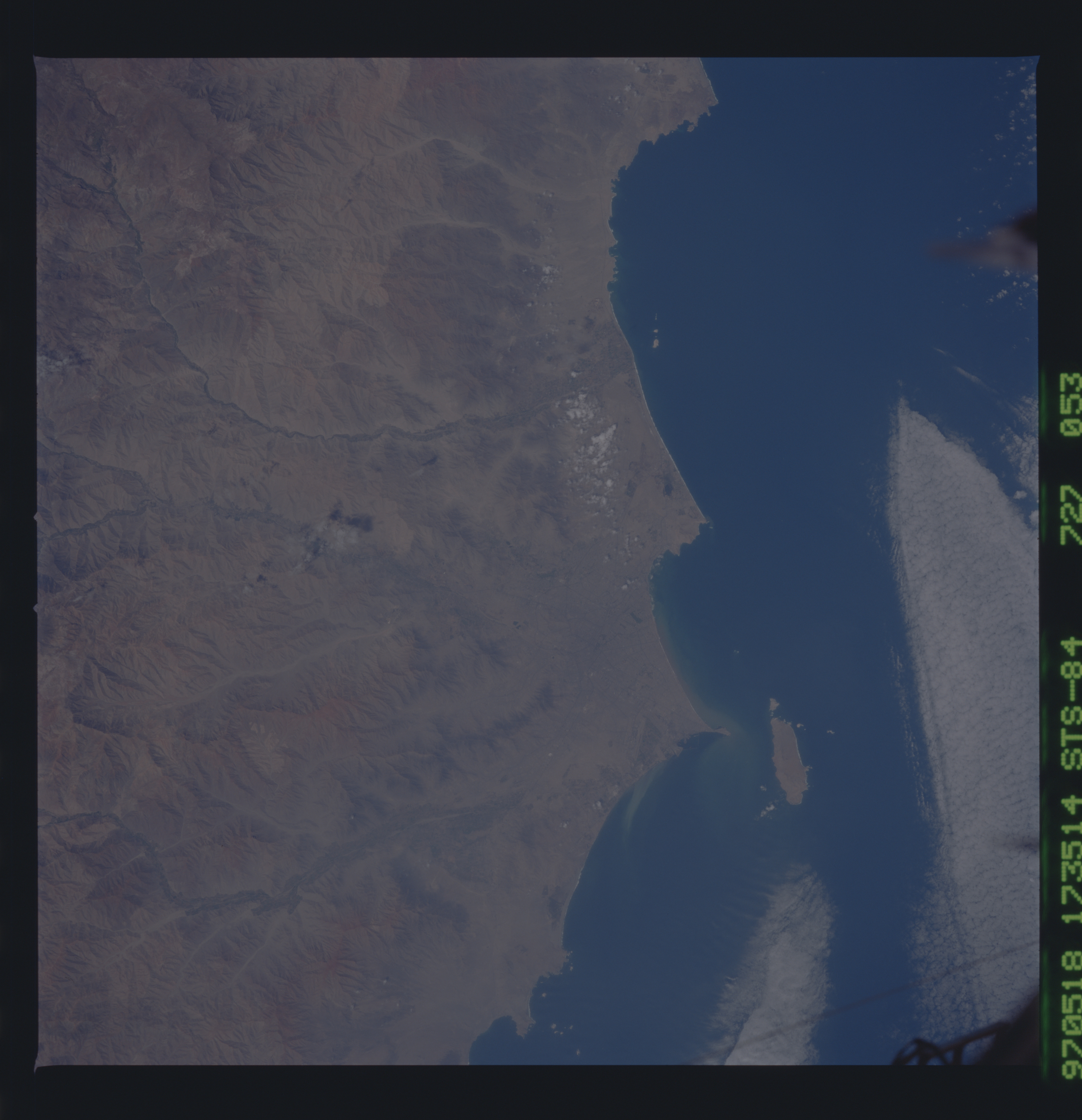
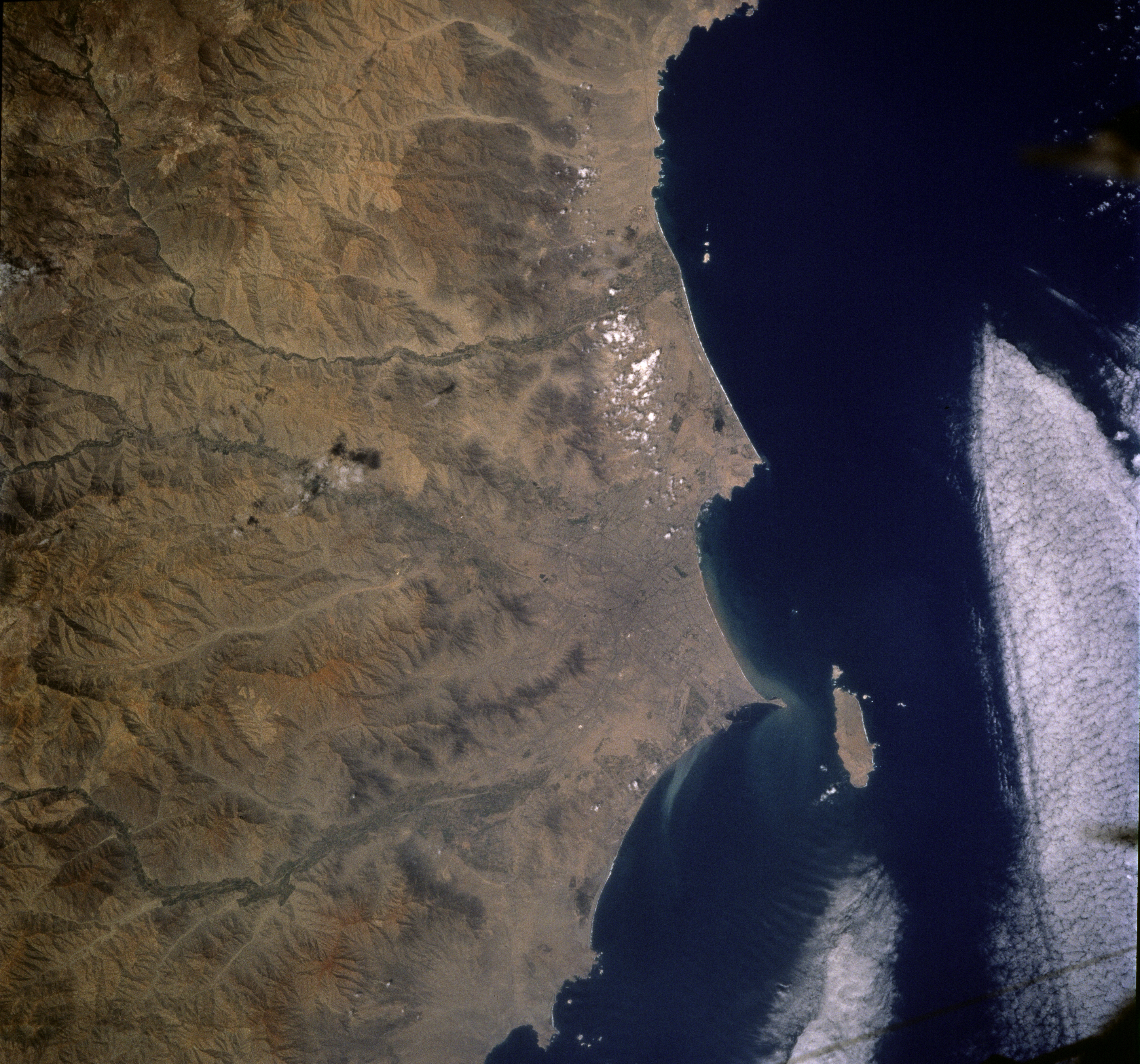
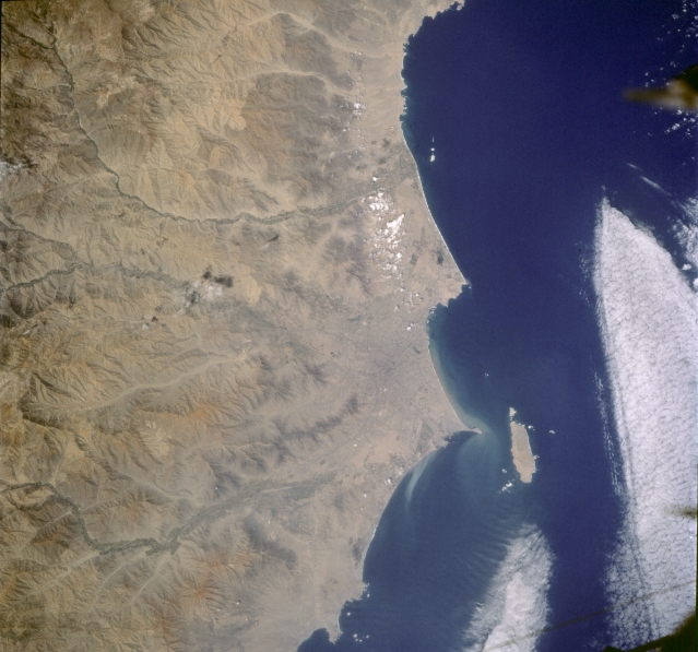
Image Caption: STS084-727-053 Lima/Callo Area, Peru May 1997
The coastal area of Peru is a desolate, rocky or sandy desert that extends from Ecuador to Chile. As seen on this image, the arid environment is broken only by short-flowing rivers that rapidly descend through the western flank of the Andes Mountains as deeply eroded and incised river valleys. Over fifty percent of Peru's population lives in the coastal valleys where irrigated agriculture is possible. The capitol, Lima, and its port city of Callao (barely visible in this small scale picture), are located along the coast near the center of the image. The island of San Lorenzo is located immediately offshore of the Callao-Lima urban area. The human settlements in the coastal valleys are totally dependent on water that flows from the Andes Mountains along canals and aqueducts that were built thousands of years ago.
The coastal area of Peru is a desolate, rocky or sandy desert that extends from Ecuador to Chile. As seen on this image, the arid environment is broken only by short-flowing rivers that rapidly descend through the western flank of the Andes Mountains as deeply eroded and incised river valleys. Over fifty percent of Peru's population lives in the coastal valleys where irrigated agriculture is possible. The capitol, Lima, and its port city of Callao (barely visible in this small scale picture), are located along the coast near the center of the image. The island of San Lorenzo is located immediately offshore of the Callao-Lima urban area. The human settlements in the coastal valleys are totally dependent on water that flows from the Andes Mountains along canals and aqueducts that were built thousands of years ago.
