STS084-708-67
| NASA Photo ID | STS084-708-67 |
| Focal Length | 250mm |
| Date taken | 1997.05.22 |
| Time taken | 02:52:16 GMT |
Resolutions offered for this image:
4096 x 4096 pixels 640 x 640 pixels 5700 x 5900 pixels 483 x 500 pixels 516 x 509 pixels
4096 x 4096 pixels 640 x 640 pixels 5700 x 5900 pixels 483 x 500 pixels 516 x 509 pixels


Cloud masks available for this image:
Spacecraft nadir point: 30.1° N, 86.8° E
Photo center point: 29.0° N, 85.5° E
Photo center point by machine learning:
Photo center point: 29.0° N, 85.5° E
Photo center point by machine learning:
Nadir to Photo Center: Southwest
Spacecraft Altitude: 205 nautical miles (380km)
Country or Geographic Name: | CHINA |
Features: | TIBET PLATEAU, L. PAIKU |
| Features Found Using Machine Learning: | |
Cloud Cover Percentage: | 5 (1-10)% |
Sun Elevation Angle: | 45° |
Sun Azimuth: | 90° |
Camera: | Hasselblad |
Focal Length: | 250mm |
Camera Tilt: | 26 degrees |
Format: | 5069: Kodak Elite 100S, E6 Reversal, Replaces Lumiere, Warmer in tone vs. Lumiere |
Film Exposure: | Normal |
| Additional Information | |
| Width | Height | Annotated | Cropped | Purpose | Links |
|---|---|---|---|---|---|
| 4096 pixels | 4096 pixels | No | No | Earth From Space collection | Download Image |
| 640 pixels | 640 pixels | No | No | Earth From Space collection | Download Image |
| 5700 pixels | 5900 pixels | No | No | Download Image | |
| 483 pixels | 500 pixels | No | No | Download Image | |
| 516 pixels | 509 pixels | No | No | Download Image |
Download Packaged File
Download a Google Earth KML for this Image
View photo footprint information
Download a GeoTIFF for this photo
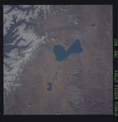
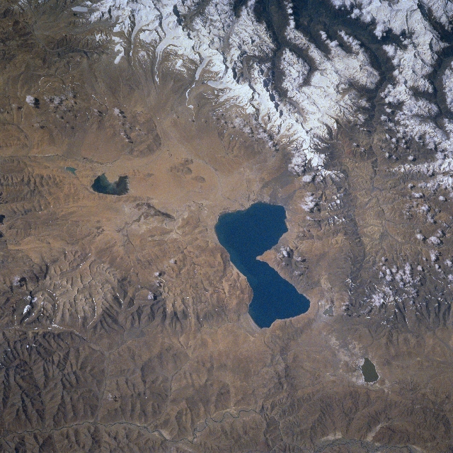
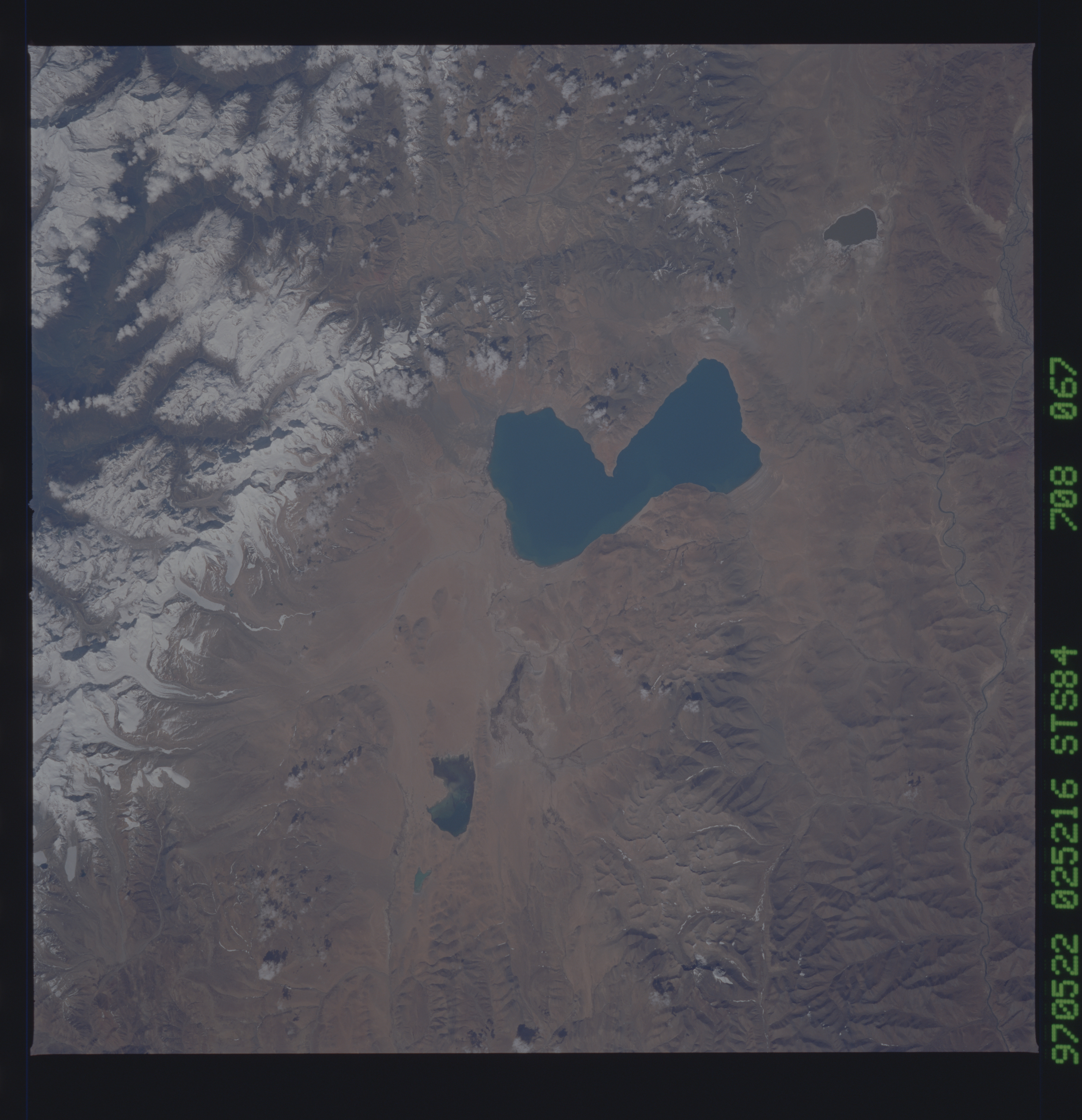
Image Caption: STS084-708-067 Lake Paiku, China May 1997
Located on the Tibetan Plateau, "The Roof of the World", at 15070 feet (4591 meters), Lake Paiku is visible (center of image) in this south-looking view. Lake Paiku is 17 miles (27 km) long and 4 miles (6 km) wide at its narrowest point. Surrounded by rugged mountains on three sides that reach altitudes in excess of 19000 feet (5725 meters), numerous small streams drain into the lake. To the south of Lake Paiku at the upper center of the image, the snow-capped, glaciated rugged peaks of the Himalaya Mountains, that reach altitudes in excess of 24000 feet (7320 meters) are visible. Streams fed by glaciers (upper center) cascade to the valley floor south of Lake Paiku, but only a few streams actually reach the lake. Lake Paiku has no stream outlet. Two small salt lakes can be seen on the image, Lake Lodu Loney to the north (bottom right), and Lake Langiang to the east (left center). The Dogxung River is visible in the lower left quadrant of the image.
Located on the Tibetan Plateau, "The Roof of the World", at 15070 feet (4591 meters), Lake Paiku is visible (center of image) in this south-looking view. Lake Paiku is 17 miles (27 km) long and 4 miles (6 km) wide at its narrowest point. Surrounded by rugged mountains on three sides that reach altitudes in excess of 19000 feet (5725 meters), numerous small streams drain into the lake. To the south of Lake Paiku at the upper center of the image, the snow-capped, glaciated rugged peaks of the Himalaya Mountains, that reach altitudes in excess of 24000 feet (7320 meters) are visible. Streams fed by glaciers (upper center) cascade to the valley floor south of Lake Paiku, but only a few streams actually reach the lake. Lake Paiku has no stream outlet. Two small salt lakes can be seen on the image, Lake Lodu Loney to the north (bottom right), and Lake Langiang to the east (left center). The Dogxung River is visible in the lower left quadrant of the image.
