STS084-706-69
| NASA Photo ID | STS084-706-69 |
| Focal Length | 100mm |
| Date taken | 1997.05.22 |
| Time taken | 15:25:35 GMT |
Resolutions offered for this image:
4055 x 4055 pixels 639 x 639 pixels 5700 x 5900 pixels 483 x 500 pixels 1296 x 1273 pixels
4055 x 4055 pixels 639 x 639 pixels 5700 x 5900 pixels 483 x 500 pixels 1296 x 1273 pixels

Cloud masks available for this image:
Spacecraft nadir point: 17.7° S, 63.0° W
Photo center point: 19.5° S, 68.0° W
Photo center point by machine learning:
Photo center point: 19.5° S, 68.0° W
Photo center point by machine learning:
Nadir to Photo Center: West
Spacecraft Altitude: 212 nautical miles (393km)
Country or Geographic Name: | BOLIVIA |
Features: | LAKE POOPO, DUST |
| Features Found Using Machine Learning: | |
Cloud Cover Percentage: | 15 (11-25)% |
Sun Elevation Angle: | 51° |
Sun Azimuth: | 16° |
Camera: | Hasselblad |
Focal Length: | 100mm |
Camera Tilt: | Low Oblique |
Format: | 5069: Kodak Elite 100S, E6 Reversal, Replaces Lumiere, Warmer in tone vs. Lumiere |
Film Exposure: | Normal |
| Additional Information | |
| Width | Height | Annotated | Cropped | Purpose | Links |
|---|---|---|---|---|---|
| 4055 pixels | 4055 pixels | No | No | Earth From Space collection | Download Image |
| 639 pixels | 639 pixels | No | No | Earth From Space collection | Download Image |
| 5700 pixels | 5900 pixels | No | No | Download Image | |
| 483 pixels | 500 pixels | No | No | Download Image | |
| 1296 pixels | 1273 pixels | No | No | Download Image |
Download Packaged File
Download a Google Earth KML for this Image
View photo footprint information
Download a GeoTIFF for this photo
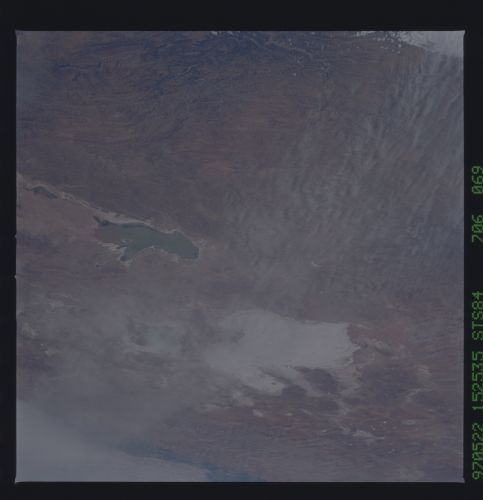
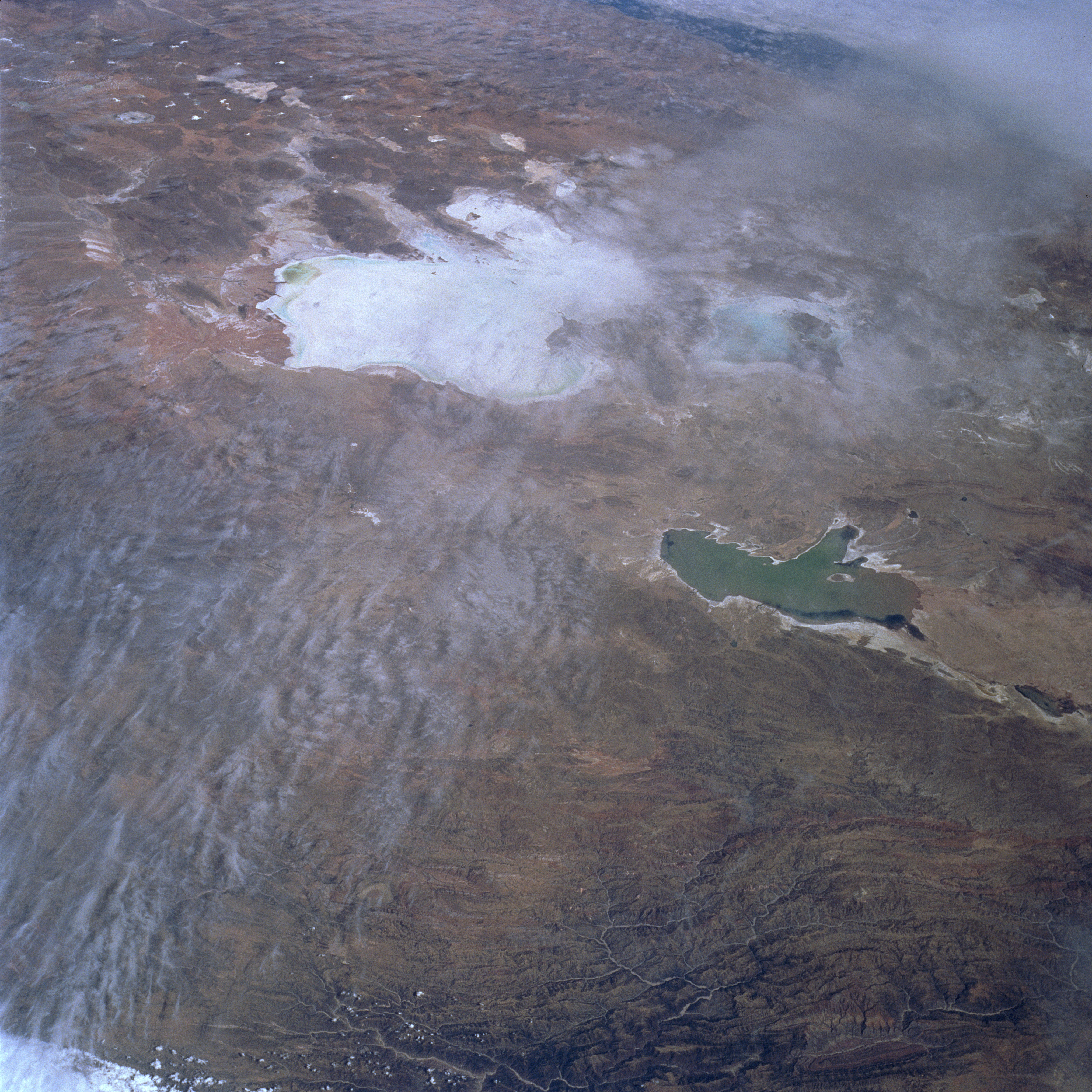
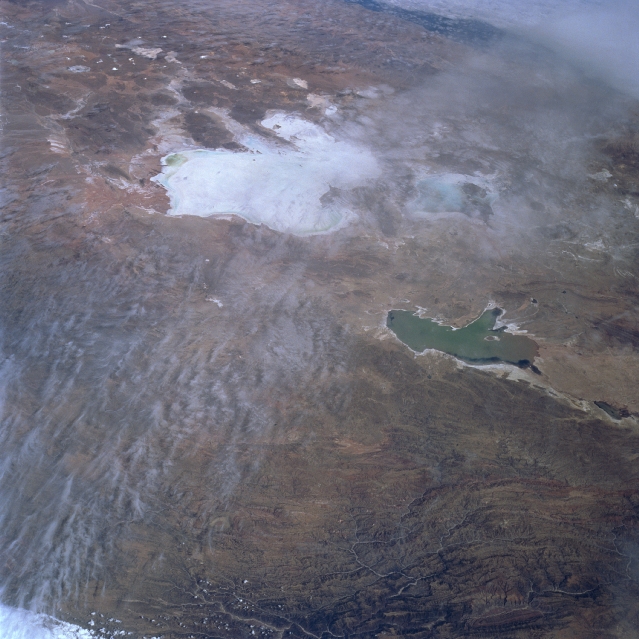
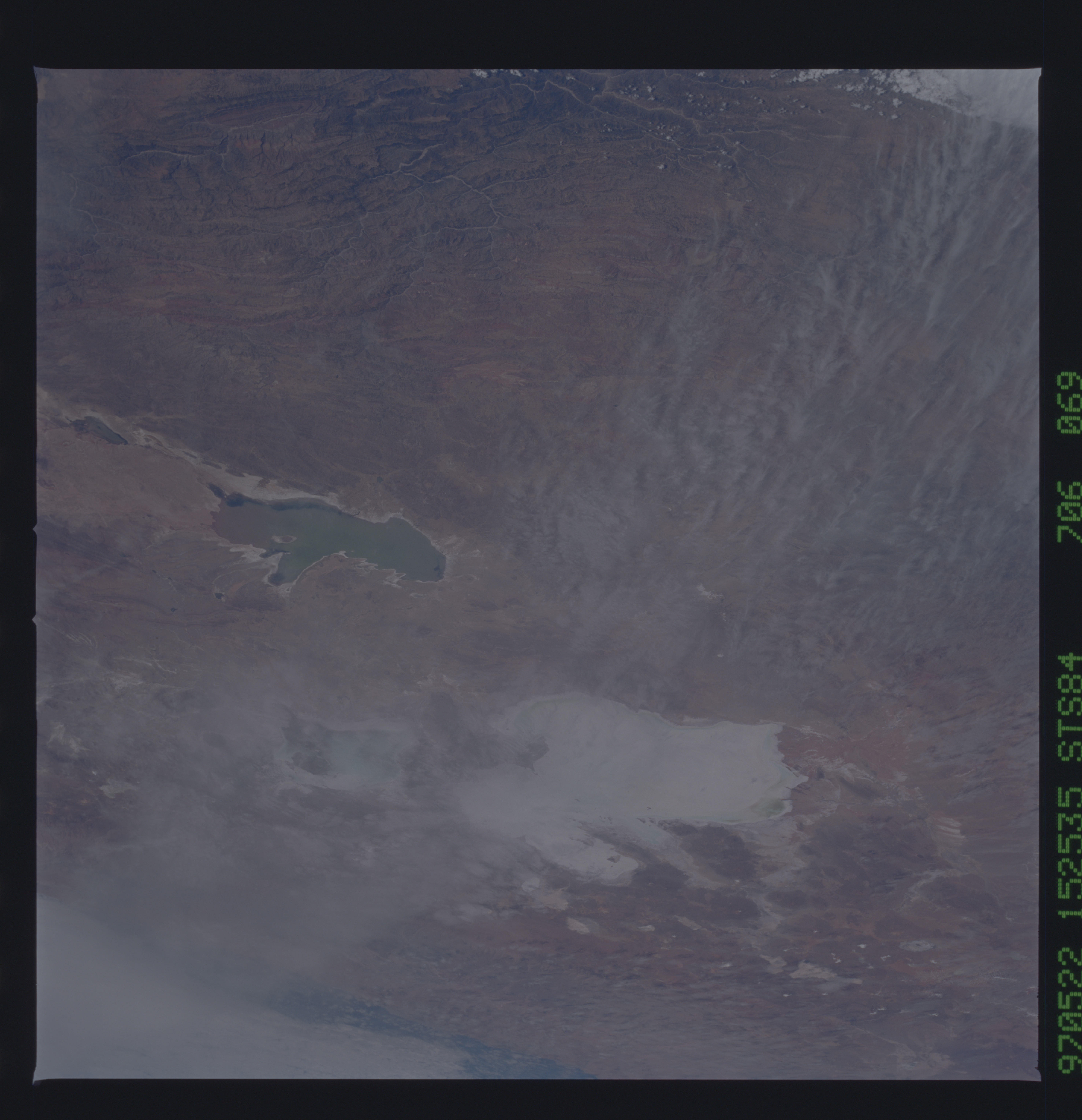
Image Caption: STS084-706-069 Altiplano, Lake Poopo, Uyuni Salar, Bolivia May 1997
The Altiplano of southern Bolivia is a sediment-filled depression between the eastern and western ranges of the Andes Mountains. The high plateau sits at an average elevation of 12,000 feet (3660 meters) and is nearly 500 miles (805 km) long and reaches 500 miles (805 km) at its widest point. Vegetation is sparse. The climate is dry and cold. The region is dotted with salars or salt pans. One such salar is the Salar Uyuni located just above the center of the image. The Salar Uyuni is nearly 85 miles (137 km) wide and 100 miles (161 km) long and covers an area of 3600 sq. miles (9324 sq. km). The Salar Uyuni is a sea of salt with a crust between 6 feet (18 meters) to 24 feet (72 meters) thick. The Salar Uyuni is the largest expanse of salt in South America. This and other salars in the southern region of the Altiplano of southern Bolivia are the remnants of former Lake Minchin that flooded the region over 10000 years ago, the result of melting glaciers from the Ice Age. Between the center and the right center of the image, Lake Poopo is discernible. Covering an area of 965 sq. miles (2499 sq. km) and sitting at 11000 feet (3355 meters) above sea level, Lake Poopo has an average depth of just 10 feet (3 meters) and at times will have little or no standing water within it. The Desaguadero River feeds the lake.
The Altiplano of southern Bolivia is a sediment-filled depression between the eastern and western ranges of the Andes Mountains. The high plateau sits at an average elevation of 12,000 feet (3660 meters) and is nearly 500 miles (805 km) long and reaches 500 miles (805 km) at its widest point. Vegetation is sparse. The climate is dry and cold. The region is dotted with salars or salt pans. One such salar is the Salar Uyuni located just above the center of the image. The Salar Uyuni is nearly 85 miles (137 km) wide and 100 miles (161 km) long and covers an area of 3600 sq. miles (9324 sq. km). The Salar Uyuni is a sea of salt with a crust between 6 feet (18 meters) to 24 feet (72 meters) thick. The Salar Uyuni is the largest expanse of salt in South America. This and other salars in the southern region of the Altiplano of southern Bolivia are the remnants of former Lake Minchin that flooded the region over 10000 years ago, the result of melting glaciers from the Ice Age. Between the center and the right center of the image, Lake Poopo is discernible. Covering an area of 965 sq. miles (2499 sq. km) and sitting at 11000 feet (3355 meters) above sea level, Lake Poopo has an average depth of just 10 feet (3 meters) and at times will have little or no standing water within it. The Desaguadero River feeds the lake.
